Method for optimizing topography and geomorphology of dump in large opencast coal mine in loess area

A technology of open-pit coal mines and optimization methods, applied in design optimization/simulation, image data processing, instruments, etc., can solve problems such as inability to make overall planning, damage to hydrology and landforms, and reduction of biodiversity, and achieve benefits for agricultural mechanization operations. Conducive to safety and overall benefits, the effect of improving soil and water conservation capacity

Active Publication Date: 2017-09-22
CHINA UNIV OF GEOSCIENCES (BEIJING)
View PDF4 Cites 13 Cited by
  • Summary
  • Abstract
  • Description
  • Claims
  • Application Information

AI Technical Summary

Problems solved by technology

[0002] The traditional soil dumping technology is mainly based on the convenience of the soil dumping project. The nearby dumping soil cannot be planned as a whole, and the hydrology and landform of the original landform are completely destroyed. It is difficult to coordinate the restored ecosystem with the original landform ecosystem.
Under the existing landform remodeling project in the mining area, the large-scale artificial piling landform with alternate platforms and slopes has unstable topography, rock and soil erosion on the slope, uncoordinated landscape, reduced biodiversity, excessive human intervention, and rigid engineering. Easily damaged, high maintenance cost and other issues

Method used


Image

  • Method for optimizing topography and geomorphology of dump in large opencast coal mine in loess area

Examples


Embodiment Construction

[0024] The principles and features of the present invention are described below in conjunction with the accompanying drawings, and the examples given are only used to explain the present invention, and are not intended to limit the scope of the present invention.

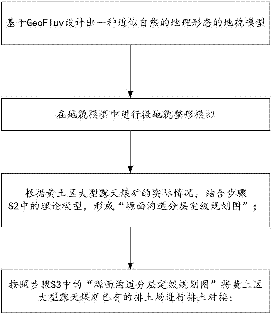
[0025] A topography and landform optimization technology for large-scale open-pit coal mine dumps in the loess area, including the following steps:

[0026] (1) GeoFluv simulates and optimizes the reshaping landform of the mining area based on the AutoCAD platform, and its theoretical basis is the theory of watershed geomorphology and the classification of Rosgen rivers. By investigating and analyzing natural landforms, and integrating features of landforms such as slopes, water systems, and lowlands, changes in remodeling landforms under restoration conditions can be predicted.

[0027] Select the overall parameters: watershed area, watershed length, watershed slope, watershed direction, watershed average elevation...


PUM


Abstract

The present invention relates to a method for optimizing the topography and the geomorphology of a dump in a large opencast coal mine in the loess area. The method comprises: "soft base removal", "base gully filling", "smooth base blasting treatment", "base piling for skid resistance", "fan-shaped disposal and layered compaction", and other steps. According to the method provided by the present invention, based on the simulation of the original "plateau" geomorphology millions years ago in the loess plateau, the artificial landmine terraces mode of the traditional sloping land in the water and soil erosion area in the Loess Plateau are changed; and relying on the convenient conditions of the mining and moving soil, the large-scale earthwork is used to deploy and form the basin geomorphology to co-ordinate the hydrological topography, and micro-topography modification is used to reduce the generation of the surface runoff, so that under the premise of ensuring the stability of the dump, the geomorphology of the dump in the large opencast coal mine in the loess area is restored to the "plateau" geomorphology, and the foundation is provided for the restoration of ecosystems and biological diversity.

Description

technical field [0001] The present invention relates to the technical field of ecological restoration, in particular to a method for reshaping the landform of large-scale open-pit coal mine dumps in the Loess Plateau area with arid climate and fragile ecological environment, and especially to a method of imitating the original "plain landform" in the Loess Plateau area. "Geomorphology" mining area geomorphology optimization method. Background technique [0002] The traditional soil-discharging technology mainly depends on the convenience of the soil-discharging project, and the nearby soil is piled up, which cannot be planned as a whole, completely destroys the hydrology and landform of the original landform, and it is difficult to coordinate the restored ecosystem with the original landform ecosystem. Under the existing landform remodeling project in the mining area, the large-scale artificial piling pads with alternating platforms and slopes have unstable topography, rock ...

Claims


Application Information

Patent Timeline
Patent Type & Authority Applications(China)
IPC IPC(8): G06T17/05G06F17/50G06Q50/02E02B1/00
CPCE02B1/00G06F30/20G06Q50/02G06T17/05
Inventor 白中科张成梁贺振伟刘宪权赵中秋王金满周伟
Owner CHINA UNIV OF GEOSCIENCES (BEIJING)
Why Eureka
Try Eureka