An urban main road traffic operation information processing method based on floating vehicle data

An information processing method and technology of floating car data, which are applied in the traffic control system of road vehicles, traffic flow detection, traffic control system, etc. low cost effect

Active Publication Date: 2014-03-12
TONGJI UNIV
View PDF4 Cites 18 Cited by
  • Summary
  • Abstract
  • Description
  • Claims
  • Application Information

AI Technical Summary

Problems solved by technology

At present, the commonly used traffic information collection technology is based on the data collection technology of the coil detector, which mainly uses traffic parameters such as traffic flow, saturation, and speed of the fixed section to describe the operation status of the urban road section, and the urban traffic system is a complex system. Dynamic system, each section on the road section may have different operating conditions, and at the same time, there may be completely different speed fluctuations on the road section with the same average speed, so only using a single section traffic parameter cannot reflect the overall real operation of the entire road section of traffic flow situation

Method used


Image

  • An urban main road traffic operation information processing method based on floating vehicle data
  • An urban main road traffic operation information processing method based on floating vehicle data
  • An urban main road traffic operation information processing method based on floating vehicle data

Examples


Embodiment 1

[0047] In the present invention, taxis are used as floating vehicles for collecting samples, and taxi vehicles equipped with specific vehicle-mounted Global Positioning System (Global Position System, GPS) equipment are used to record data such as current date, time, vehicle location (latitude and longitude) at fixed time intervals, These data are continuous in time and space. The average speed or speed fluctuation parameters obtained by processing Floating Car Data (FCD) information can be used as the basis for describing the traffic operation status of the entire section of the main road.

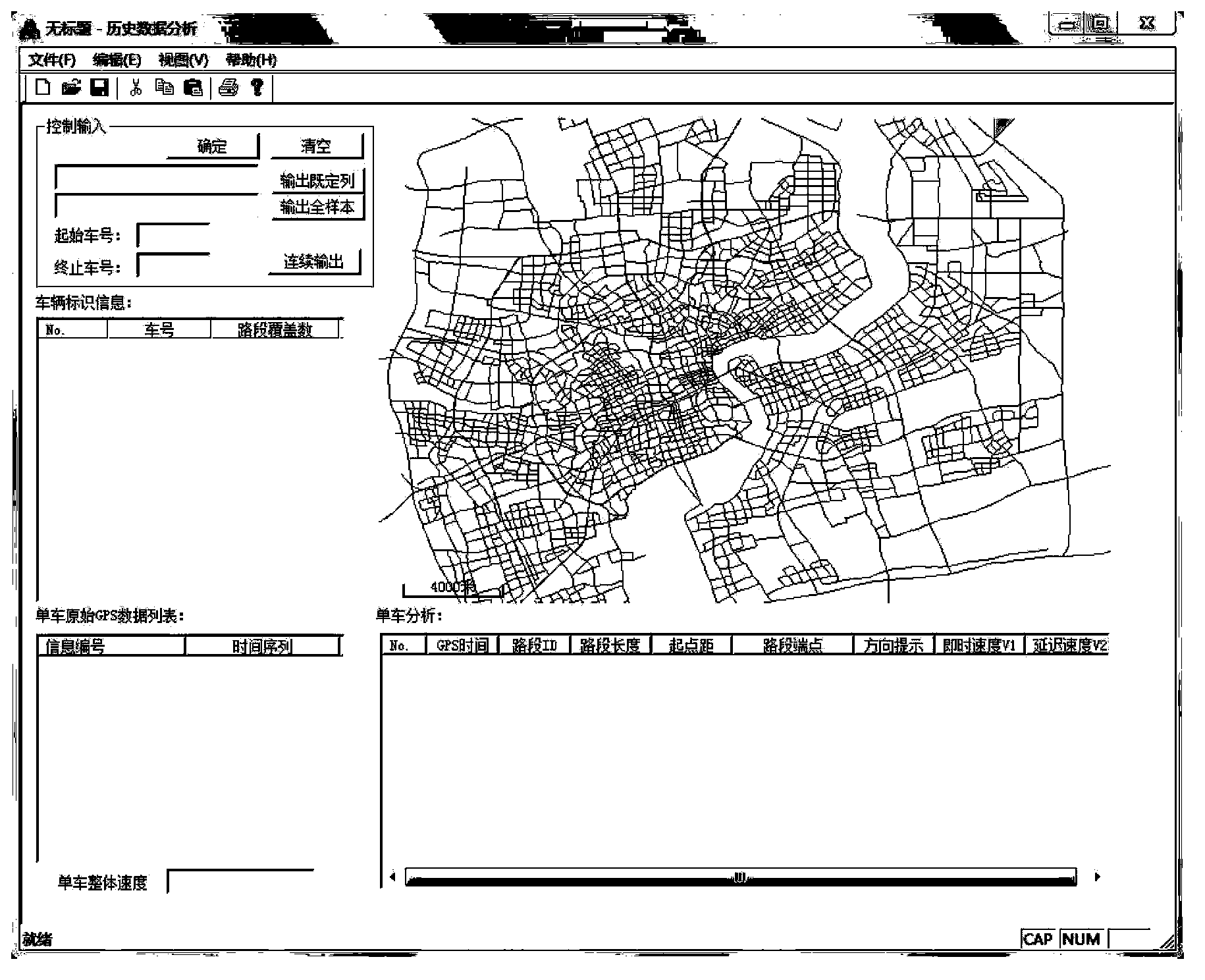
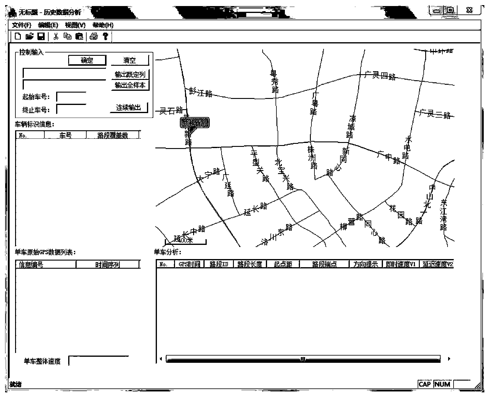
[0048] Such as figure 1 As shown, a method for processing traffic operation information of urban arterial roads based on floating car data includes the following steps:

[0049] 1) Carry out map matching on the GPS raw data sent by the floating car, match the vehicle position coordinates to the road network, obtain GPS operation data, and display the vehicle operation status on different...

Embodiment 2

[0053] The main steps of the urban road traffic operation characteristic analysis method based on the taxi floating car data proposed by the present invention include GPS raw data map matching, speed calculation and road traffic operation characteristic index extraction.

[0054] Referring to Table 1, the original GPS data includes the vehicle number, the time when the vehicle records GPS information, the longitude position of the vehicle and the latitude position of the vehicle;

[0055] Table 1

[0056]

[0057] Refer to attached Figure 2-4 , open the map matching software based on Web-GIS, select the main road segment to be analyzed, check the continuity and direction consistency of the selected road segment after selection, and proceed to the next step if "Passed the integrity detection of the road segment" appears, otherwise "Clear" Select the road segment, and re-select until "Passing the road segment integrity test".

[0058] Refer to attached Figure 5-6 , open ...


PUM


Abstract

The invention relates to an urban main road traffic operation information processing method based on floating vehicle data. The method comprises the following steps: 1) map-matching is carried out on GPS original data transmitted by a floating vehicle, and a coordinate of a vehicle position is matched to a road network to obtain GPS operation data; and vehicle operation statuses on different road segments are displayed through combining with a map; 2), pretreatment is carried out on the GPS operation data, and the pretreatment process comprises sample screening and speed calculating; and 3), extraction of traffic operation characteristic indexes are carried out, and the average speed, the speed variance and the speed distribution are calculated; a speed-distance curve, a speed skewness coefficient, a kurtosis coefficient, a speed mileage distribution map and a speed time distribution map are output. Compared with urban main road traffic operation information processing methods in the prior art, the urban main road traffic operation information processing method based on the floating vehicle data of the invention has advantages of utilizing a taxi floating vehicle technique to analyze and process urban road traffic operation and to obtain indexes such as the road segment average speed, the speed fluctuation and the speed distribution; and the floating vehicle data of the invention has an advantage of being able to reflect a whole road segment traffic operation status, etc.

Description

technical field [0001] The invention relates to an analysis technology of urban road traffic operation status, in particular to a method for processing information on urban arterial road traffic operation based on floating car data. Background technique [0002] The traffic operation status is the result of the interaction between vehicles and the geometric characteristics of the road. In practical applications, the description of the urban road operation status depends on the technology of data collection. At present, the commonly used traffic information collection technology is based on the data collection technology of the coil detector, which mainly uses traffic parameters such as traffic flow, saturation, and speed of fixed sections to describe the operation status of urban road sections, and the urban traffic system is a complex system. Dynamic system, each section on the road section may have different operating conditions, and at the same time, there may be complete...

Claims


Application Information

Patent Timeline
Patent Type & Authority Applications(China)
IPC IPC(8): G08G1/01G08G1/052
Inventor 王雪松王丽丽
Owner TONGJI UNIV
Why Eureka
Try Eureka