

Precision error compensation method and self-calibration acoustic beacon positioning equipment based on method
A technology for positioning equipment and error compensation, applied in the field of positioning systems, can solve problems such as ultra-short baseline positioning accuracy errors, underwater sound propagation uncertainty, positioning uncertainty, etc., and achieve the effect of compensating for the impact
- Summary
- Abstract
- Description
- Claims
- Application Information
AI Technical Summary
Problems solved by technology
Method used
Image


Examples
Embodiment 1
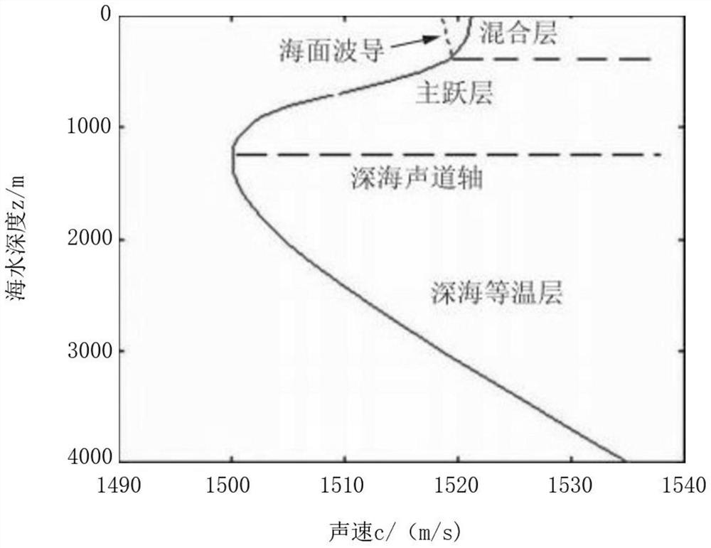
[0032] In the ocean waveguide, the sound propagation path is mainly affected by the sea surface, the seabed and the seawater medium. The speed of sound in seawater is related to temperature, salinity and static pressure. The change of salinity has little effect on the speed of sound, so the effect of temperature is the most significant. The variation of sound velocity with depth is represented by the sound velocity profile. The change of the ocean sound velocity profile is affected by factors such as the sea environment and seasons. When the sound wave propagates in the water medium space, it is more seriously affected by the fluctuation of the water sound field environment. Unlike in the air, the medium can be regarded as uniform, and the sound velocity is constant. .
[0033] Such as figure 1 As shown, the thermocline in water divides the sound field into channels in the upper layer and channels in the lower layer. In the upper layer or the lower layer, the vertical temper...
Embodiment 2
[0040] This embodiment provides a precision error compensation method:
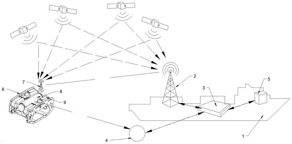
[0041] This accuracy error compensation method is based on the self-calibrating acoustic beacon positioning equipment in Embodiment 1, in which the relative position of the acoustic beacon calculated by the ultra-short baseline underwater acoustic positioning system is calculated according to the incident angle of sound rays and the known depth . By allowing the acoustic beacon carrier 6 to carry the second GPS satellite positioning system 7 and the transponder 8 to emerge from the positioning position along the vertical direction, the second GPS satellite positioning system 7 that emerges from the water surface is used to obtain the water surface where the acoustic beacon is located. The absolute position of the acoustic beacon on the water surface includes the longitude and latitude of the acoustic beacon. At the same time, the absolute position obtained is compared with the relative position of the aco...
PUM
 Abstract
Description
Claims
Application Information