
Determining density contrast at subsurface interface
a density contrast and subsurface technology, applied in the direction of instruments, specific gravity measurement, material analysis, etc., can solve the problem that the process has not been too successful
- Summary
- Abstract
- Description
- Claims
- Application Information
AI Technical Summary
Benefits of technology
Problems solved by technology
Method used
Image

Examples
Embodiment Construction
[0018]The discussion below is directed to certain specific implementations. It is to be understood that the discussion below is only for the purpose of enabling a person with ordinary skill in the art to make and use any subject matter defined now or later by the patent “claims” found in any issued patent herein.
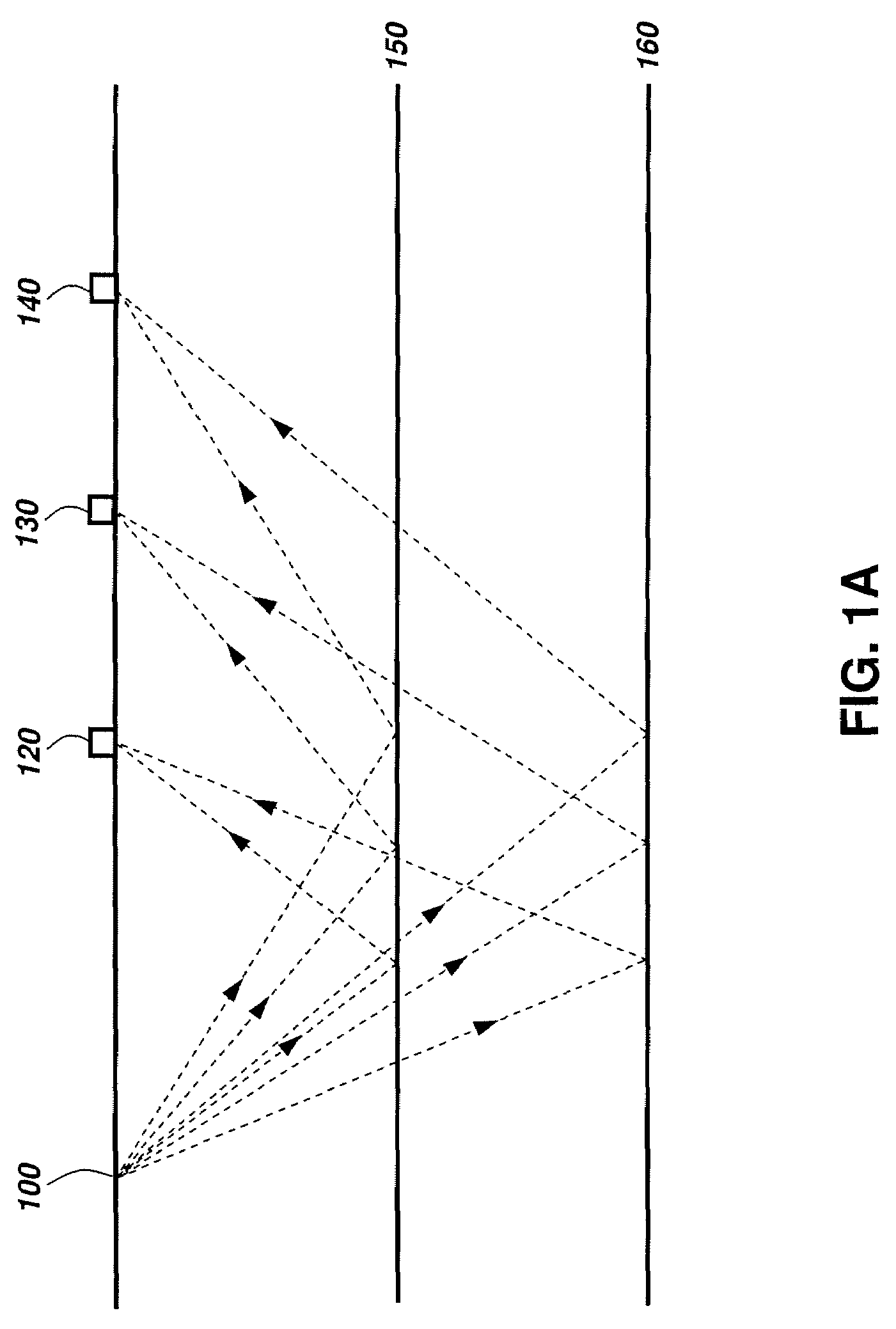
[0019]FIG. 1A illustrates a schematic diagram of a seismic survey that may be used in connection with implementations of various techniques described herein. A seismic survey is generally performed using at least one seismic source 100 and an array of seismic receivers 120, 130 and 140. For land seismic surveying, the seismic source 100 may be buried beneath the earth's surface and the seismic receivers 120, 130 and 140 may be disposed on the earth's surface. For marine seismic surveying, the seismic source 100 may be disposed below the sea water level and the seismic receivers 120, 130 and 140 may be disposed on the sea floor. When the source 100 is actuated, acoustic (or s...
PUM
| Property | Measurement | Unit |
|---|---|---|
| incident angles | aaaaa | aaaaa |
| velocity | aaaaa | aaaaa |
| reflection coefficient | aaaaa | aaaaa |
Abstract
Description
Claims
Application Information