
Method for realizing error prediction by combining tangent method and tropical cyclone prediction path
A tropical cyclone and tangent technology, applied in the direction of instruments, etc., can solve problems such as deviation, reduce data reference meaning, forecast path error, etc., to achieve the effect of increasing controllability, visual display of application effect, amplitude and participation.
- Summary
- Abstract
- Description
- Claims
- Application Information
AI Technical Summary
Problems solved by technology
Method used
Image

Examples
Embodiment Construction
[0028] The present invention will be further described below with reference to the accompanying drawings and embodiments.
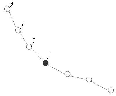
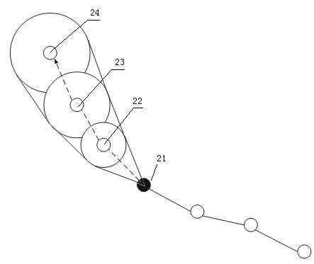
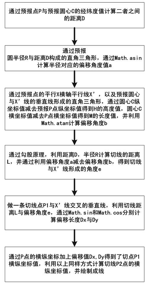
[0029] This embodiment provides a method for realizing forecast error by using the tangent method combined with the tropical cyclone forecast path, including providing a current position point and an integer number of forecast nodes. The method creates an error range circle for each forecast node and uses the circle tangent method to achieve The current position point is the starting point to connect the tangents of the error range circles of two adjacent different forecast nodes to form a forecast error range circle, and the accuracy of future forecast data can be effectively verified through the forecast error range circle. The error range circle is created with the corresponding forecast node as the center and the number of kilometers set according to the actual weather conditions as the radius.
[0030] In this embodiment, the calculation method of th...
PUM
 Abstract
Description
Claims
Application Information