

A precise modeling method for gnss ionospheric delay suitable for China
A technology of ionospheric delay and modeling method, which is applied in the direction of radio wave measurement system, satellite radio beacon positioning system, measurement device, etc.
- Summary
- Abstract
- Description
- Claims
- Application Information
AI Technical Summary
Problems solved by technology
Method used
Image

Examples
Embodiment Construction
[0039] The present invention will be described in detail below with reference to the accompanying drawings and examples.
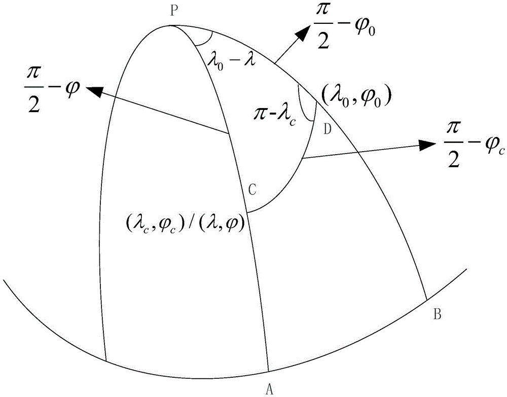
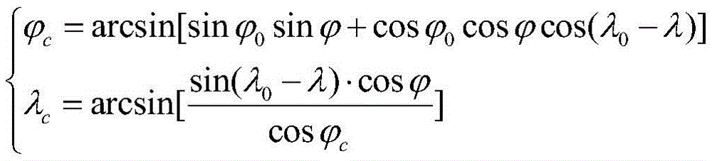
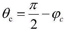
[0040]The invention provides an ionospheric delay accurate modeling method suitable for the Chinese region, which includes the calculation of the ionospheric total electron concentration (TEC) information in the direction of the satellite line of sight of the reference station, the ionospheric TEC information in the direction of the satellite line of sight and the vertical direction The conversion of TEC information, the calculation of the longitude and latitude of the intersection point in the spherical cap coordinate system, the conversion of the intersection point latitude to the co-latitude of the spherical cap coordinate system, the transformation of the latitude and longitude change range of the intersection point through projection to the whole world, spherical harmonic function ionization There are six steps to solve the layer TEC model coefficients...
PUM
 Abstract
Description
Claims
Application Information