

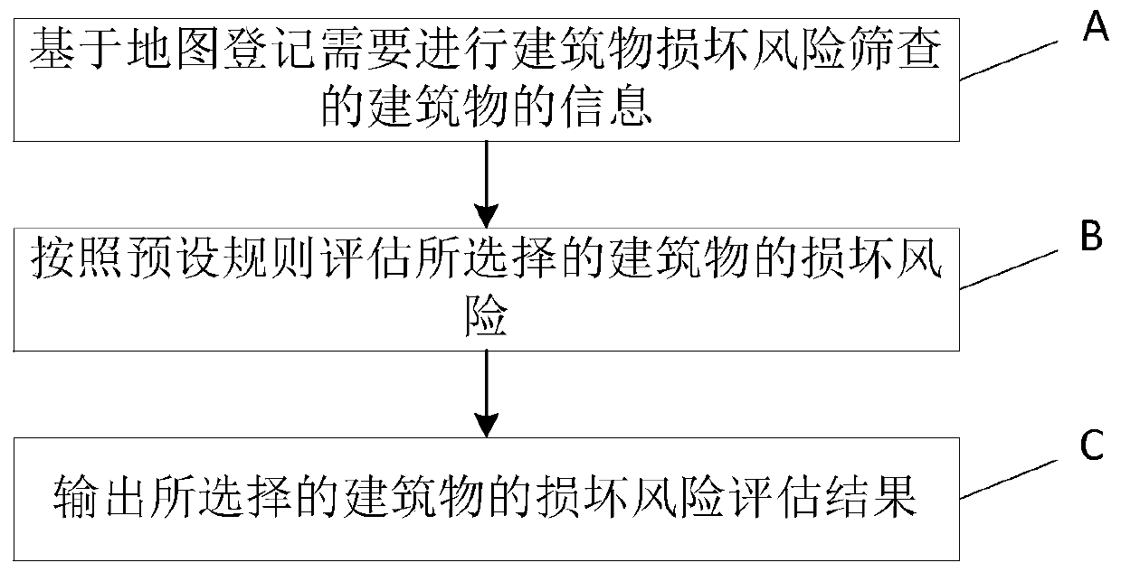
Building damage risk screening method and system based on geographic space information
A geospatial information and building technology, applied in the field of earthquake disaster assessment, can solve problems such as low degree of automation and poor reliability, and achieve the effect of enhancing building structure and rapid screening
- Summary
- Abstract
- Description
- Claims
- Application Information
AI Technical Summary
Problems solved by technology
Method used
Image

Examples
Embodiment Construction
[0041] In order to make the objectives, technical solutions, and advantages of the present invention clearer, the present invention will be further described in detail below in conjunction with embodiments and drawings.
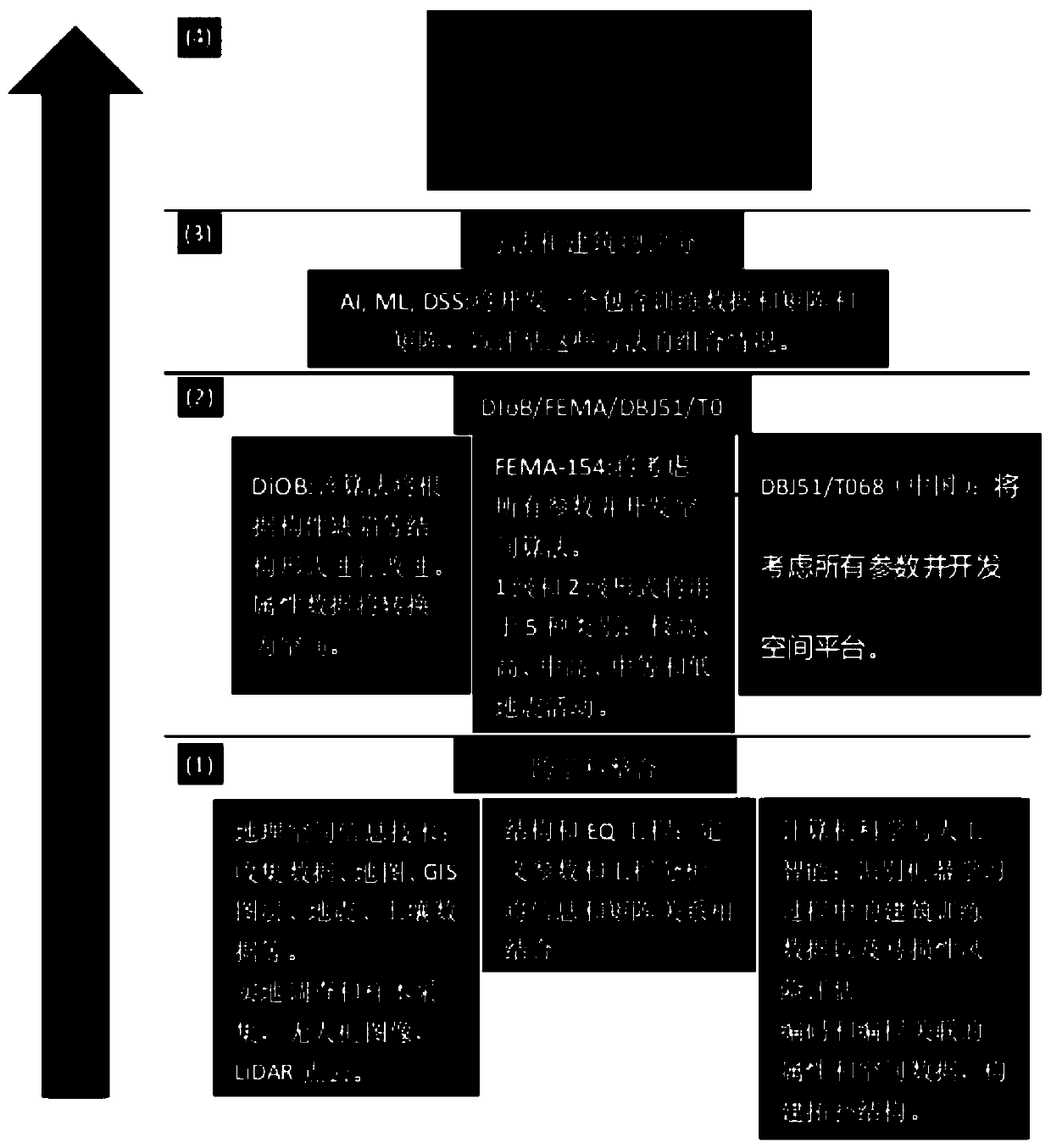
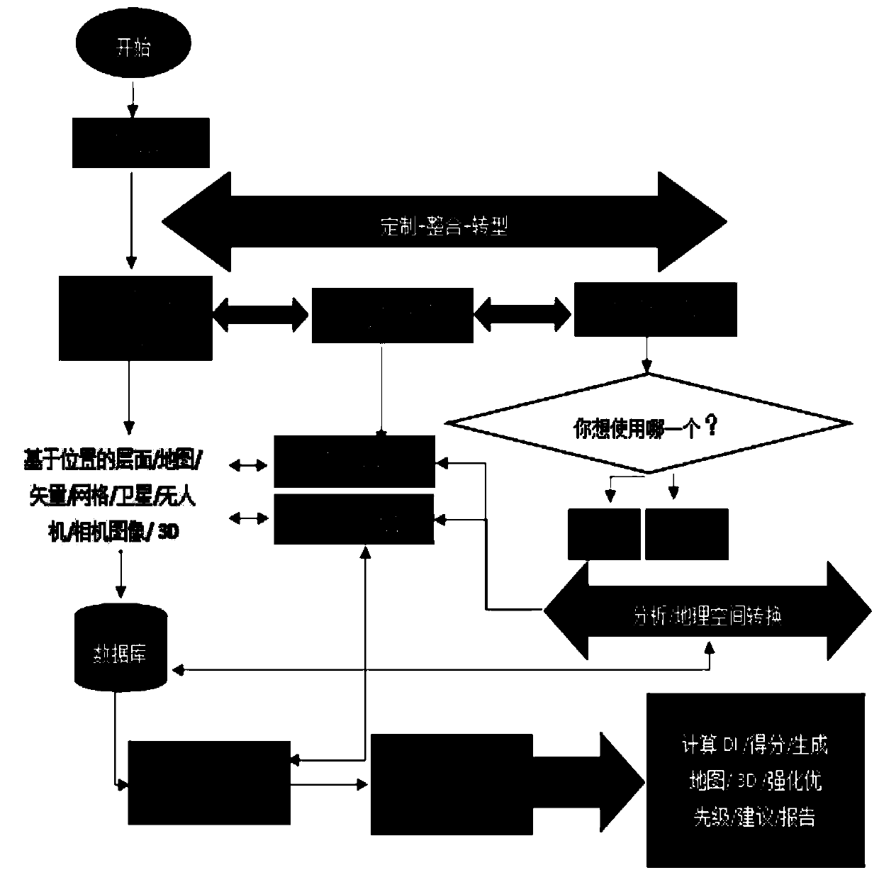
[0042] The GeoRVS (Geospatial Information-based Rapid Visual Screening, geographic information-based rapid visual screening) method constructed by the present invention requires a comprehensive and complex calculation process to generate damage index (DI) and building scores. The present invention utilizes and improves the recommendation algorithm combined with geospatial information technology, and then combines seismic and structural engineering technology and parameters to implement the Federal Emergency Management Agency (FEMA) method and DBJ51 / T068 (2016 and 2017) . After that, the present invention constructs a cloud-based platform for determining the vulnerability and risk assessment of buildings.
[0043] The present invention integrates major disciplines...
PUM
 Abstract
Description
Claims
Application Information