

Marine target position measuring method
A measurement method and technology of target position, applied in the field of target position measurement, can solve the problem of high cost, and achieve the effect of cost saving, accurate measurement method and simplified measurement mode
- Summary
- Abstract
- Description
- Claims
- Application Information
AI Technical Summary
Problems solved by technology
Method used
Image

Examples
Embodiment Construction
[0036] Hereinafter, embodiments of the present invention will be described with reference to the accompanying drawings. In the following description, the same blocks are denoted by the same reference numerals. With the same reference numerals, their names and functions are also the same. Therefore, its detailed description will not be repeated.
[0037] In order to make the object, technical solution and advantages of the present invention clearer, the present invention will be further described in detail below in conjunction with the accompanying drawings and specific embodiments. It should be understood that the specific embodiments described here are only used to explain the present invention, but not to limit the present invention.
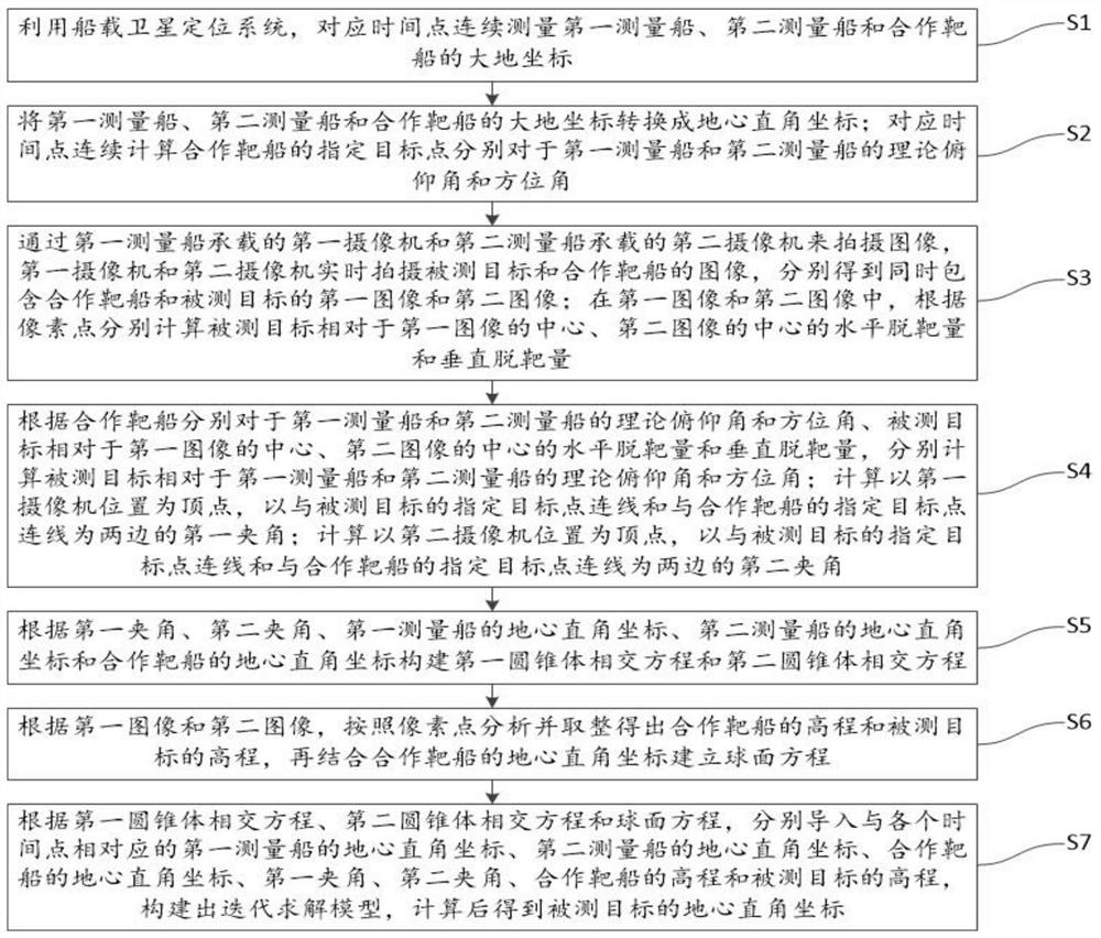
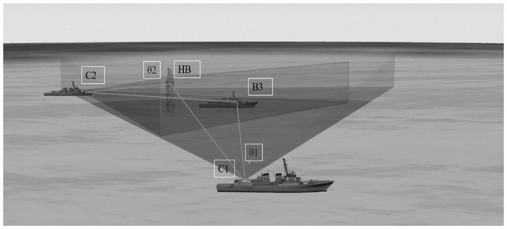
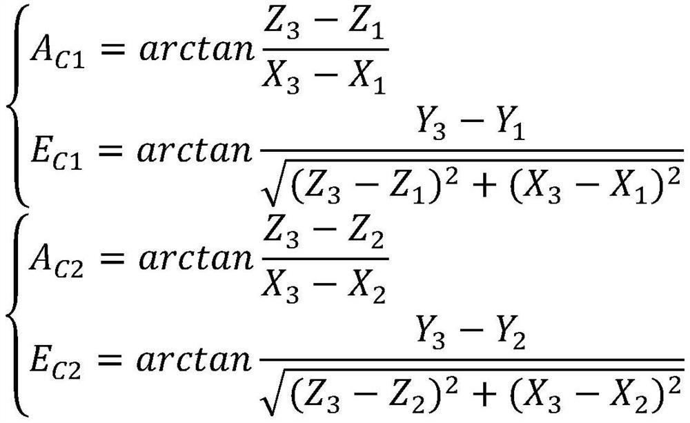
[0038] Combine below figure 1 with figure 2 The concrete mode of work of the present invention is described in detail:
[0039] The invention provides a method for measuring the position of a target at sea, which specifically includes th...
PUM
 Abstract
Description
Claims
Application Information