Drawing method and device of vehicle geographic position distribution map, and storage medium

A geographical location and distribution map technology, applied in the field of vehicles, can solve problems such as difficult to intuitive distribution, data processing fluctuations, upgrade servers, etc., to achieve the effect of clear distribution of vehicles, ease of computing pressure, and fast processing speed

Pending Publication Date: 2022-06-03
SHENZHEN SEG SCI NAVIGATIONS CO LTD
View PDF0 Cites 0 Cited by
  • Summary
  • Abstract
  • Description
  • Claims
  • Application Information

AI Technical Summary

Problems solved by technology

Most of the existing geographical distribution maps of automobiles are heat maps of automobile distribution. The heat map of automobile distribution is to depict the geographical location of automobiles on the map, and deepen or lighten the depth of its color according to its weight. This heat map can display the geographical distribution of vehicles well when the number of vehicles is small, but the disadvantage is that when the number of vehicles is particularly large and the range is particularly wide, a large dark area will be displayed on the map area, such as figure 1 As shown, the distribution of cars on the entire map is large and wide at this time, and it is impossible to accurately identify the area with the largest number of cars, and it is difficult to obtain the specific distribution situation intuitively.
[0003] Moreover, in the prior art, in order to obtain the location of the car, it is necessary to perform reverse address resolution on the last reported position of each car, and due to the large number of vehicles, a large number of reverse address resolution requests are required to the server, so the requirements for the server are relatively high. High, it takes a lot of cost to upgrade the server, and the data processing will fluctuate according to the network conditions, resulting in data that cannot reflect the distribution of vehicles in real time

Method used


Image

  • Drawing method and device of vehicle geographic position distribution map, and storage medium
  • Drawing method and device of vehicle geographic position distribution map, and storage medium
  • Drawing method and device of vehicle geographic position distribution map, and storage medium

Examples


Embodiment 1

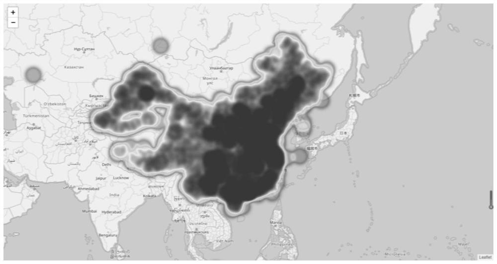
[0041] refer to figure 1 , the method for drawing the geographical location distribution map of the vehicle of the present invention can be executed by the server, the longitude and latitude of all vehicles are reported to the server, and the server executes the following method to draw the distribution map to display the distribution of the vehicles. Of course, the user can use various The terminal accesses the server to realize interactive control such as map updating and viewing. It can be understood that the server can be a single server or a server group. The server farm can be centralized or distributed. Of course, a storage end may also be configured separately to store the latitude and longitude data of the vehicle, and the storage end may be a single memory or a memory group. The server can execute the method of the present invention by retrieving data from the memory in a wired or wireless manner.

[0042] The method of this embodiment specifically includes:

[0...

Embodiment 2

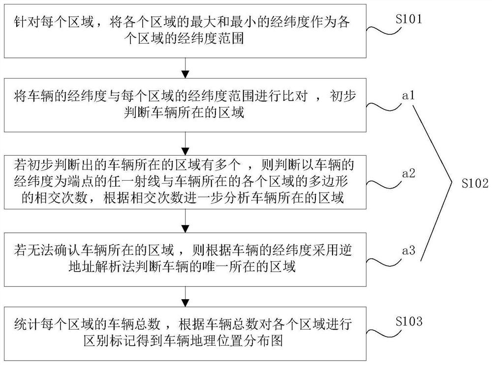
[0065] like Figure 4 , Based on the same inventive concept, this embodiment discloses a device for drawing a geographic location distribution map of a vehicle. The method includes: a region range determination module 201 , a region binding module 202 , and a mapping module 203 .

[0066] The area range determination module 201 is used for, for each area, the maximum and minimum longitude and latitude of each area as the longitude and latitude range of each area;

[0067] The area binding module 202 is used to determine a unique area for each vehicle, including: comparing the latitude and longitude of the vehicle with the latitude and longitude range of each area, and preliminarily determining the area where the vehicle is located; If there are multiple areas, judge the intersection times of any ray with the latitude and longitude of the vehicle as the endpoint and the polygons of each area where the vehicle is located, and further analyze the area where the vehicle is located...

Embodiment 3

[0080] Based on the same inventive concept, an embodiment of the present invention also provides a device for drawing a geographic location distribution map of a vehicle, including a processor and a memory, where the memory stores a computer program, and the computer program is executed by the processor to implement the above embodiments For the steps and the specific implementation process of the method, reference may be made to the description of the above method embodiments, and details are not repeated here.


PUM


Abstract

The invention discloses a method and a device for drawing a vehicle geographic position distribution map, and a storage medium. The method comprises the following steps: taking the maximum longitude and latitude and the minimum longitude and latitude of each region as the longitude and latitude range of each region; comparing the longitude and latitude of the vehicle with the longitude and latitude range of each region, and preliminarily judging the region where the vehicle is located; if a plurality of areas where the vehicle is located are preliminarily judged, judging the number of times of intersection between any ray taking the longitude and latitude of the vehicle as the end point and the polygon of each area where the vehicle is located, and further analyzing the area where the vehicle is located according to the number of times of intersection; if the area where the vehicle is located cannot be confirmed, the unique area where the vehicle is located is judged according to the longitude and latitude of the vehicle by adopting an inverse address resolution method; counting the total number of vehicles in each area, and performing distinguishing marking on each area according to the total number of vehicles to obtain a vehicle geographic position distribution map; according to the method, a large number of inverse address analysis instructions do not need to be used, the processing speed is higher, and vehicle distribution in each region is clearer.

Description

technical field [0001] The invention relates to the field of vehicles, in particular to a method and device for drawing a geographic location distribution map of a vehicle, and a storage medium. Background technique [0002] In today's increasingly mature automotive Internet technology, mastering the geographical distribution of cars can intuitively view the most concentrated areas of cars, so as to make appropriate adjustments to the sales or tracking of car-related products. Most of the existing car geographical location distribution maps are car distribution heat maps. The car distribution heat map is to trace the geographical location of the car on the map, and deepen or lighten its color according to its weight. The heat map can display the geographical distribution of vehicles well when the number of vehicles is small, but the disadvantage is that when the number of vehicles is very large and the range is very wide, a large dark area will be displayed on the map. area...

Claims


Application Information

Patent Timeline
Patent Type & Authority Applications(China)
IPC IPC(8): G06F16/29G06T11/20
CPCG06F16/29G06T11/206
Inventor 易明朱杰刘杰
Owner SHENZHEN SEG SCI NAVIGATIONS CO LTD
Why Eureka
Try Eureka