
Method and apparatus for generating and distributing satellite tracking information in a compact format
a satellite tracking and compact technology, applied in the field of satellite tracking information generation, can solve the problems of inconvenient transmission of satellite tracking information, remote gps receivers that cannot accurately determine position, and inability to accurately transmit satellite tracking information, etc., and achieve the effect of improving the performance of the receiver
- Summary
- Abstract
- Description
- Claims
- Application Information
AI Technical Summary
Benefits of technology
Problems solved by technology
Method used
Image

Examples
Embodiment Construction
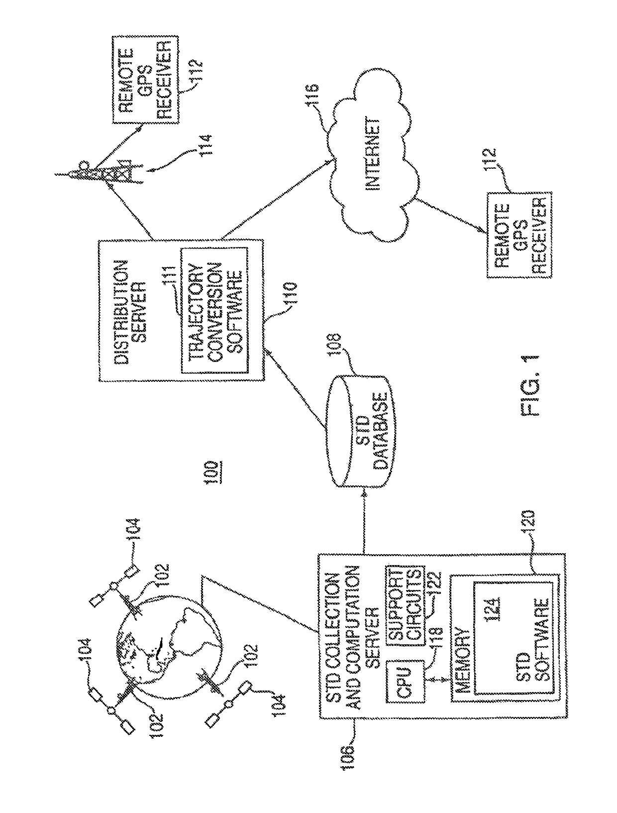
[0017]FIG. 1 depicts a block diagram of a system 100 for creating and distributing satellite tracking data (STD). The satellite system may include the global positioning system (GPS), GLONASS, GALILEO, or other satellite systems that may use STD to enhance the performance of the receiver. The following disclosure uses GPS as an illustrative system within which the invention operates. From the following disclosure, those skilled in the art will be able to practice the invention in conjunction with other satellite based positioning systems.
[0018]A network of GPS tracking stations 102 is used to collect measurement data from the GPS satellites 104. Such a network is described in detail in U.S. patent application Ser. No. 09 / 615,105, filed Jul. 13, 2000 and incorporated herein by reference. The network could comprise several tracking stations that collect satellite tracking information (STI) from all the satellites in the constellation, or a few tracking stations, or a single tracking s...
PUM
 Abstract
Description
Claims
Application Information