Regulation based spatial data integration method

A technology of spatial data and data integration, applied in the direction of electrical digital data processing, special data processing applications, instruments, etc., can solve the problems of data without consideration of standards, difficult to be practical, and difficult to describe data structure, so as to reduce error rate and improve The effect of maneuverability and convenient operation

A technology of spatial data and data integration, applied in the direction of electrical digital data processing, special data processing applications, instruments, etc., can solve the problems of data without consideration of standards, difficult to be practical, and difficult to describe data structure, so as to reduce error rate and improve The effect of maneuverability and convenient operation

CN101477547AInactive Publication Date: 2009-07-08CHINESE ACAD OF SURVEYING & MAPPING

Image

  • Regulation based spatial data integration method
  • Regulation based spatial data integration method
  • Regulation based spatial data integration method

Examples


Embodiment Construction

[0037] A preferred embodiment of the invention will now be described in detail with reference to the illustrations in the accompanying drawings.

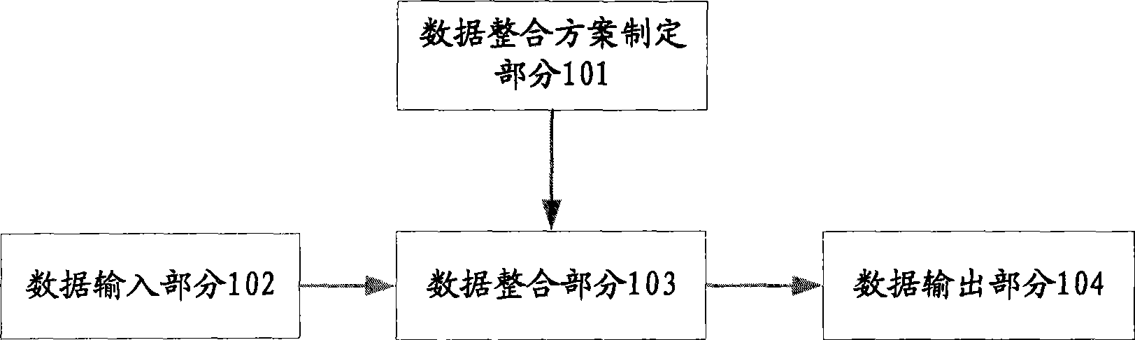
[0038] According to the present invention, a spatial data integration system for spatial data integration is provided. The spatial data integration system mainly realizes the conversion between spatial data in different formats, wherein the spatial data has spatial information and attribute information, and constitutes corresponding spatial database. For example, examples of spatial data may include western map data and national 1:50000 update data.

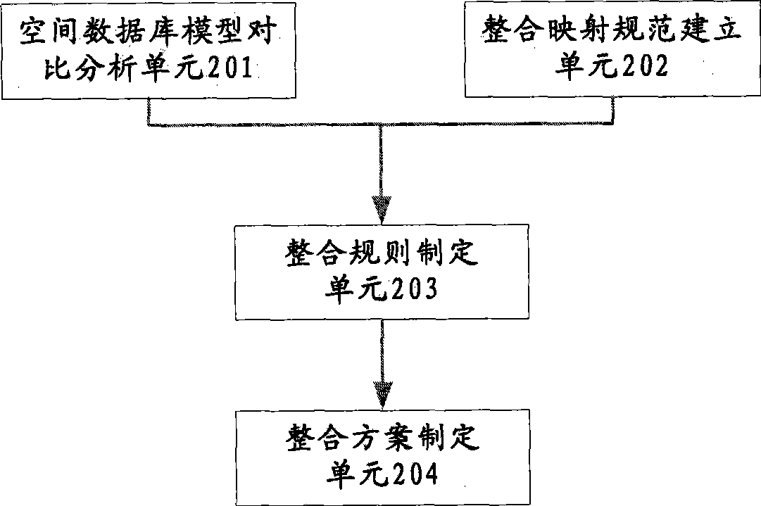
[0039] figure 1 A schematic block diagram of a spatial data integration system according to a preferred embodiment of the present invention is illustrated. according to figure 1 As shown, the spatial data integration system includes: a data integration plan formulation part 101, which is used to formulate integration rules by analyzing the standards of the source spatial data and th...


PUM


Abstract

The invention discloses a method for integrating spatial data, which comprises the following steps: inputting the data required to be integrated; formulating integration rules through analyzing a database model of different spatial data and establishing mapping specifications under different database models according to characteristics of various spatial data, and generalizing the integration rules so as to form an integration scheme; integrating the input data on various layers of the logical structure of the database according to the formulated data integration scheme; and outputting the integration data as a final data file. By adopting the method for integrating spatial data and a system in the method of the invention, the invention can realize an integral data integration system of integrating data comparison and analysis, formulation of the integration scheme and display of the integration result into one body, so as to realize automatic integration among different types of data. Therefore, the controllable property of the data integration is improved, the error rate of the data conversion is effectively reduced, and the operation is greatly convenient for the user.

Description

technical field [0001] The invention relates to a rule-based spatial data integration method and a spatial data integration system using the method. More specifically, the present invention relates to a spatial database integration method and system for spatial data integration using integration rules formed by analyzing input source data and a spatial database formed from the source data. Background technique [0002] The ever-changing space technology and information technology have promoted the global informatization. The development of the information society, on the one hand, puts forward new requirements for geospatial data, and on the other hand, it strongly promotes the construction of spatial data infrastructure. All countries in the world are vigorously strengthening the construction of spatial data infrastructure according to their own needs. Among them, the integration and updating of national basic geographic information databases has always been concerned by t...

Claims


Application Information

Patent Timeline
08 Jul 2009
Publication
CN101477547A
IPC
G06F17/30
Inventors
雷兵; 张继贤