Interference analysis method of nuclear power plant landscape

An analysis method, technology of nuclear power plants, applied in the direction of instruments, data processing applications, calculations, etc.

CN104134158AInactive Publication Date: 2014-11-05SATELLITE ENVIRONMENT CENT MINIST OF ENVIRONMENTAL PROTECTION
3 Cites 2 Cited by

Patent Information

Authority / Receiving Office
CN · China
Patent Type
Applications(China)
Current Assignee / Owner
Publication Date
2014-11-05
Estimated Expiration
Not applicable · inactive patent

Smart Images

  • Figure 1
    Figure 1
  • Figure 2
    Figure 2
  • Figure 3
    Figure 3
Patent Text Reader

Abstract

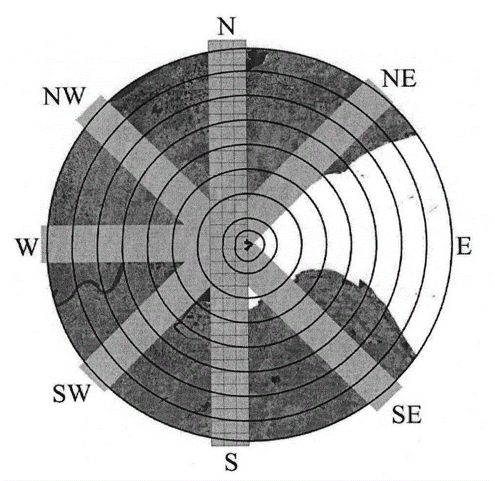
The invention relates to the remote sensing monitoring field, in particular to an interference analysis method of a nuclear power plant perimeter zone on the basis of a remote sensing satellite image. The method comprises the following steps: (1) carrying out data collection and processing to a nuclear power plant appraisal zone by the remote sensing satellite image, and extracting a land utilization type according to classes; (2) calculating a landscape pattern index; (3) calculating a landscape interference degree index; (4) analyzing a landscape interference effect zone; and (5) arranging a plurality of radicalized belt transects by taking a nuclear power plant as a center to carry out interference gradient change characteristic analysis of the nuclear power plant landscape. The invention creates a technical method system of the interference degree and direction characteristic analysis of a nuclear power plant landscape pattern, the affect degree to surrounding ecological environment, the spatial distribution and the direction characteristic of the nuclear power plant can be fully reflected, and a technical bland of the interference analysis of the nuclear power plant landscape is filled up.
Need to check novelty before this filing date? Find Prior Art

Description

technical field

[0001] The invention relates to the field of remote sensing monitoring, in particular to a landscape interference analysis method for the surrounding area of ​​a nuclear power plant based on remote sensing satellite images. Background technique

[0002] At present, my country's nuclear power development has entered a new period of systematization and scale, and has become one of the focuses of global nuclear power development. After more than 20 years of construction, my country's nuclear power industry has made great progress. At present, there are 20 nuclear power units in commercial operation in mainland China, with a total installed capacity of nearly 18 million kilowatts; 28 nuclear power units are under construction, accounting for more than 40% of the world's construction scale.

[0003] The construction and operation of nuclear power plants will continue to drive the rapid development of the local economy, and further promote the rapid development of...

Examples

Embodiment Construction

[0032] The present invention will be described in further detail below in conjunction with the accompanying drawings of the description.

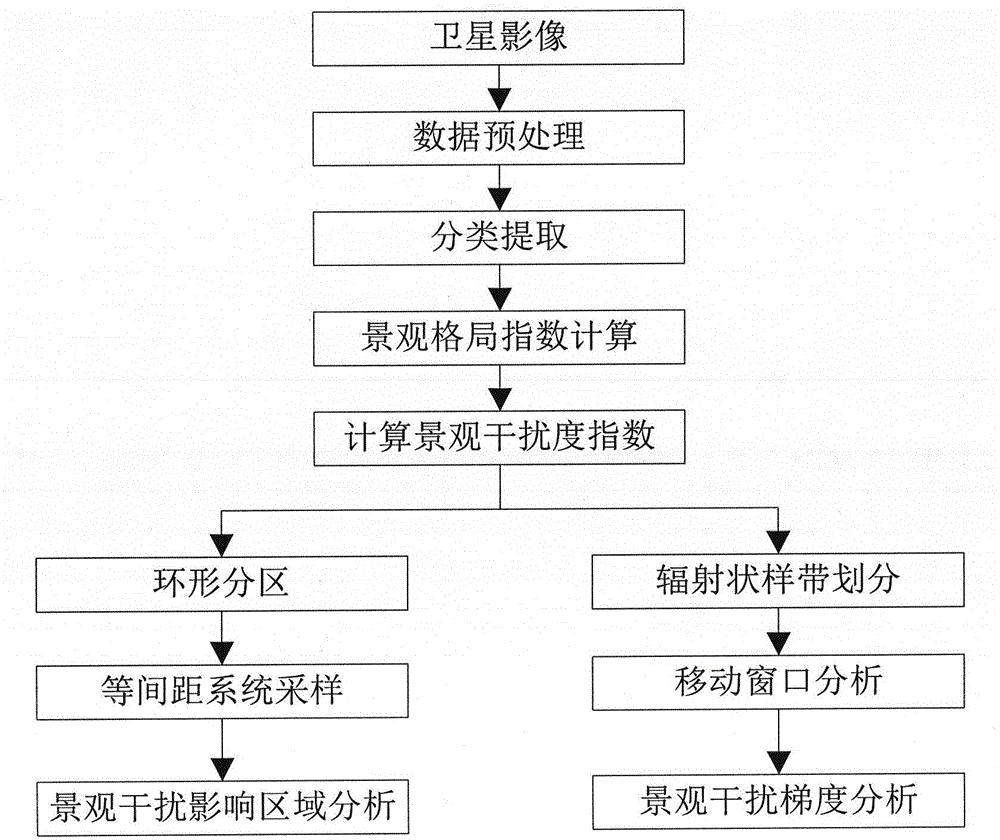
[0033] Such as figure 1 , taking the calculation of the landscape disturbance index of Qinshan Nuclear Power Base in 2010 as an example to illustrate the specific implementation process of the present invention.

[0034] (1) Data collection and processing

[0035] The evaluation area is the 80km land area around the Qinshan nuclear power base, and the land use type is extracted by using satellite remote sensing images with a spatial resolution of 30M during the growing season.

[0036] In this embodiment, the satellite remote sensing image adopts the multispectral data of the Environment-1 satellite in 2010. The texture of the selected remote sensing image is clear, and the cloud cover in the evaluation area is very little, and the cloud cover does not exceed 5%. Satellite remote sensing data are processed through geometric precision cor...