
Power transmission line tower lightning strike risk evaluation method based on data mining technology
A transmission line and data mining technology, applied in data processing applications, instruments, calculations, etc., can solve problems such as the inability to consider the guiding role of lightning strike operation experience, the inability to accurately assess the lightning strike risk of transmission line towers, and the correction and evaluation method of tower information.
- Summary
- Abstract
- Description
- Claims
- Application Information
AI Technical Summary
Problems solved by technology
Method used
Image

Examples
Embodiment Construction
[0022] The technical solutions in the present invention will be clearly and completely described below in conjunction with the accompanying drawings in the present invention.
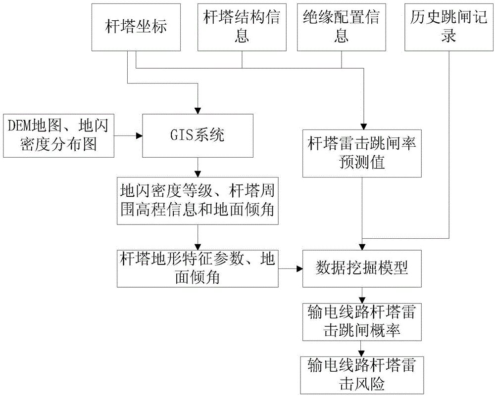
[0023] figure 1 Shown is the structure schematic diagram of the lightning strike risk assessment method for transmission line towers based on data mining technology in the present invention, and the method includes the following steps:
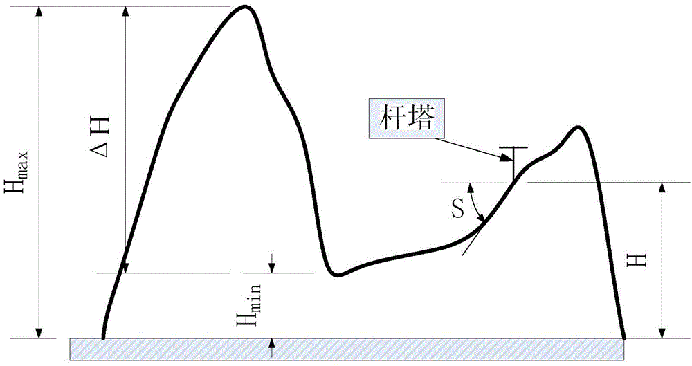
[0024] Step 10: Input the coordinates of transmission line towers into the GIS system, and use the GIS system to extract the elevation information within a certain range around the transmission line towers and the location of the towers according to the digital elevation map (DEM) and the distribution map of the ground flash density Ground flash density level and ground inclination;
[0025] Specifically, the digital elevation map (DEM), ground flash density distribution map and tower coordinate information of the area where the tower is located are input into the GIS ...
PUM
 Abstract
Description
Claims
Application Information