Elevation accuracy analysis method for GB-InSAR (Ground-based Interferometric Synthetic Aperture Radar) system based on target spatial distribution information

A technology of spatial distribution and spatial position information, applied in the field of InSAR radar, can solve the problem of inaccurate precision expression, not considering the spatial position of the observation object, etc., to achieve the effect of improving the inaccuracy

Active Publication Date: 2019-03-05
BEIJING INSTITUTE OF TECHNOLOGYGY
View PDF3 Cites 2 Cited by
  • Summary
  • Abstract
  • Description
  • Claims
  • Application Information

AI Technical Summary

Problems solved by technology

However, the existing technology does not consider the spatial position of the observation object when calculating the elevation accuracy. The location parameters of the observation object only take a few typical values. In this way, the elevation accuracy of a single location is used to express the elevation accuracy of an area, and the accuracy expression is not accurate enough.

Method used


Image

  • Elevation accuracy analysis method for GB-InSAR (Ground-based Interferometric Synthetic Aperture Radar) system based on target spatial distribution information
  • Elevation accuracy analysis method for GB-InSAR (Ground-based Interferometric Synthetic Aperture Radar) system based on target spatial distribution information
  • Elevation accuracy analysis method for GB-InSAR (Ground-based Interferometric Synthetic Aperture Radar) system based on target spatial distribution information

Examples


Embodiment Construction

[0048] The present invention will be described in detail below with reference to the drawings and embodiments.

[0049] Aiming at the problem of inaccurate accuracy analysis of current ground-based interference systems, the present invention proposes a GB-InSAR system elevation accuracy analysis method based on target spatial distribution information. The analysis method can be used for ground-based interference systems with system parameters and error source accuracy determined .

[0050] The GB-InSAR system elevation accuracy analysis method based on target spatial distribution information of the present invention includes the following steps, such as Figure 5 Shown:

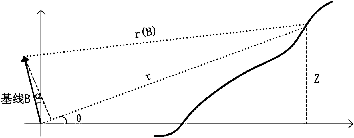
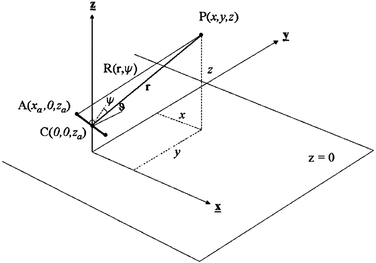
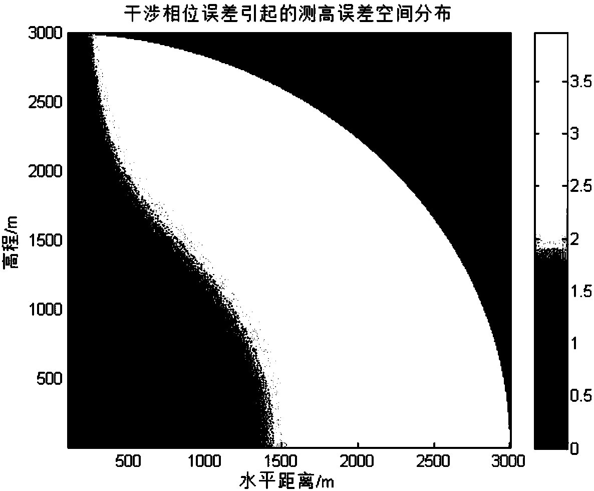
[0051] Step 1. According to the height measurement principle of the ground-based interferometric SAR system, establish the height measurement model of the ground-based interferometric SAR system, and extract the error sources that affect the accuracy of the height measurement.

[0052] In this step, the method of est...


PUM


Abstract

The invention discloses an elevation accuracy analysis method for a ground-based interferometric SAR (Synthetic Aperture Radar) system based on target spatial distribution information. The method comprises the steps of building an elevation measurement error model caused by error source errors for error sources which affect the elevation measurement accuracy, and introducing spatial position information into the elevation measurement error model; obtaining the spatial distribution of elevation measurement errors caused by each error source by using the elevation measurement error model, and then integrating to obtain the spatial distribution of the total elevation measurement accuracy within the radar operation range under the current error accuracy. The elevation accuracy analysis methodobtains the spatial distribution of errors by combining the spatial position information of an observed target under the premise of elevation measurement error source distribution so as to obtain theelevation accuracy of the observation area. The inaccuracy of the prior art in accuracy quantitative analysis is improved by replacing a selected typical value in accuracy analysis with the position information of the target.

Description

Technical field [0001] The invention relates to the technical field of InSAR radar, in particular to a ground-based interferometric SAR (GB-InSAR) system elevation accuracy analysis method based on target spatial distribution information. Background technique [0002] Synthetic Aperture Radar Interferometry (Interferometric Synthetic Aperture Radar or Synthetic Aperture Radar Interferometry, InSAR or IFSAR) technology is fast, high-precision, all-weather, all-weather in Digital Elevation Model (DEM) reconstruction and surface deformation monitoring, etc. Outstanding advantages such as large areas and large areas have become one of the most potential new technologies for earth observation. Among them, the ground-based SAR (GB-SAR) technology has the advantages of short repeated observation time, flexible and stable operation, and high data accuracy. It is possible to obtain terrain height and deformation information within a safe distance. [0003] For ground-based interferometric...

Claims


Application Information

Patent Timeline
Patent Type & Authority Applications(China)
IPC IPC(8): G01S13/90G01S7/40
CPCG01S7/4052G01S13/9023
Inventor 田卫明胡程龙腾赵政曾涛丁泽刚
Owner BEIJING INSTITUTE OF TECHNOLOGYGY
Why Eureka
Try Eureka