

Dual map system for navigation and wireless communication
a dual-map system and wireless communication technology, applied in the field of wireless communication, can solve the problems of not defining the precise degree of coverage area or the location of existing maps, and unable to predict the transition from good to bad communications
- Summary
- Abstract
- Description
- Claims
- Application Information
AI Technical Summary
Problems solved by technology
Method used
Image

Examples
Embodiment Construction
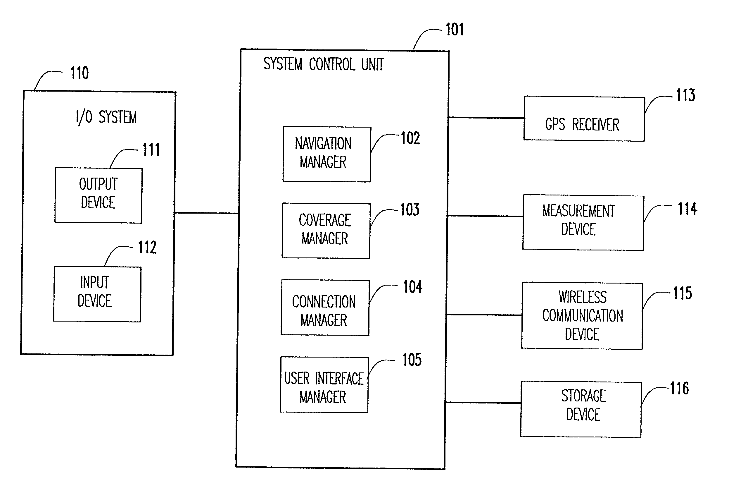
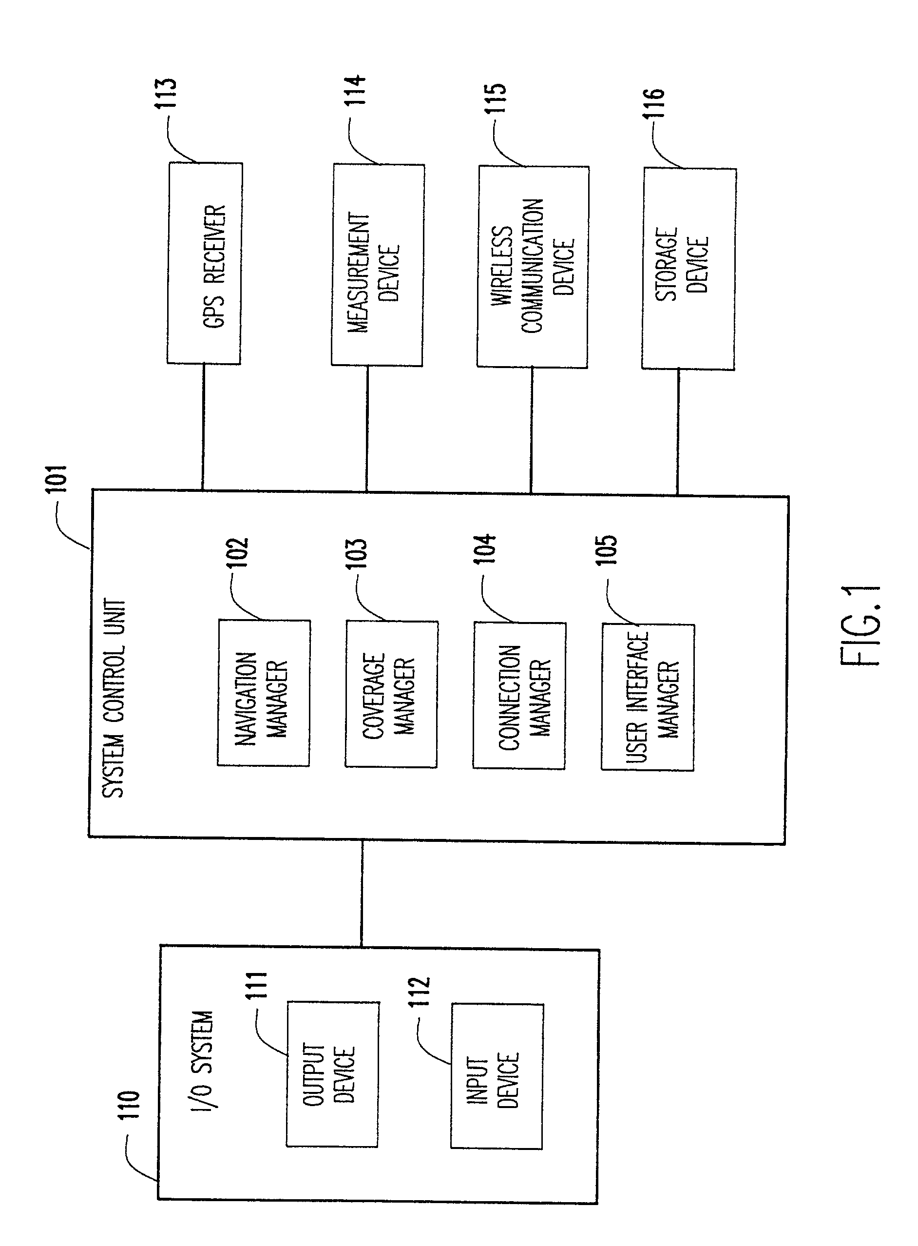
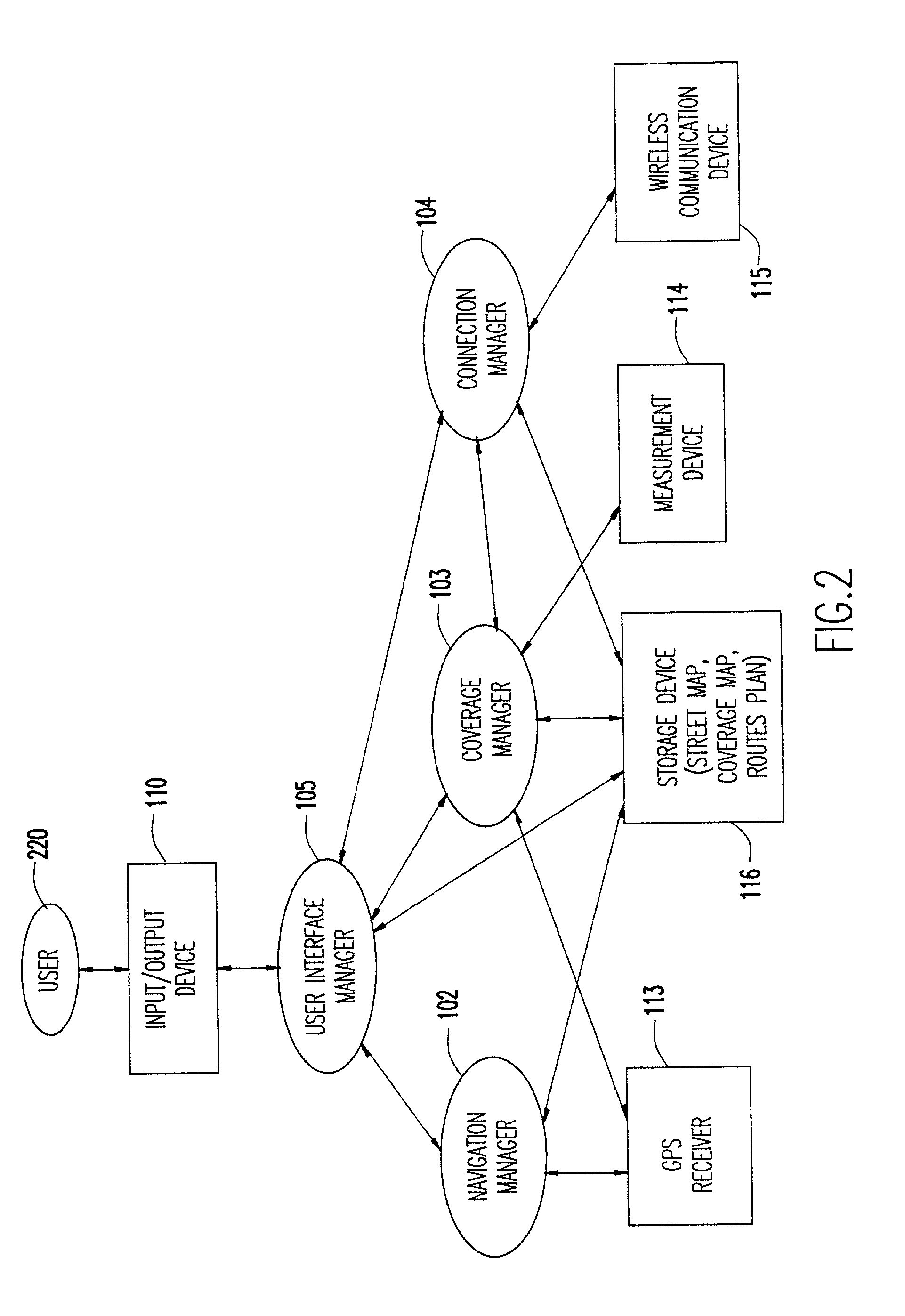
[0019] Referring now to the drawings, and more particularly to FIG. 1, there is shown the overall system diagram. The major components of the system include the system control unit 101, such as a general purpose computer having a central processing unit (CPU) supported by read only memory (ROM) storing basic input / output system (BIOS) and random access memory (RAM) storing application program code. Such a general purpose computer may be, for example, a lap top computer or an on board, built-in computer. The system unit 101 communicates with a user via an input / output (I / O) system 110, which comprises an output device 111, such as a speaker and display, and an input device 112, such as a microphone and a keyboard.
[0020] The system control unit 101 has connected to it and communicates with a GPS receiver 113, a measurement device 114, a wireless communication device 115, and the storage device 116. The GPS receiver 113 provides location information to the system control unit which det...
PUM
 Abstract
Description
Claims
Application Information