
Methods and systems utilizing true airspeed to improve vertical velocity accuracy
a technology of true airspeed and vertical velocity, applied in the direction of navigation instruments, instruments, process and machine control, etc., can solve the problems of manufacturing defects, inertial navigation system errors, and unstable vertical channel of inertial navigation systems
- Summary
- Abstract
- Description
- Claims
- Application Information
AI Technical Summary
Benefits of technology
Problems solved by technology
Method used
Image

Examples
Embodiment Construction
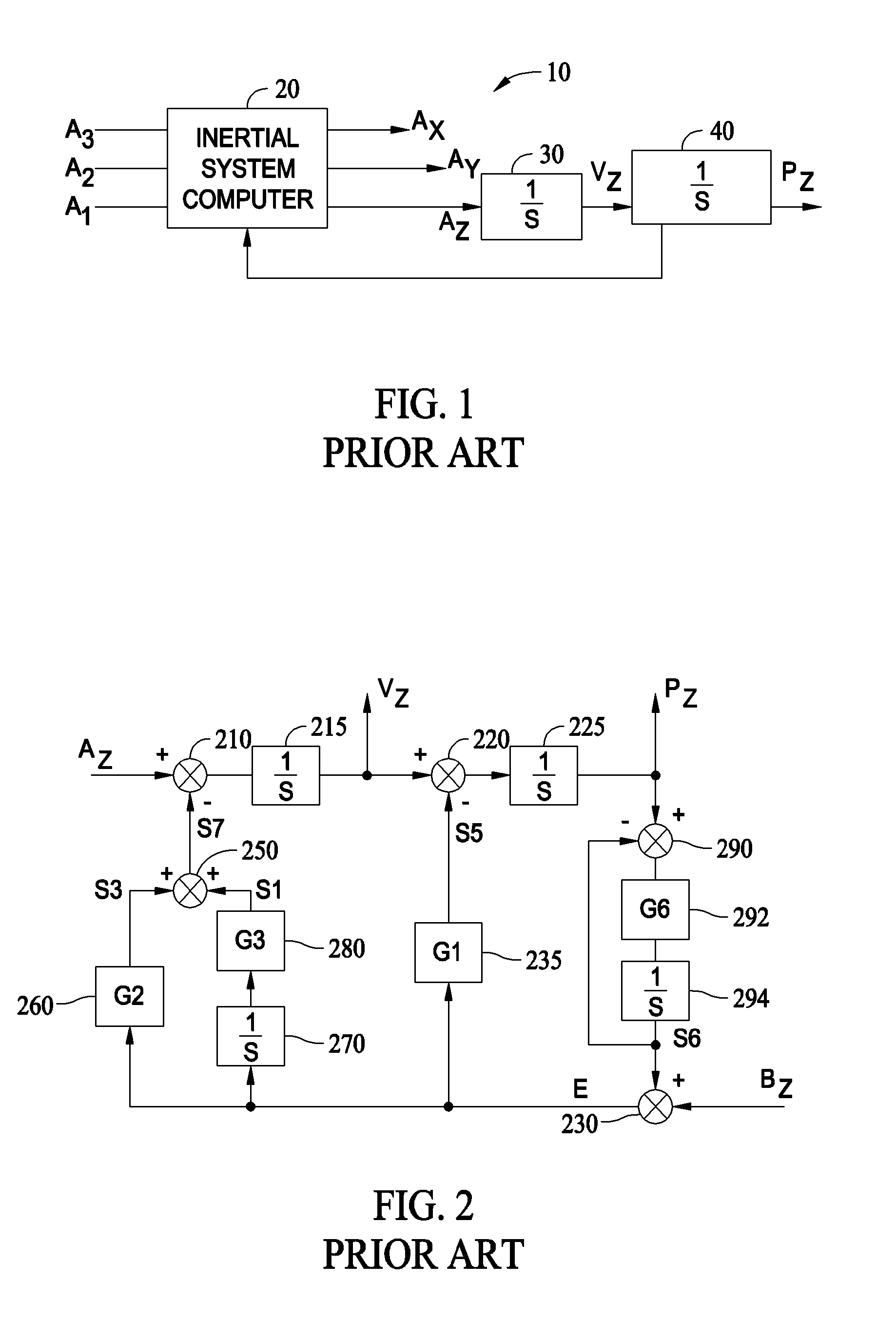
[0015]FIG. 1 is a simplified block diagram of a inertial navigation control system 10 which includes the above described orthogonal triad of accelerometers having outputs A1, A2 and A3 applied as inputs to an inertial navigation system computer 20. The accelerometers are orthogonally positioned relative to one another in order to provide orthogonal components of acceleration. After initialization of inertial navigation system computer 20, computer 20 is configured to calculate the orthogonal components of acceleration AX, AY and AZ, where the acceleration AZ, is identified as the acceleration in the vertical direction, i.e., perpendicular to the earth's surface. The vertical acceleration information is further provided to an integrator 30, which determines a vertical velocity VZ, from the received vertical acceleration, AZ. Because gravitation and the earth's radius are included in the calculations performed by inertial system computer 20, vertical position information from a second...
PUM
 Abstract
Description
Claims
Application Information