

Road crossing navigation method and navigation system using the navigation method
A technology for intersections and navigation methods, applied to road network navigators and other directions, can solve problems such as waste of human resources, storage space occupation, large storage space of navigation systems, etc., and achieve the effect of improving compatibility and portability, and saving resources
Active Publication Date: 2008-10-22
SHENZHEN CARELAND TECH
View PDF1 Cites 37 Cited by
- Summary
- Abstract
- Description
- Claims
- Application Information
AI Technical Summary
Problems solved by technology
Due to the large number of intersections, such as Shenzhen City, there are thousands of different intersections, and the number of intersections in a province can reach millions, which makes the navigation system require a large storage space to meet the needs of using real-world pictures for navigation. requirements, resulting in a huge occupation of storage space
In addition, this model also requires navigation system developers to spend a lot of money and a lot of time to make thousands of real-scene pictures of intersections, which greatly wastes human resources, and when the map of the navigation system is changed to other provinces and cities When using a map, the real-world picture database for navigation at intersections must also be replaced, and the compatibility and portability are poor.
Method used
View moreImage
Smart ImageViewing Examples

Examples
Embodiment Construction
Login to View More PUM
 Abstract
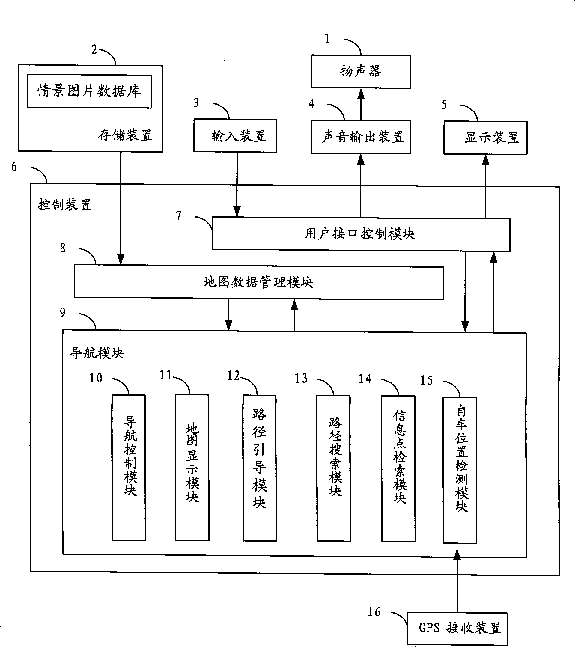
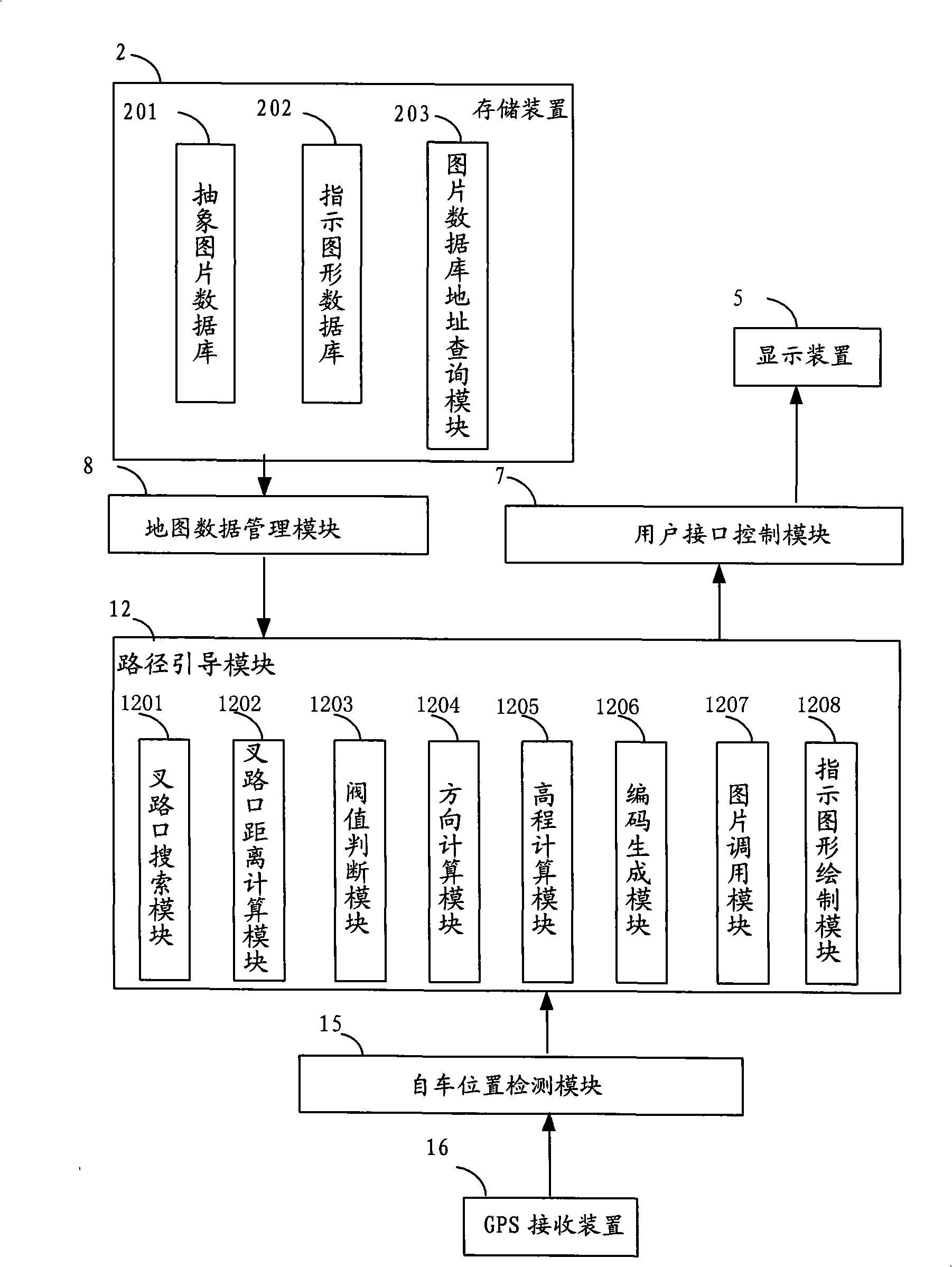
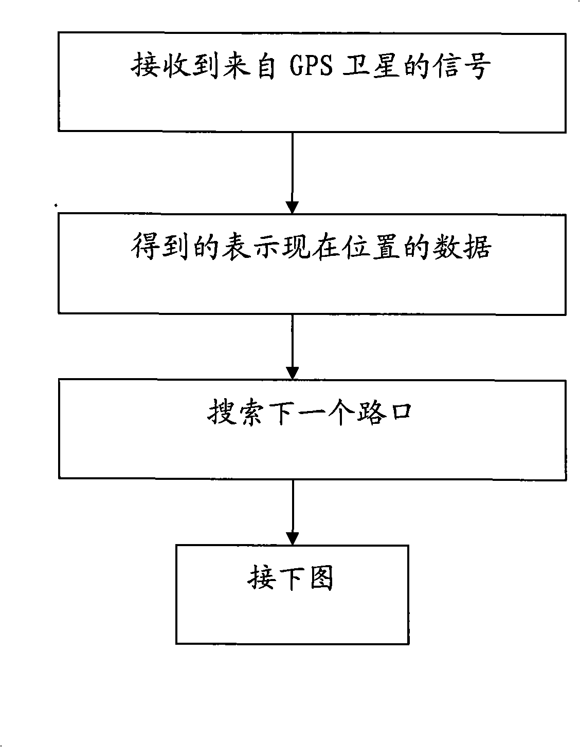
The present invention discloses a navigation method for a way crossing and a navigation system using the same. The navigation method comprises the following steps of: detecting the road state navigation information of the next way crossing to obtain a road state parameter; obtaining the road state navigation information of the next way crossing according to a calculation process and finding out a corresponding abstract picture in an abstract picture database to be used as a prompt picture of the way crossing to display. Since the abstract picture database in which various abstract pictures reflecting the navigation information of the road sate of the way crossing are saved is arranged in the navigation system, when the navigation system enters into the way crossing abstract picture mode to navigate, the actual road state navigation information of the way crossing is detected, and then the abstract picture is found out for the navigation. Since most way crossings have the same road state, the navigation system can intuitively display the road condition of the next way crossing, and can not occupy large storage space.
Description
A navigation method for an intersection and a navigation system using the navigation method technical field The invention relates to the technical field of GPS navigation, and more specifically, relates to a navigation method for an intersection and a navigation system using the navigation method. Background technique At present, GPS navigation in road system navigation is one of the important application directions of GPS navigation. The GPS antenna of the GPS navigation system receives the data information transmitted by at least 3 of the 24 GPS satellites around the earth, combined with the electronic map stored in the navigation terminal, the position coordinates determined by the GPS satellite signal match this, and determine The exact position of the navigation object in the electronic map. When encountering complex intersections, especially when there are elevated or sunken roads, because the voice prompts are long and it is difficult to accurately express the dri...
Claims
Login to View More Application Information
Patent Timeline
 IPC IPC(8): G01C21/26G01C21/34G01C21/36
Inventor张文星
OwnerSHENZHEN CARELAND TECH