
Soil physical property classification recognition method and device based on geological radar
A technology of geological radar and identification method, applied in the field of detection, which can solve the problems of non-stationarity and randomness, difficulty in correctly interpreting appearance features, and time-varying echo signals.
- Summary
- Abstract
- Description
- Claims
- Application Information
AI Technical Summary
Problems solved by technology
Method used
Image

Examples
Embodiment Construction
[0030] The technical solution of the present invention will be described in detail below with reference to the accompanying drawings and examples.
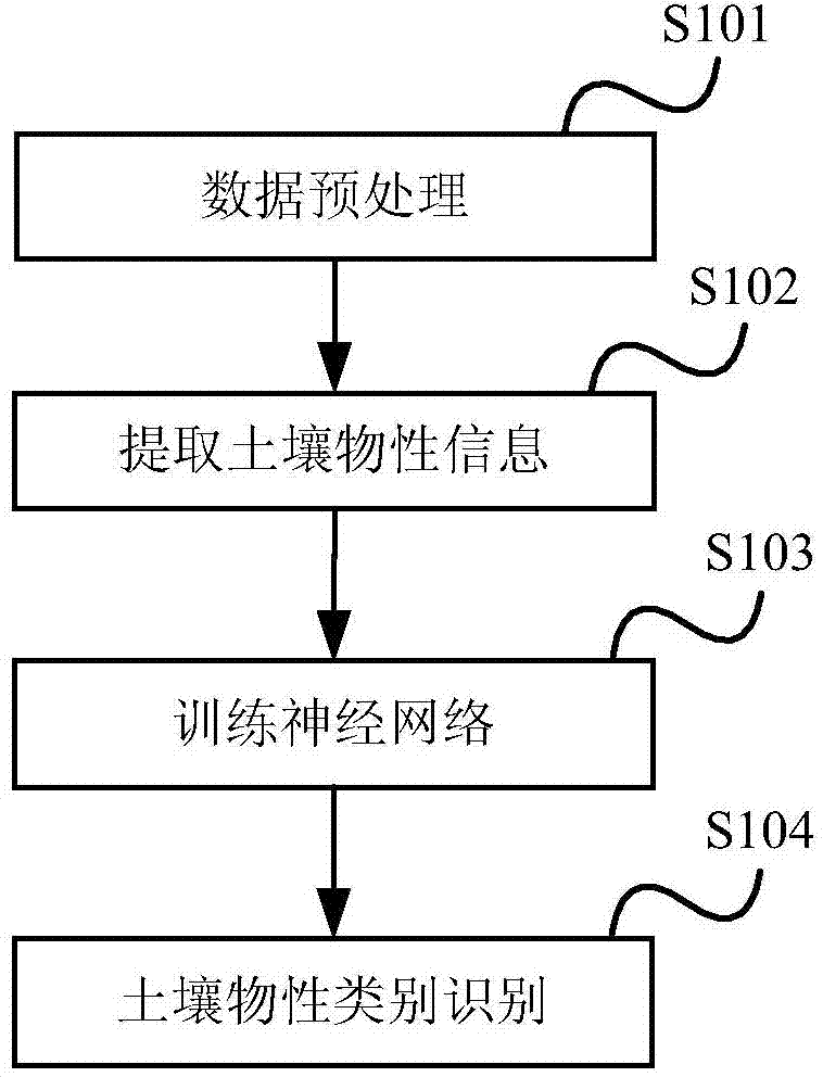
[0031] figure 1 It is a flow chart of the soil physical property category identification method based on geological radar in the present invention, including:
[0032] S101, a data preprocessing step, performing denoising processing and filtering processing on the digital signal collected by the ground radar;
[0033] S102, the soil physical property information extraction step, extracting characteristic data representing soil physical properties from the data that has undergone the data preprocessing step;
[0034] S103, the neural network training step, using the feature data as a data set for training the neural network, training the neural network, and obtaining a mapping result corresponding to the feature data;
[0035] S104, the step of identifying the soil physical property category, inputting the characteristic data rep...
PUM
 Abstract
Description
Claims
Application Information