

Abnormal submerging area detection method based on remote sensing vegetation index time sequence
A time series and vegetation index technology, which is applied in the field of remote sensing image processing and information extraction, and can solve the problems of difficult flood dynamic change and unstable water body identification accuracy.
- Summary
- Abstract
- Description
- Claims
- Application Information
AI Technical Summary
Problems solved by technology
Method used
Image

Examples
Embodiment Construction
[0031] Now in conjunction with the accompanying drawings and specific embodiments, the present invention is further illustrated. It should be understood that the specific embodiments are only used to illustrate the present invention and not to limit the present invention. The modifications to various equivalent forms of the present invention all fall within the appended rights of the application The scope limited by the requirements.
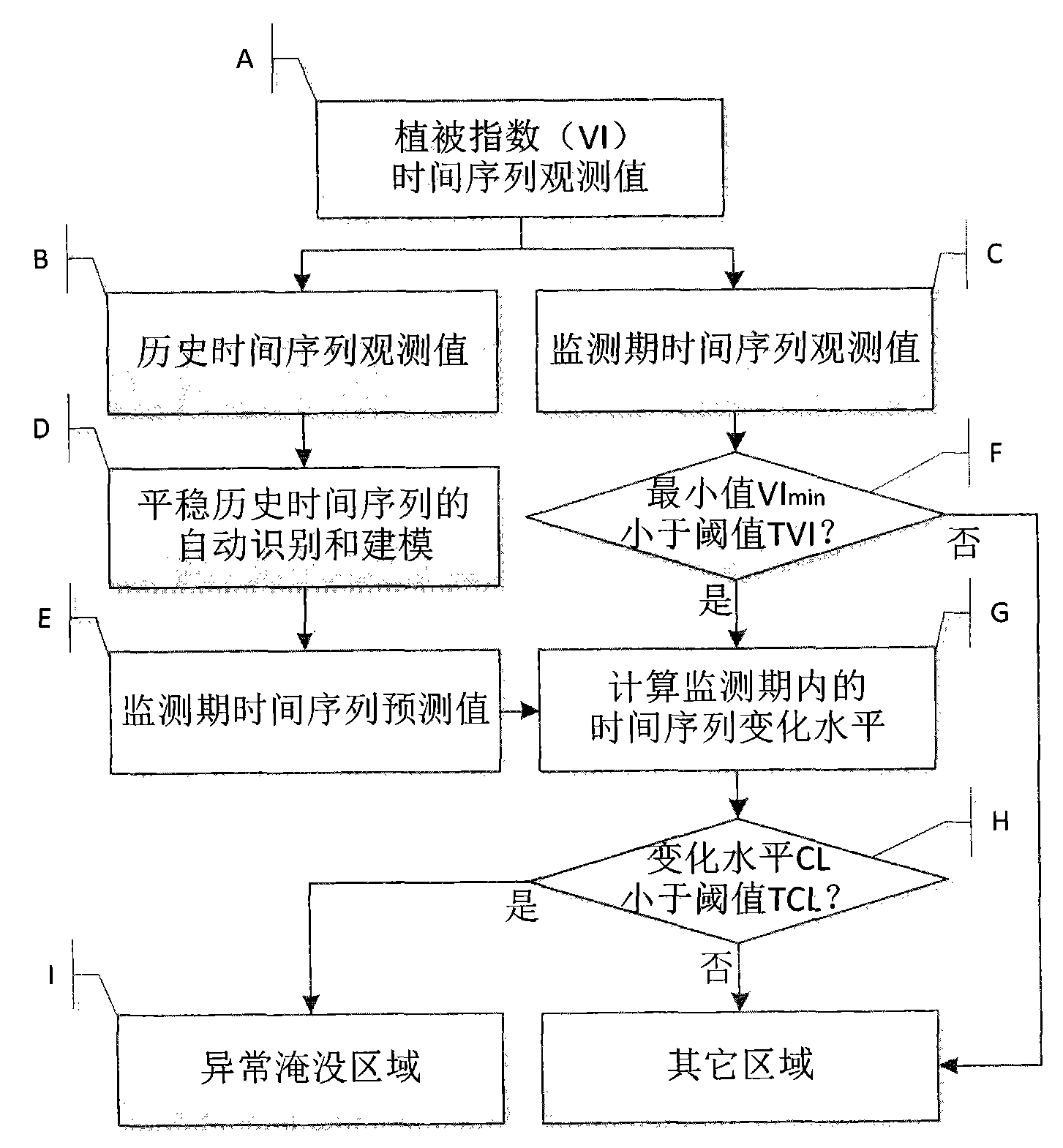
[0032] figure 1 It is a flow chart of the abnormal submerged area detection method based on the remote sensing vegetation index time series of the present invention, combined with the specific description in the "Summary of the Invention", the specific implementation of the present invention includes the following steps:
[0033] A. Extract the vegetation index time series observation data pixel by pixel from the remote sensing vegetation index time series image, and the vegetation index time series observation value is expressed as {Y t : t=1,...
PUM
 Abstract
Description
Claims
Application Information