Navigation Device and Control Method for Displaying Detour

a technology of navigation device and control method, which is applied in the direction of navigation instruments, surveying and navigation, instruments, etc., can solve the problems of difficult to see an overview of the detour, the shortcut, or the back road, and the operation is complicated

Active Publication Date: 2014-02-27
ALPINE ELECTRONICS INC
View PDF20 Cites 8 Cited by
  • Summary
  • Abstract
  • Description
  • Claims
  • Application Information

AI Technical Summary

Benefits of technology

[0014]According to the present invention having the above-mentioned configuration, while a small-scale wide area map is displayed, the display of the wide area map is maintained and a detour to pass through a road included in a detailed map showed using map data at a level lower than a predetermined level is synthesized and additionally displayed. The detour is synthesized and displayed on the wide area map while the routes included in the detailed map are zoomed. This can display the detour over a wide area. Thus, the user can receive an overview of the detour. Thus, according to the present invention, a detour to avoid a traffic hazard, for example, a traffic jam, can be shown to the user in an easily understood manner without a user's complicated operation for changing the scale.

Problems solved by technology

Accordingly, there is a problem in that a road that is not included in the map data at the level corresponding to the currently designated scale (currently displayed on the screen) cannot be displayed as a detour even if a detour is explored near the intersection to which the vehicle is guided as described in JP 09-042984 A. Similarly, there is a problem in that a road that is not included in the map data at the level corresponding to the currently designated scale cannot be displayed as a shortcut or a back road even if a shortcut or a back road is displayed as described in JP 2006-275729 A.
There is a problem in that, if it is desirable that narrow roads such as a narrow street are displayed as detours, shortcuts or back roads, it is necessary to change the designation of the scale to a level at which the detailed map of the city is displayed, and this complicates the operation.
Further, there is a problem in that, if the scale is increased to a level at which the detailed map of the city is displayed, it is difficult to see an overview the detour, the shortcut, or the back road.
This brings a feeling of anxiety to the driver because it is difficult for the driver to know the route of the detour or how far is the detour.

Method used


Image

  • Navigation Device and Control Method for Displaying Detour
  • Navigation Device and Control Method for Displaying Detour
  • Navigation Device and Control Method for Displaying Detour

Examples


Embodiment Construction

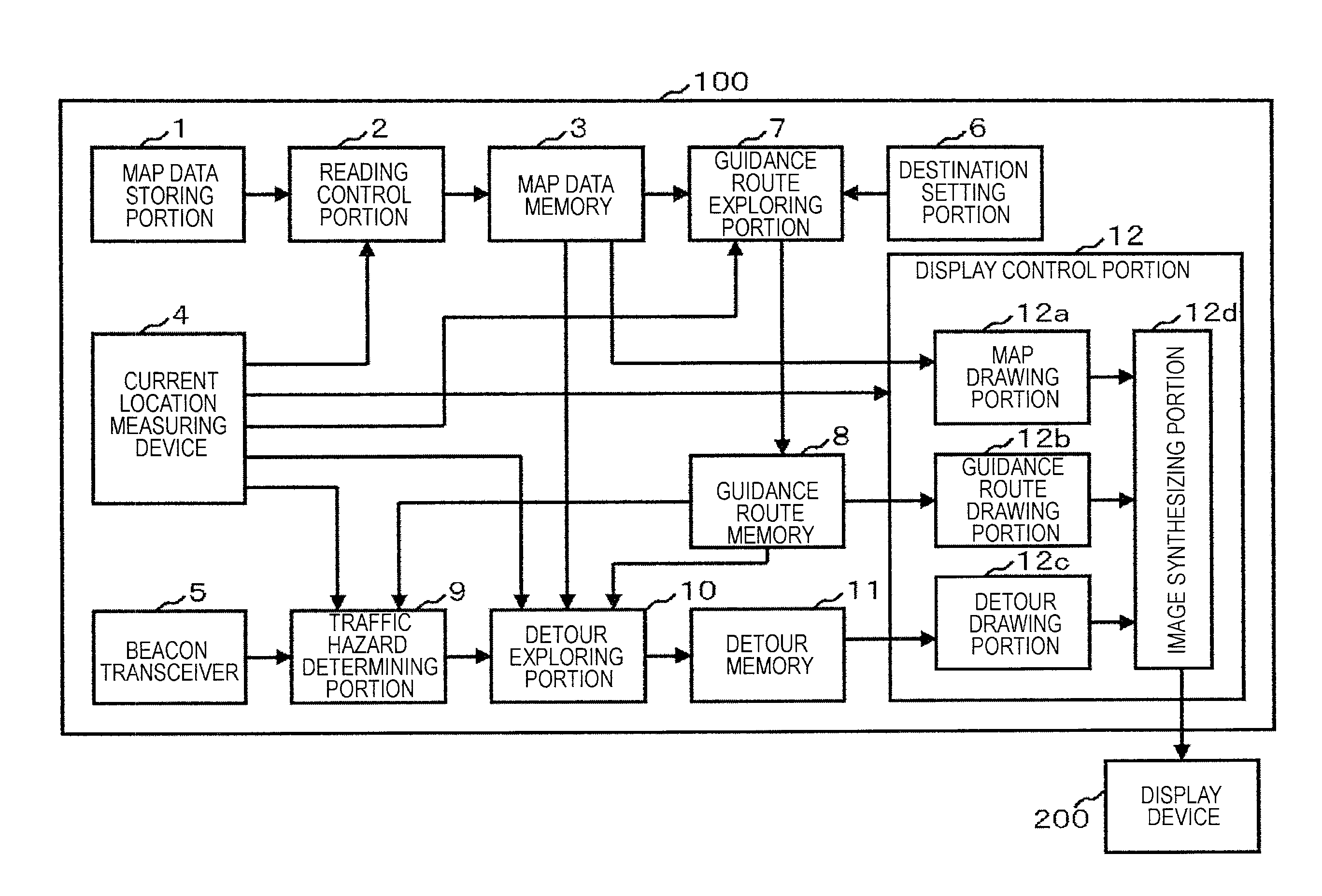
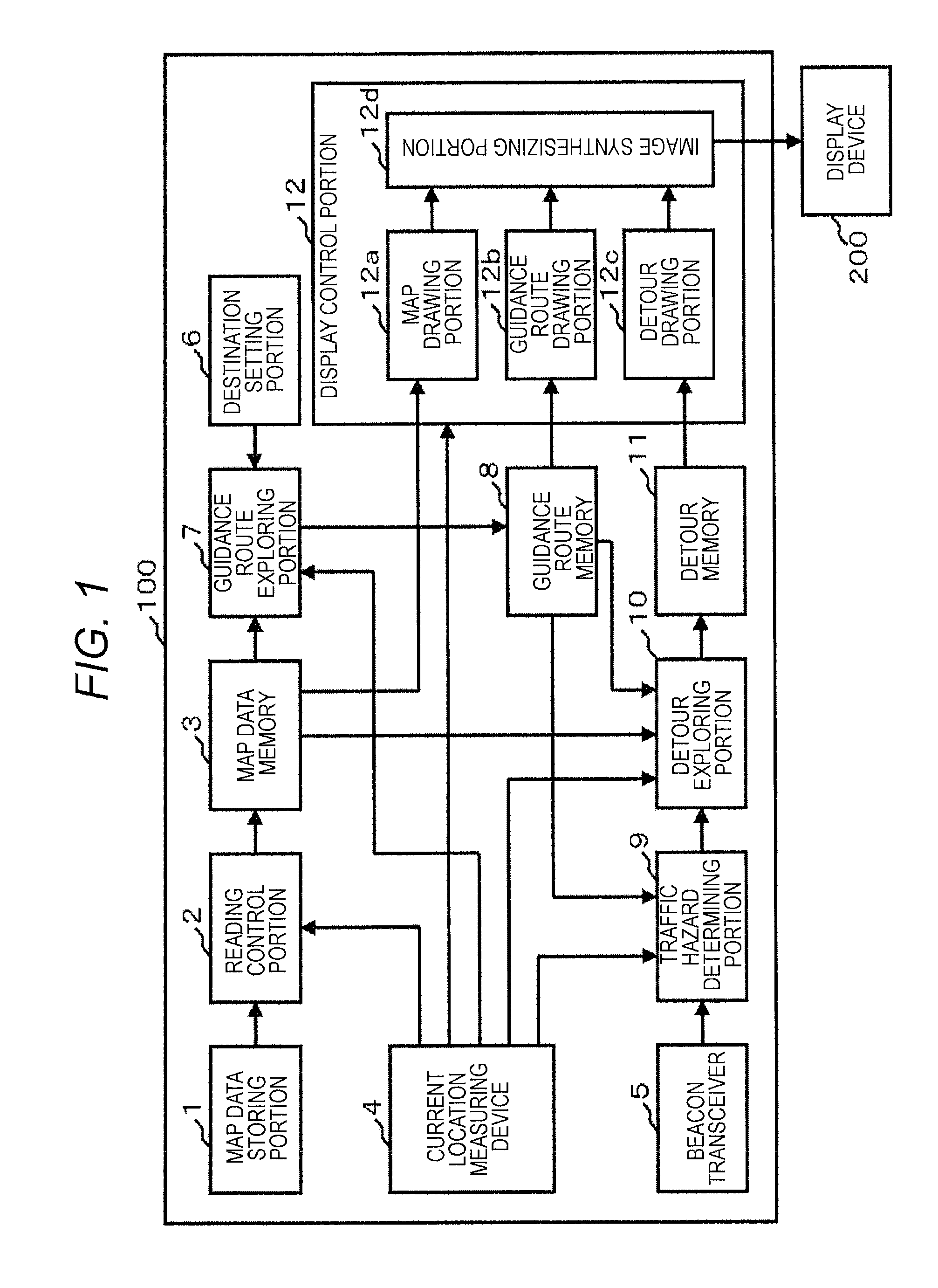
[0019]Hereinafter, an embodiment of the present invention will be described based on the drawings. FIG. 1 is a block diagram of an example of the functional configuration of a navigation device 100 in the present embodiment. As illustrated in FIG. 1, the navigation device 100 according to the present embodiment includes, as its functional components, a map data storing portion 1, a reading control portion 2, a map data memory 3, a current location measuring device 4, a beacon transceiver 5, a destination setting portion 6, a guidance route exploring portion 7, a guidance route memory 8, a traffic hazard determining portion 9, a detour exploring portion 10, a detour memory 11, and a display control portion 12. Further, the display control portion 12 includes, as its specific functional components, a map drawing portion 12a, a guidance route drawing portion 12b, a detour drawing portion 12c, and an image synthesizing portion 12d.

[0020]Note that each function of the reading control po...


PUM


Abstract

The navigation device includes a detour exploring portion configured to explore a detour to avoid a section in which a traffic hazard occurs using map data at a level lower than a predetermined level when a traffic hazard determining portion determines that the traffic hazard occurs on the guidance route, and a display control portion configured to zoom the detour to match a scale of the detour to a currently designated scale, and synthesize and display the detour on a map image. The navigation device maintains the display of the wide area map and synthesizes and additionally displays a detour, for example, to pass through a road such as a narrow street included in a detailed map on the map image such that the user can receive, at a glance, a detour to easily bypass the section in which a traffic hazard occurs.

Description

RELATED APPLICATION[0001]The present application claims priority to Japanese Application Number 2012-183834, filed Aug. 23, 2012, the entirety of which is hereby incorporated by reference.BACKGROUND[0002]1. Field of the Invention[0003]The present invention relates to a navigation device and a control method for displaying a detour and, in particular, to a navigation device and a control method for displaying a detour when a traffic hazard, for example, a traffic jam occurs on a guidance route.[0004]2. Description of the Related Art[0005]A car-mounted navigation device generally detects a current location of the vehicle using an autonomous navigation sensor, a Global Positioning System (GPS) receiver, or the like and reads map data near the location from a storage medium to display a map on a screen. Then, a driver's location mark that shows the vehicle location is also superimposed and displayed at a predetermined point on the screen such that the location where the vehicle currentl...

Claims


Application Information

Patent Timeline
Patent Type & Authority Applications(United States)
IPC IPC(8): G01C21/34
CPCG01C21/3492G01C21/3694G08G1/096827G08G1/096844G08G1/0969G01C21/3415
Inventor ICHIKAWA, TAKASHIOSHIKA, TAKAHIRONISHIKAWA, NORIMITSUABE, MAKOTOYAMAZAKI, NOBORUSUZUKI, MITSURU
Owner ALPINE ELECTRONICS INC
Why Eureka
Try Eureka