FloodGraphic: A site and elevation specific flood history, warning, and data collection capable sign and a methodology for deployment of the sign

Inactive Publication Date: 2019-08-22
HYLAND MICHAEL WILLIAM
View PDF0 Cites 1 Cited by
  • Summary
  • Abstract
  • Description
  • Claims
  • Application Information

AI Technical Summary

Benefits of technology

[0178]FloodGraphic signs, dispersed in a block by block grid in flood sensitive communities, will provide graphic evidence of the variability of depths of historic & threatened flooding and highlight the variability of flood depths attributable to subtle topographic variations that are commonplace, but too slight to be familiar even to neighborhood residents. This will provoke the moving of cars and other valuables from flood prone sites to less flood prone sites, which are often only a block or two away. It will expand knowledge of the locations of extremely flood prone sites and sites of lesser flood propensity. Such expanded knowledge will positively affect decision making re: building and home purchases, development, and redevelopment, and even where one parks one's car

Problems solved by technology

But no prior art to this applicant's knowledge includes precise location and elevation-specific warnings as is producible through FloodGraphic's array of site elevation specific referencing signs.
These signs incorporate the MUTCD vernacular, and discourage motor vehicle drivers from entering waters of unknown depth, but do not present precise location specific elevation data, historic flooding data, or elevation rang

Method used


Image

  • FloodGraphic: A site and elevation specific flood history, warning, and data collection capable sign and a methodology for deployment of the sign
  • FloodGraphic: A site and elevation specific flood history, warning, and data collection capable sign and a methodology for deployment of the sign
  • FloodGraphic: A site and elevation specific flood history, warning, and data collection capable sign and a methodology for deployment of the sign

Examples


Embodiment Construction

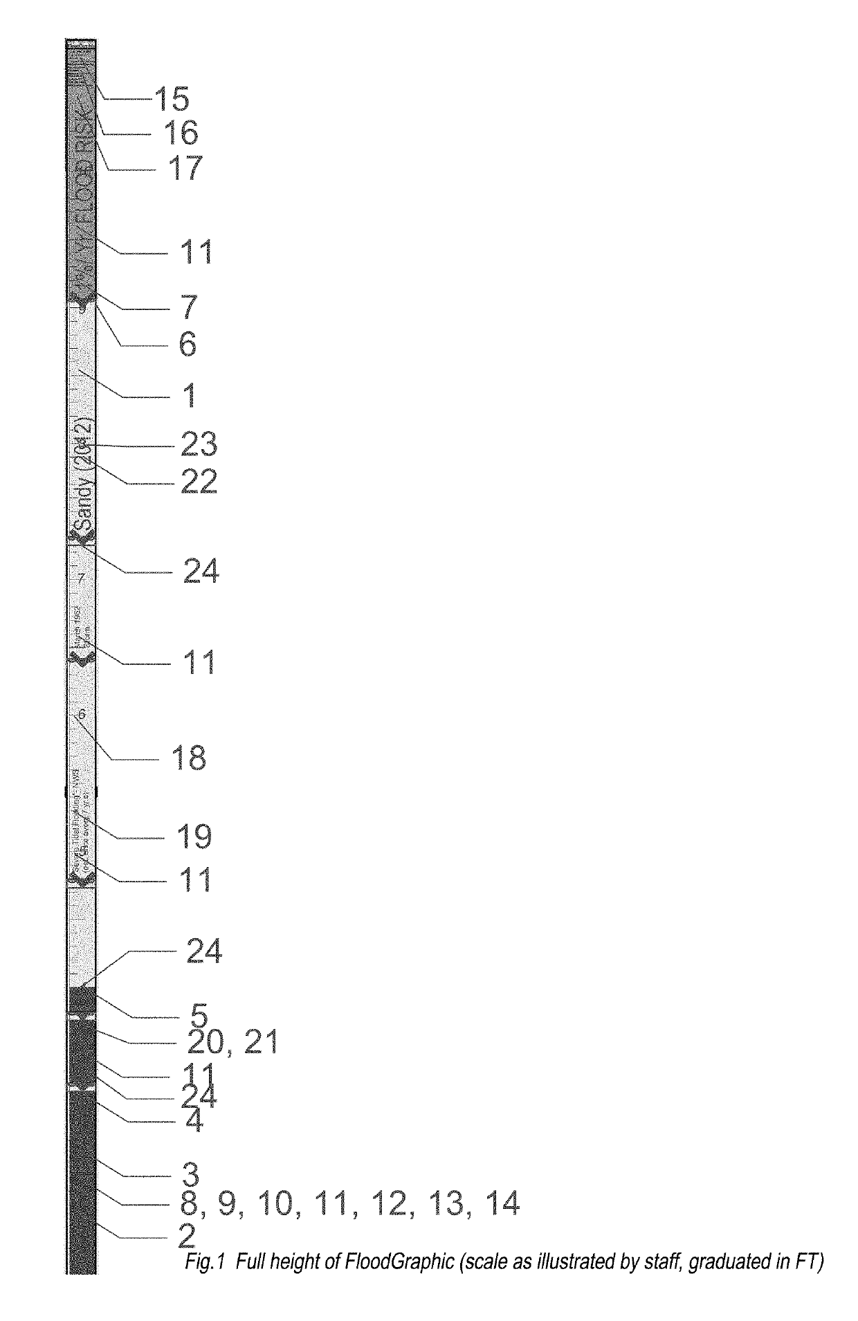
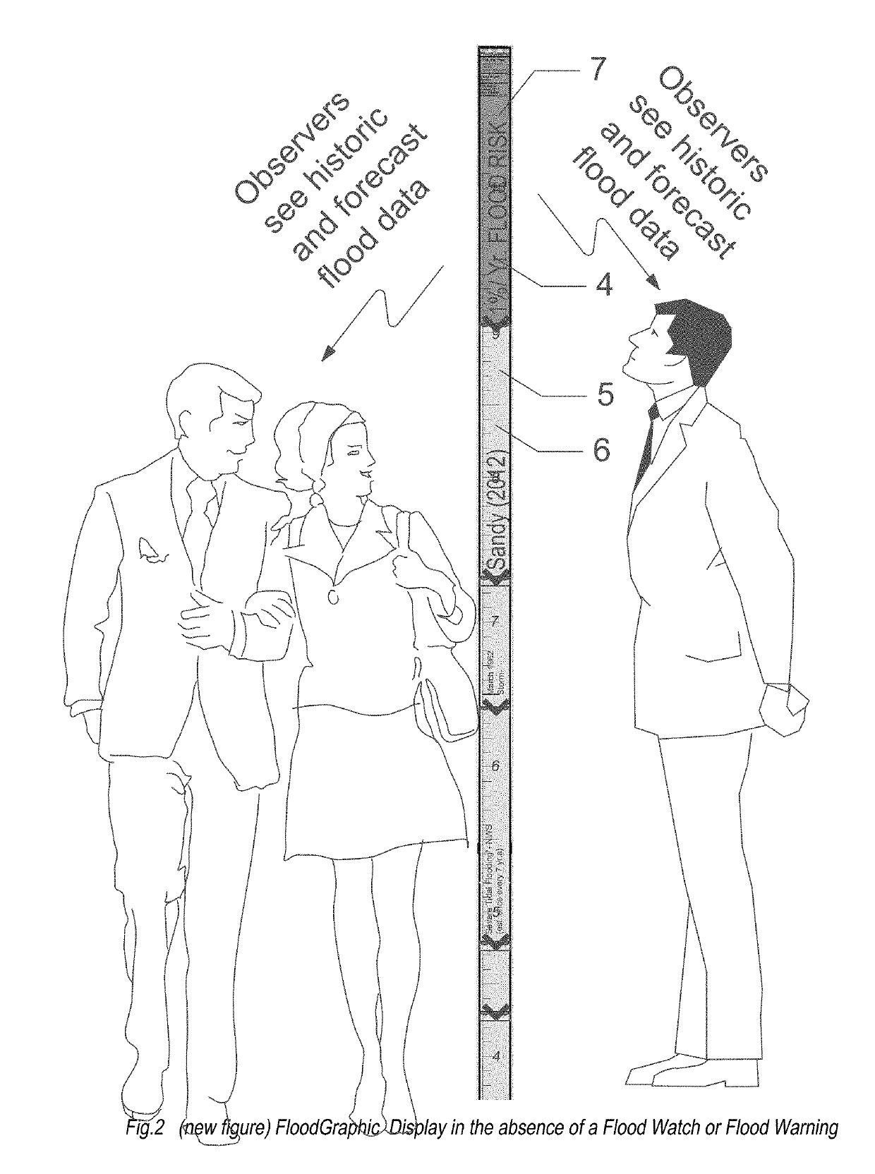
[0197]FloodGraphic is a method of communicating the spatial variability of flood zone information, particularly the physical elevation or height above the ground of the 100 year flood and historic flood data with respect to the height above the ground within a flood prone community through an array of signs at multiple locations, which signs are produced, installed, monitored, and managed by a central headquarters, FloodGraphic Headquarters (FG HQ).

[0198]By virtue of a multiplicity of such signs within a given flood prone community, residents and visitors to such communities are exposed to graphic information that quickly and perceptibly communicates the risk of flood within the community, and especially the variability of such risk derivative from variations in topography.

[0199]In the event of issuance of flood warnings and or flood watches by US government agencies, the FloodGraphic-dynamic version of the FloodGraphic signs, under management of FG HQ will communicate via video lik...


PUM


Abstract

The method of FloodGraphic graphically present location specific topographic and flood hazard data, including time-sensitive NWS watches and warnings inclusive of site-specific forecast flood depths via an array of particularly shaped and colored, site-specifically annotated, video-capable signs
The signs include vertical gradations in feet or meters in full scale presenting the elevation of the site, historic, and predicted future flood levels, specific to the location of each FG installation. FloodGraphic headquarters administers a program of information accumulation, vetting, information dissemination and management of installations.
The method achieves a standard nationwide array of warning signs.
The FloodGraphic method provides information and warning of actual past and forecast flood heights at a multiplicity of locations more effectively than any existing method by presenting data at each installation with reference to the grade level and a National Datum. No linking to or differentiation between the flood watch and flood warnings of the NWS is provided by any prior art.

Description

CROSS-REFERENCE TO RELATED APPLICATIONS[0001]A Design Patent application, Ser. No. 29 / 629,258, has been filed by this applicant for the FloodGraphic (FG) signs; it presents and describes the appearance of the FloodGraphic series of signs. The static and dynamic versions of the signs, FG and FG-D, are the same in appearance until the onset of a Flood Watch or Flood Warning, issued by the National Weather Service. In the case of FloodGraphic-Dynamic (FG-D), the capabilities of data collection and interactive communication enable updating of graphics, provision of time-sensitive warnings of impending flood events, and communication of the elevation of flooding events as they transpire to FloodGraphic Headquarters (FG HQ).STATEMENT REGARDING FEDERALLY SPONSORED RESEARCH OR DEVELOPMENT[0002]There are no government license rights to this invention. This invention has not been made with government support.NAMES OF THE PARTIES TO A JOINT RESEARCH AGREEMENT[0003]There is no joint research ag...

Claims


Application Information

Patent Timeline
IPC IPC(8): G01W1/10G09F13/22H04W4/90G01B7/26G09F27/00
CPCG01W1/10G09F13/22H04W4/90G01B7/26G09F27/007G09F2013/222G09F9/33G09F27/005
Inventor HYLAND, MICHAEL WILLIAM
Owner HYLAND MICHAEL WILLIAM
Why Eureka
Try Eureka