Method and system for drawing bus line density distribution map
A technology of bus lines and density distribution, applied in the direction of drawing from basic elements, etc., can solve the problems that users cannot intuitively understand, are inconvenient, and cannot intuitively understand the number of bus lines.
- Summary
- Abstract
- Description
- Claims
- Application Information
AI Technical Summary
Problems solved by technology
Method used
Image
Examples
Embodiment Construction
[0023] The present invention will be further described below in conjunction with the drawings and specific implementations:
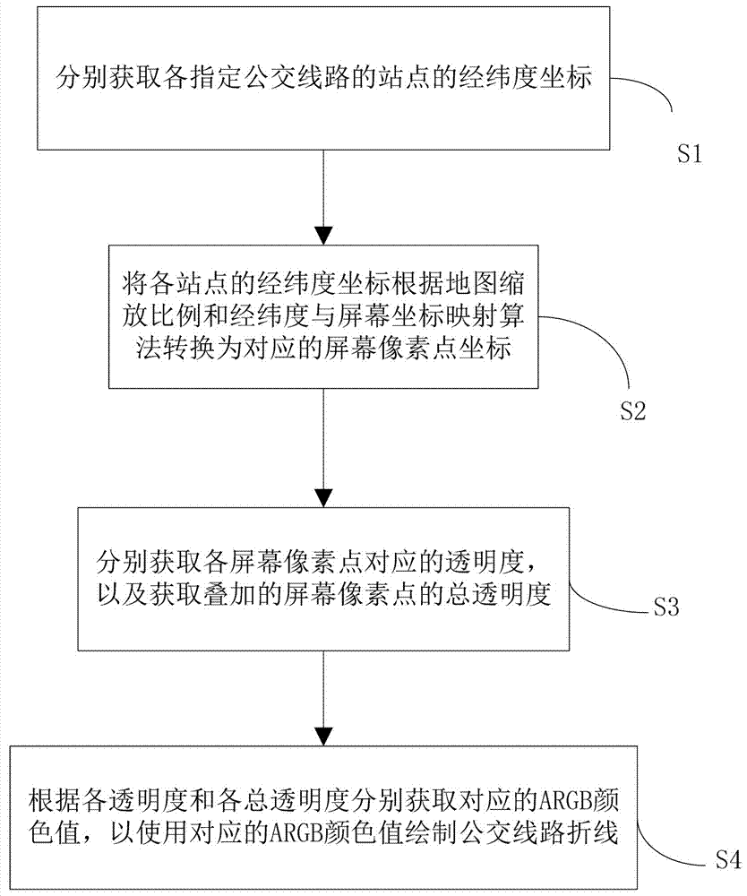
[0024] Please refer to 1. The present invention relates to a method for drawing a bus line density distribution map, and its preferred implementation includes the following steps:
[0025] Step S1: Obtain the latitude and longitude coordinates of the path reference points of each designated bus line respectively.
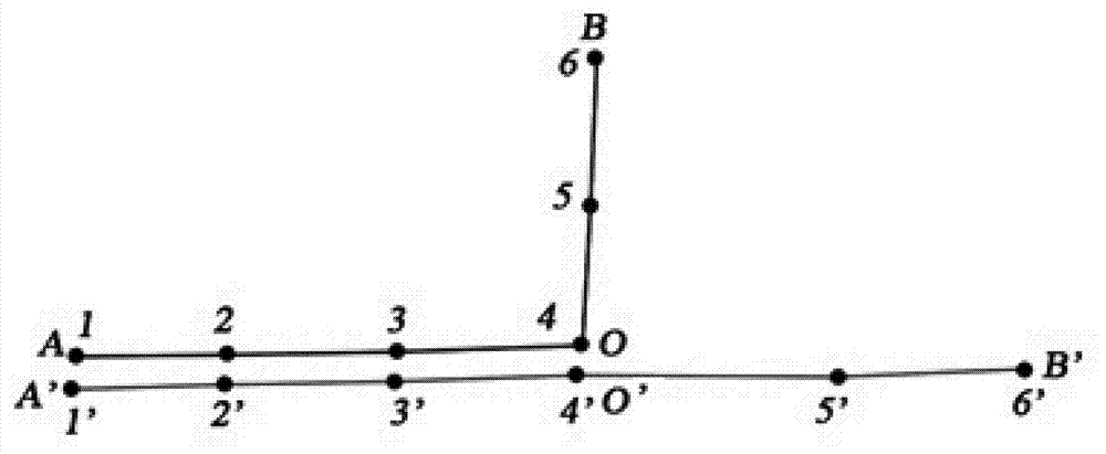
[0026] For example, such as figure 2 As shown, the latitude and longitude coordinates of path reference points 1 to 6 and path reference points 1'to 6'are obtained respectively.
[0027] Step S2: Convert the latitude and longitude coordinates of each path reference point into corresponding screen pixel coordinates according to the map zoom ratio and the latitude and longitude and screen coordinate mapping algorithm;
[0028] Step S3: Obtain the transparency corresponding to each screen pixel, and obtain the total transparency of the superimposed scree...
PUM
 Abstract
Description
Claims
Application Information
 - R&D Engineer
- R&D Manager
- IP Professional
- Industry Leading Data Capabilities
- Powerful AI technology
- Patent DNA Extraction
Browse by: Latest US Patents, China's latest patents, Technical Efficacy Thesaurus, Application Domain, Technology Topic, Popular Technical Reports.
© 2024 PatSnap. All rights reserved.Legal|Privacy policy|Modern Slavery Act Transparency Statement|Sitemap|About US| Contact US: help@patsnap.com


