
Method and device of determining regional transaction, server and storage medium
A determination method and regional technology, applied in the field of data processing, can solve problems such as prone to false negatives and incomplete map updates, and achieve the effects of comprehensive map updates, comprehensive determination of changes, and guarantee of current situation
- Summary
- Abstract
- Description
- Claims
- Application Information
AI Technical Summary
Problems solved by technology
Method used
Image

Examples
Embodiment Construction
[0038] The following will clearly and completely describe the technical solutions in the embodiments of the application with reference to the drawings in the embodiments of the application. Apparently, the described embodiments are only some of the embodiments of the application, not all of them. Based on the embodiments in this application, all other embodiments obtained by persons of ordinary skill in the art without making creative efforts belong to the scope of protection of this application.
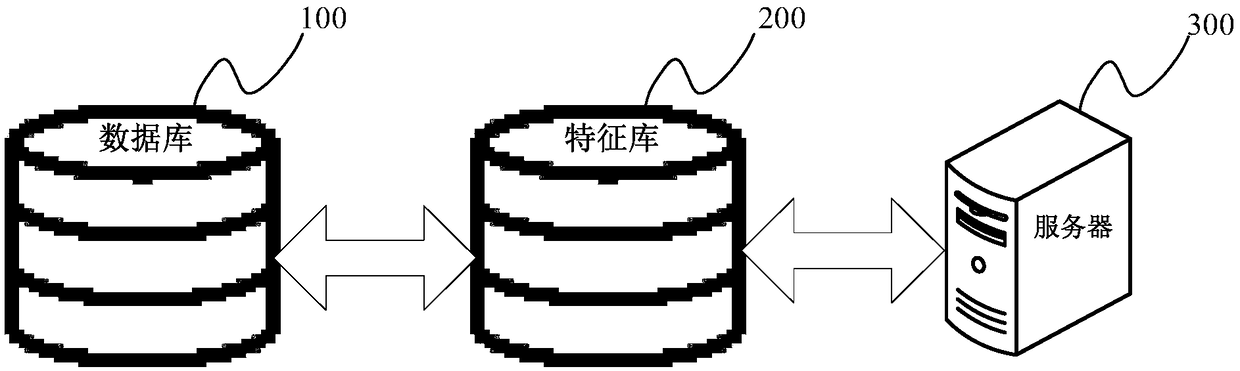
[0039] figure 1 A schematic diagram of the composition and structure of a scene applicable to the region determination method of the present application is shown.
[0040] exist figure 1 The scene includes: database 100 , feature library 200 and server 300 .
[0041] Wherein, the database 100 can be used to store information source data, and the information source data is data that can reflect changes in geographical areas over time, such as remote sensing images, positioning requ...
PUM
 Abstract
Description
Claims
Application Information