
Compression method of cloudy remote sensing image based on quantization strategy
A technology of remote sensing image and compression method, which is applied in the field of image processing, and can solve problems such as loss of cloud areas and inability to retain information of thin clouds and ground objects, so as to achieve the effects of improving compression performance, improving peak signal-to-noise ratio (PSNR), and reducing coding consumption
- Summary
- Abstract
- Description
- Claims
- Application Information
AI Technical Summary
Problems solved by technology
Method used
Image

Examples
Embodiment Construction
[0035] The specific embodiment of the present invention will be further described below in conjunction with accompanying drawing:
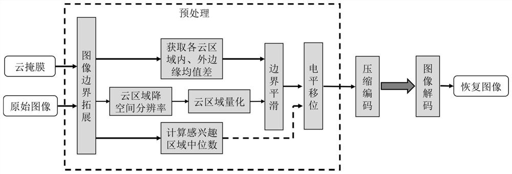
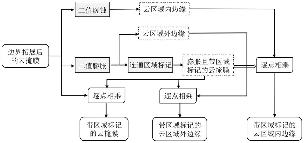
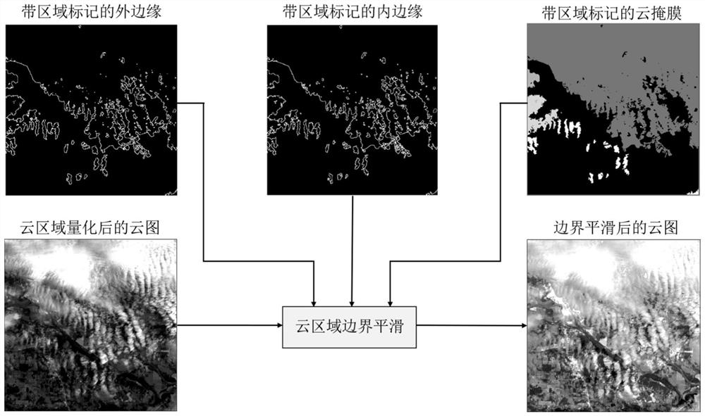
[0036] refer to figure 1 , the specific implementation steps of this example are as follows:
[0037] Step 1: Extend the boundaries of cloud-containing remote sensing images and cloud mask images.
[0038] 1.1) Note that the width of the original cloudy remote sensing image is W, the height is H, and the bit depth is Bd; the size of the original cloud mask image is consistent with the original cloudy remote sensing image;
[0039] 1.2) Boundary extension of cloudy remote sensing images:
[0040] If W is an odd number and H is an even number, add a column of data to the far right of the original cloud image, and the added data is the Wth column data of the original cloud image;
[0041] If W is an even number and H is an odd number, add a row of data at the bottom of the original cloud image, and the added data is the Hth row data of the origina...
PUM
 Abstract
Description
Claims
Application Information