

System and Method for Providing Aiding Information to a Satellite Positioning System Receiver Over Short-Range Wireless Connections
a satellite positioning system and wireless connection technology, applied in the field of positioning systems, can solve the problems of reducing the signal strength received by the gps receiver unit, degrading the accuracy of gps position determination, and many handsets, however, do not have gps receivers physically co-located with the host processor
- Summary
- Abstract
- Description
- Claims
- Application Information
AI Technical Summary
Problems solved by technology
Method used
Image

Examples
Embodiment Construction
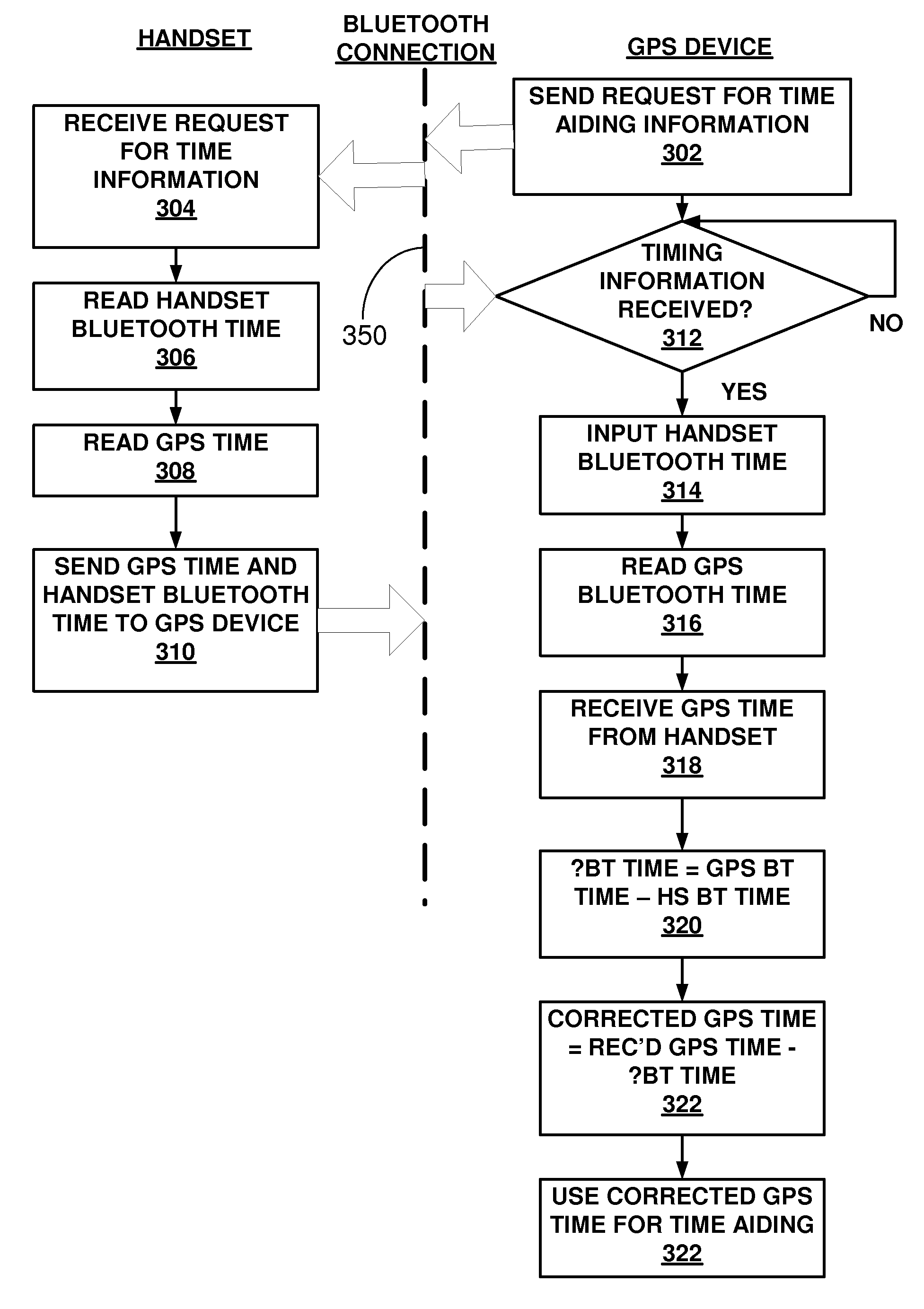
[0021]In the following description, reference is made to the accompanying drawings that form a part hereof, and in which is shown by way of illustration one or more specific implementations in which the invention may be practiced. It is to be understood that other implementations may be utilized and structural changes may be made without departing from the scope of this invention.
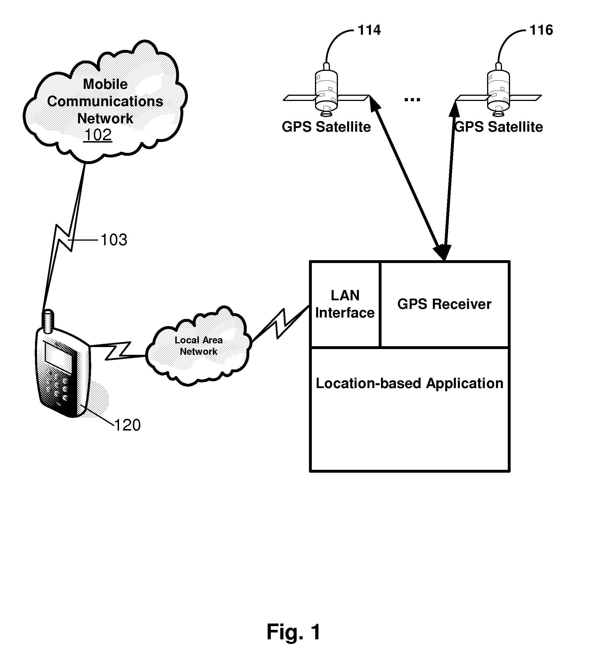
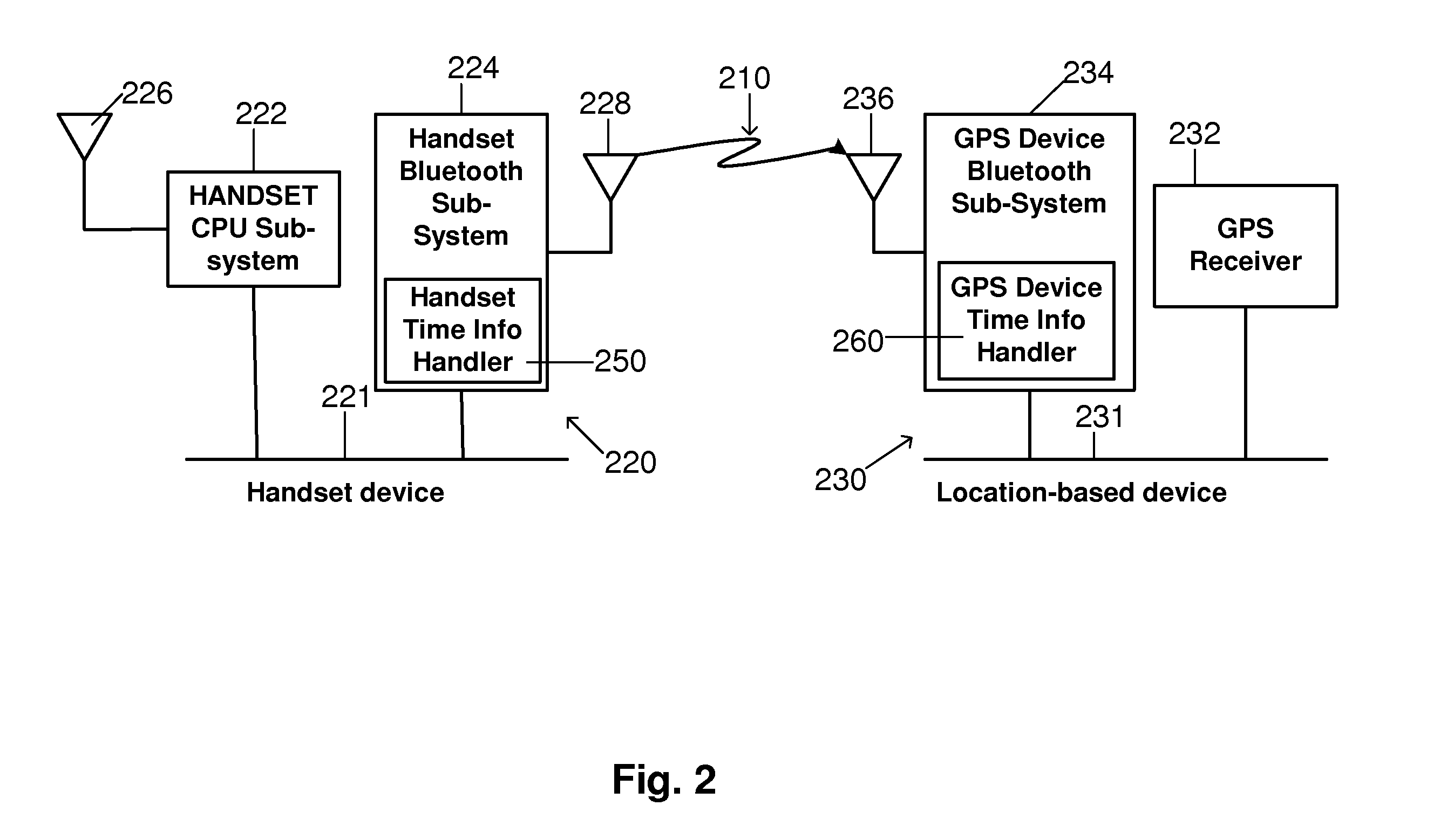
[0022]FIG. 1 is a block diagram of an example system 100 for providing time aiding information to a GPS receiver 150. The system 100 includes a mobile communications network 102 and a GPS system 104. The mobile communications network 102 provides telecommunications services to a mobile handset 120. The GPS system 104 includes a plurality of satellites 114, 116, which provide positioning data to the GPS receiver 150. The GPS receiver 150 in the system 100 in FIG. 1 may be implemented in a location-based system 110, which is a GPS-enabled device that includes a location-based application 170.
[0023]The mobile ...
PUM
 Abstract
Description
Claims
Application Information