GPS/INS combined locating navigation system and testing and correcting method for speed rate thereof

A navigation system and combined positioning technology, applied in satellite radio beacon positioning system, testing/calibration of speed/acceleration/shock measurement equipment, speed/acceleration/shock measurement, etc., can solve the speed error, increase the speed error, Problems such as different tire sizes can achieve the effect of improving positioning and navigation accuracy, reducing speed error and moving angle error

Inactive Publication Date: 2009-07-22
江苏华科导航科技有限公司
View PDF7 Cites 0 Cited by
  • Summary
  • Abstract
  • Description
  • Claims
  • Application Information

AI Technical Summary

Problems solved by technology

Therefore, the error of the rate pulse signal leads to the rate error; in addition, the tire sizes of different vehicles are different, which further increases the rate error

Method used


Image

  • GPS/INS combined locating navigation system and testing and correcting method for speed rate thereof
  • GPS/INS combined locating navigation system and testing and correcting method for speed rate thereof
  • GPS/INS combined locating navigation system and testing and correcting method for speed rate thereof

Examples


Embodiment 1

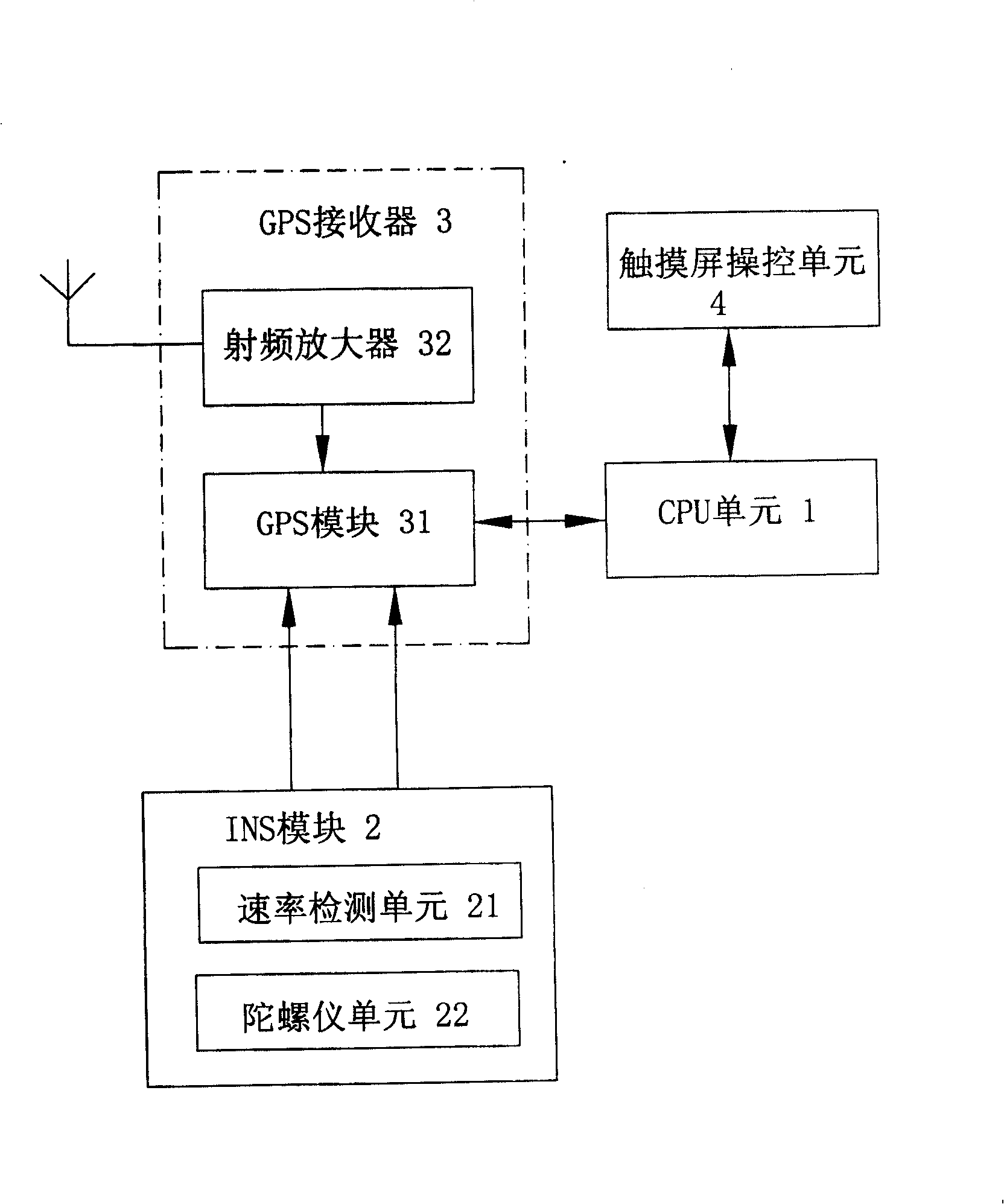
[0026] See figure 1 , the GPS / INS combined positioning and navigation system of the present embodiment is suitable for vehicles, ships, etc. that can move along a straight line, and includes: a CPU unit 1, an INS module 2, a GPS receiver 3 for receiving latitude and longitude signals, and a touch screen control unit 4.

[0027] The GPS receiver 3 includes: a GPS module 31 and a radio frequency amplifier 32 connected to the radio frequency signal input end of the GPS module 31; the signal input end of the radio frequency amplifier 32 is connected to the GPS antenna.

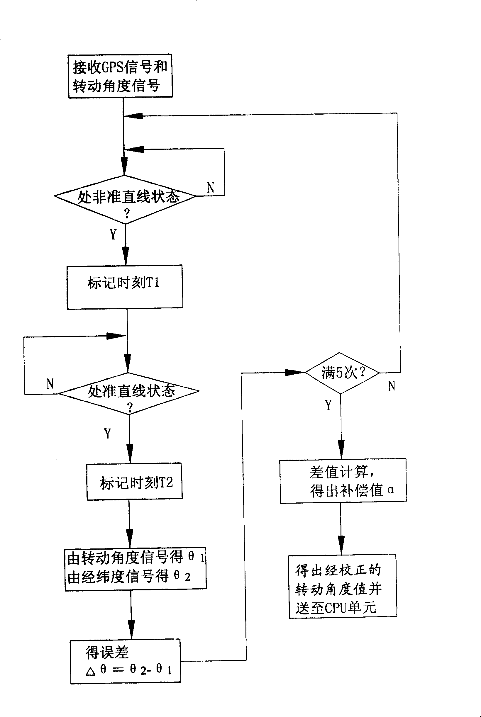
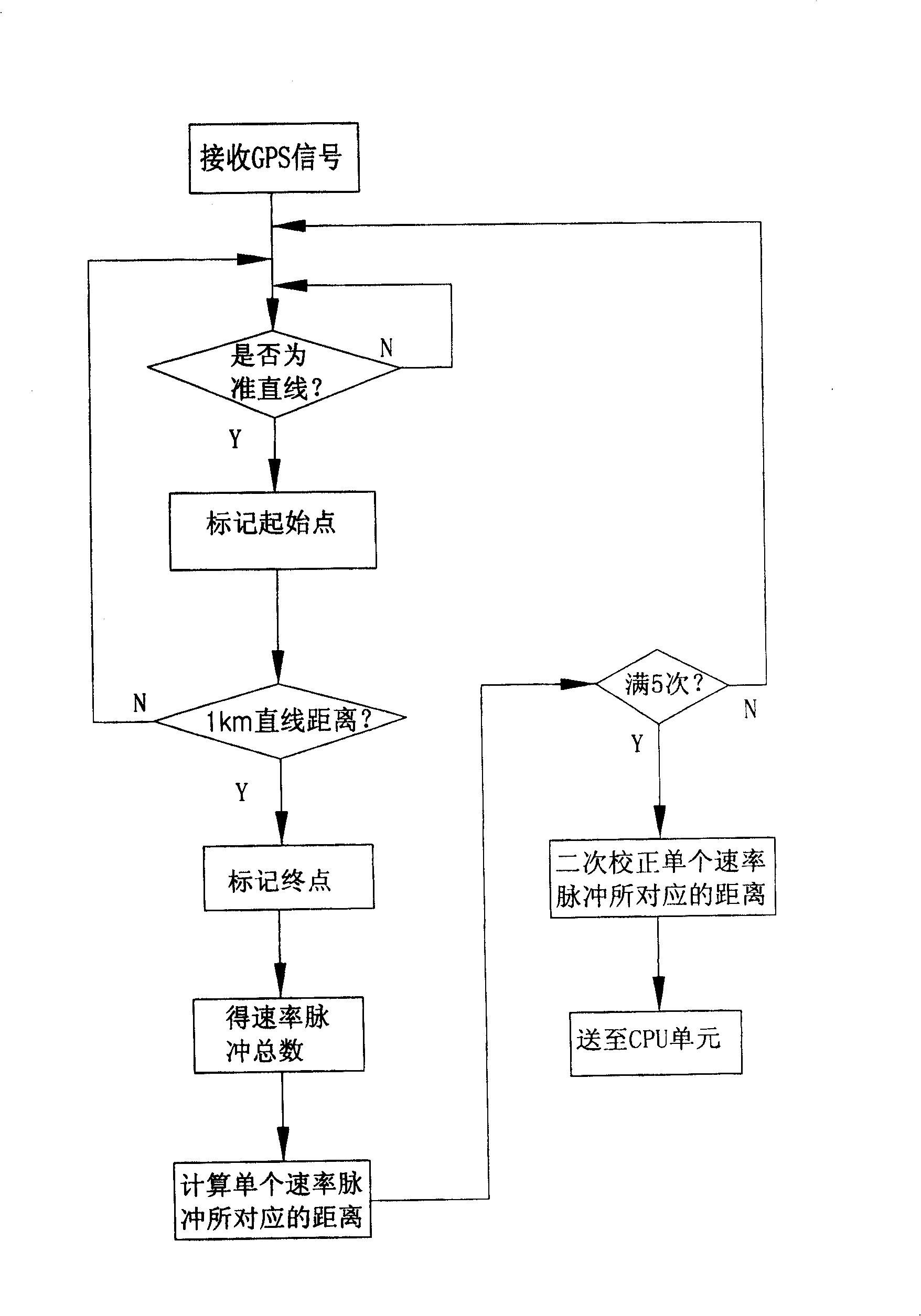
[0028] INS module 2 comprises: be used to generate the speed detection unit 21 of speed pulse signal and be used to generate the gyroscope unit 22 of mobile angle signal; The angle signal output terminal of gyroscope unit 22 is connected the angle signal input end of GPS module 31; Speed ​​detection The speed pulse signal output terminal of unit 21 is connected to the speed pulse signal input terminal of GPS modu...


PUM


Abstract

This invention relates to one GPS / INS combination position guide system and its speed test correction method, wherein, the system comprises CPU unit, INS module, GPS receiver and touch screen control unit, wherein, the INS module generated speed impulse signals and movable rotation signal into GPS receiver impulse signal input end and angle signal input end; GPS receiver position guide signal output end is through latitude signals through signal speed impulse displacement value, speed impulse signal into position guide signal input end.

Description

technical field [0001] The invention relates to a GPS / INS combined positioning and navigation system and a rate detection and correction method thereof. Background technique [0002] The mainstream technology in the vehicle navigation market is GPS (Global Position System). The GPS system calculates positioning information by receiving wireless signals sent by 24 satellites distributed in the sky. It has the advantages of global, all-weather, high-precision, and real-time positioning. However, due to the straight-line propagation characteristics of wireless signals, its dynamic performance and anti-interference ability are poor. , When the GPS receiver is near a tunnel, shade or tall building, the satellite signal is blocked, affecting accurate positioning or even unable to locate. [0003] The INS (Inertial Navigation System) system has autonomous navigation capability, and can independently provide positioning and navigation information such as carrier attitude, speed and...

Claims


Application Information

Patent Timeline
Patent Type & Authority Patents(China)
IPC IPC(8): G01C25/00G01C21/28G01C21/18G01S5/14G01P21/02G01S19/49
Inventor 秦春达姜加伟
Owner 江苏华科导航科技有限公司
Why Eureka
Try Eureka