Near space low-speed platform SAR (Synthetic Aperture Radar) imaging method

An imaging method and near-space technology, applied in the field of radar, can solve problems such as image distortion

CN103235309BActive Publication Date: 2014-12-10UNIV OF ELECTRONICS SCI & TECH OF CHINA
4 Cites 0 Cited by

Patent Information

Authority / Receiving Office
CN · China
Patent Type
Patents(China)
Current Assignee / Owner
Publication Date
2014-12-10

Smart Images

  • Figure 1
    Figure 1
  • Figure 2
    Figure 2
  • Figure 3
    Figure 3
Patent Text Reader

Abstract

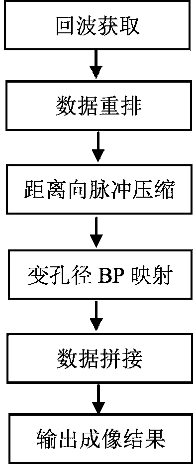
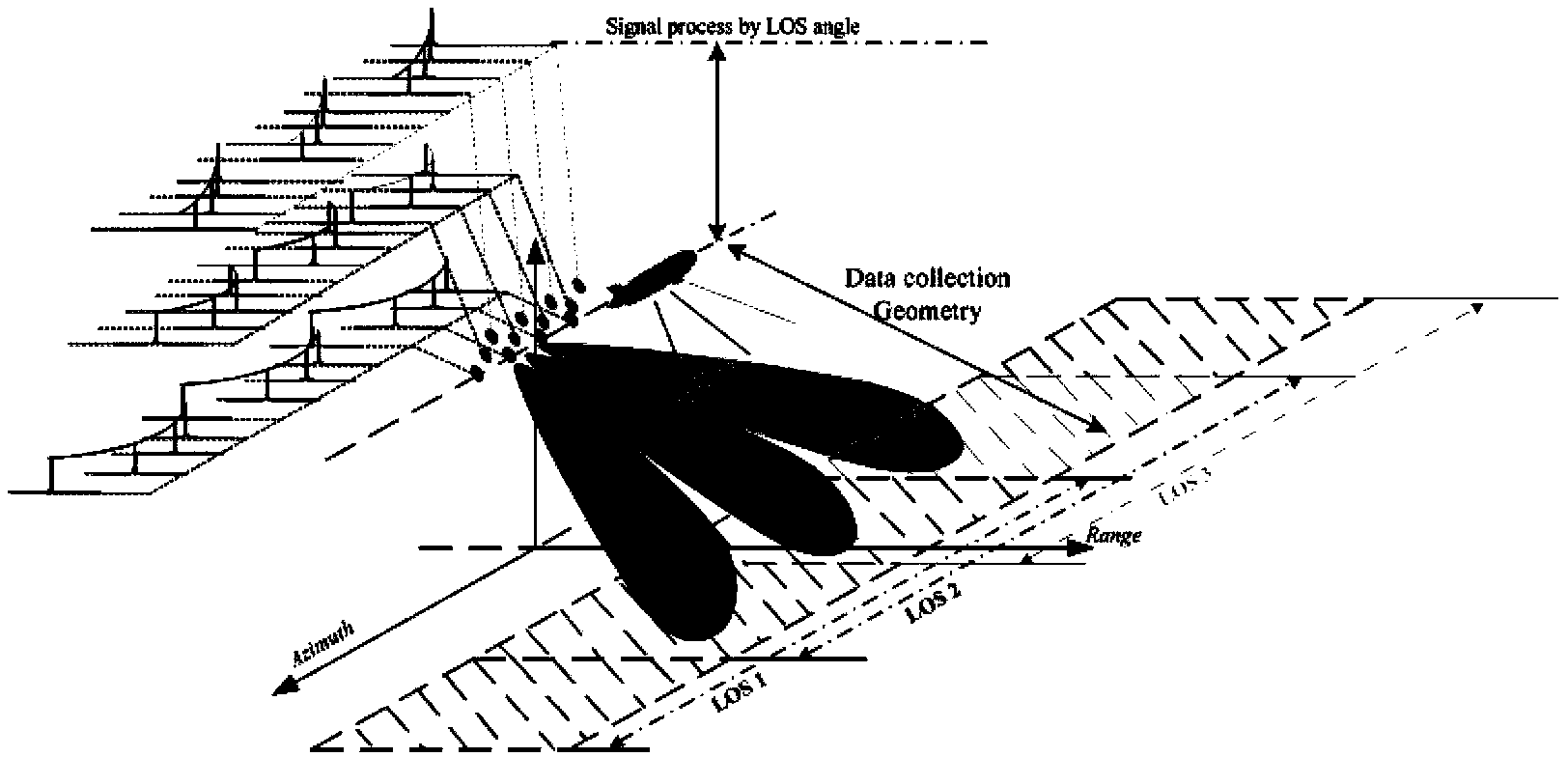
The invention discloses a near space low-speed platform SAR (Synthetic Aperture Radar) imaging method, which specifically comprises the following steps: acquiring target echo; rearranging data; performing pulse compression in range dimension; performing variable-aperture back projection imaging; and performing data splicing and outputting an imaging result. The solution of the invention is that a wide view field and common aperture working mode is adopted, and large-scene imaging is realized on the basis of a gradient aperture back projection method; the space-variant problem of range migration is solved by using the back projection method; a gradient aperture is used in the azimuth direction, so that the space-variant and image distortion problems caused by different resolutions in the azimuth direction of an image in case of different view angles are solved; and finally near space low-speed platform SAR large-scene imaging is realized.
Need to check novelty before this filing date? Find Prior Art

Description

technical field

[0001] The invention belongs to the technical field of radar, and in particular relates to a slow platform SAR imaging method in near space in synthetic aperture radar (SAR) imaging. Background technique

[0002] Synthetic aperture radar is an all-weather, all-weather modern high-resolution microwave remote sensing imaging radar, which uses the relative motion between the radar antenna and the target area to obtain high spatial resolution. Synthetic aperture radar has played an increasingly important role in military reconnaissance, topographic mapping, vegetation analysis, ocean and hydrological observation, environmental and disaster monitoring, resource exploration, and detection of crustal changes.

[0003] However, traditional airborne SAR has problems such as short time in the air, poor stealth performance, and susceptibility to ground attacks; while spaceborne SAR cannot continuously image a certain area, has poor flexibility, and cannot monitor and be...

Examples

Embodiment Construction

[0044] The present invention mainly adopts the mode of simulation experiment to verify, and the simulation verification platform is Matlab2010. The present invention will be further described in detail below in conjunction with the accompanying drawings and specific embodiments.

[0045] The schematic flow chart of the slow platform SAR wide field of view large width and high resolution imaging data processing method of the present invention is as follows figure 1 As shown, the specific process is as follows:

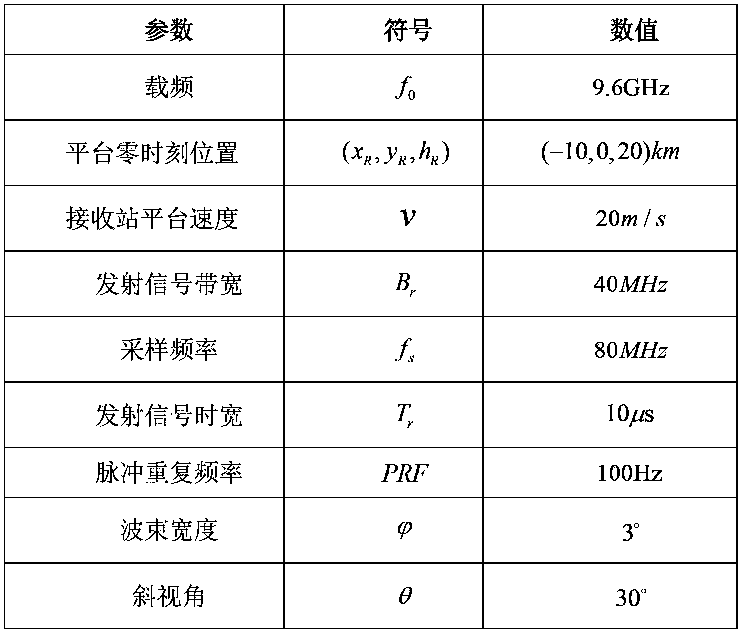
[0046] Step 1: Obtain target echo.

[0047] The surface target scene adopted by the implementation of the present invention is as follows Figure 4 As shown, the starting position coordinates of the slow platform are (-10, 0, 20) km, when the wave velocity center is at the origin of the scene coordinates in the side view mode, it is recorded as zero time, and the distance between the slow platform SAR and the origin of the scene coordinate system distance , pulse r...