
Two-dimension and three-dimension integration based transmission line corridor parameterized building method and system
A technology of transmission lines and line corridors, applied in the field of electric power information, can solve problems such as the inability to realize 2D and 3D integrated applications, long cycle times, and poor texture scene effects
- Summary
- Abstract
- Description
- Claims
- Application Information
AI Technical Summary
Problems solved by technology
Method used
Image

Examples
Embodiment 1
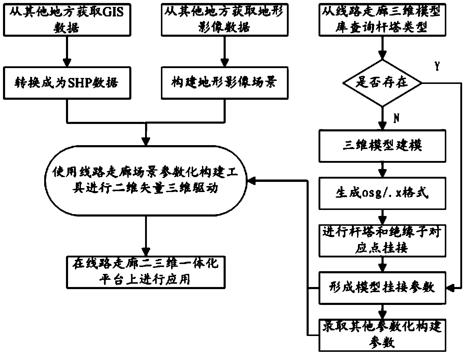
[0062] This implementation is mainly in the early stage, when there is no terrain, image, and vector data in the power grid GIS platform, and there is no parameter information related to line corridors in the PMS (power grid production management system), and the 3D model standard library has not yet been established or has not been fully established. , the manner in which the implementation is carried out.
[0063] 1. Obtain GIS data from other places and convert it into SHP data;
[0064] 2. Obtain terrain image data from other places;
[0065] 3. Construct terrain image scene;
[0066] 4. Check whether the tower type exists from the 3D model library of the line corridor;
[0067] 5. Carry out 3D modeling of poles and insulator types that do not exist in the model library as required;
[0068] 6. Generate the osg / .x format, connect the corresponding points of the tower and the insulator, and form the model connection parameters;
[0069] 7. Enter other parametric constru...
PUM
 Abstract
Description
Claims
Application Information