An automatic registration method for vector data and a remote sensing image

A remote sensing image and vector data technology, applied in the field of GIS, can solve the problems of multi-manual interaction, no fully automated mature system, difficult to meet the needs of efficient large-scale image data processing, etc., to achieve the effect of rapid automatic extraction

Active Publication Date: 2019-05-07
NANJING NORMAL UNIVERSITY
View PDF6 Cites 4 Cited by
  • Summary
  • Abstract
  • Description
  • Claims
  • Application Information

AI Technical Summary

Problems solved by technology

These research methods are only carried out for a specific type of problem. Most of the methods still require more manual interaction

Method used


Image

  • An automatic registration method for vector data and a remote sensing image
  • An automatic registration method for vector data and a remote sensing image
  • An automatic registration method for vector data and a remote sensing image

Examples


Embodiment Construction

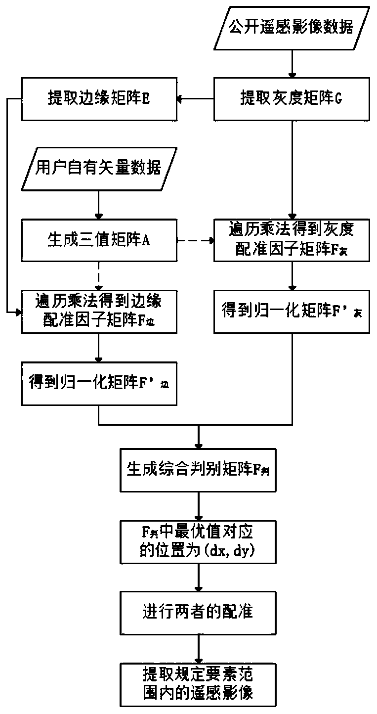
[0086] The present invention will be further described below in conjunction with the accompanying drawings and examples.

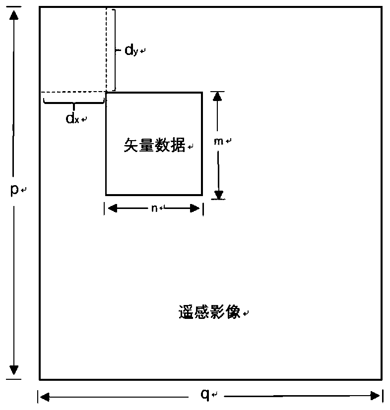
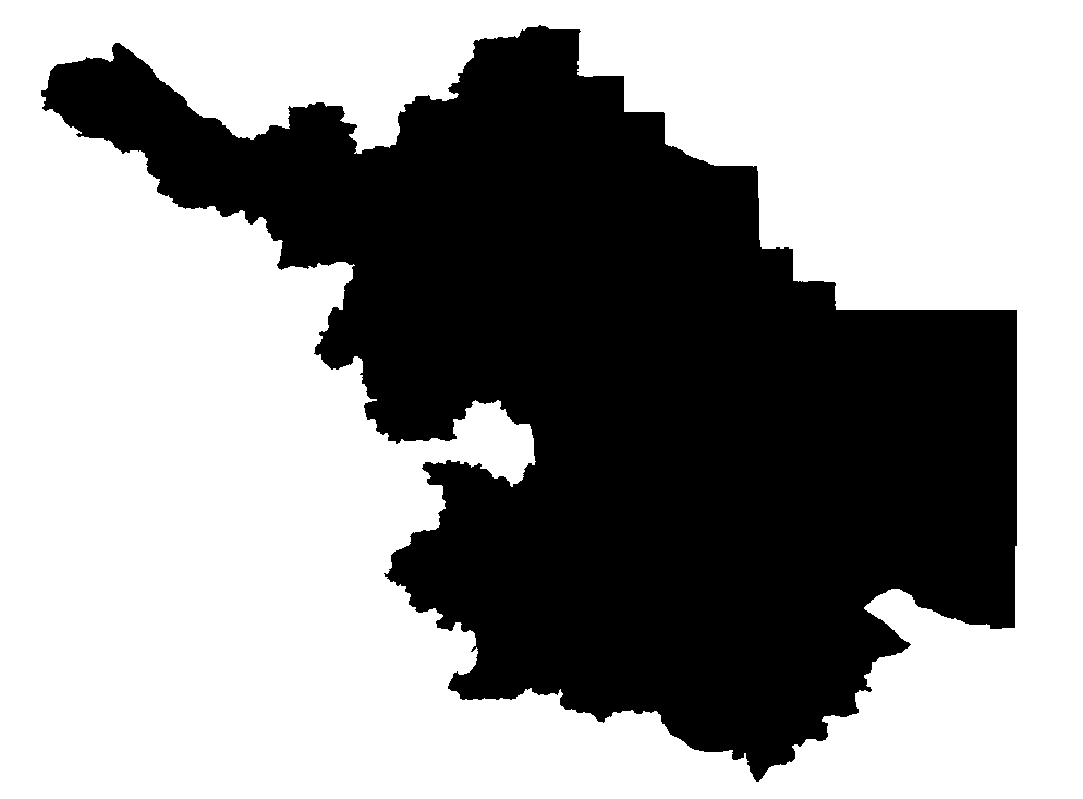
[0087] In this embodiment, the 2016 remote sensing image base map of Jiangsu Province released by Tiantu-Jiangsu is selected as the remote sensing image data ( image 3 ); the user-owned vector data is a part of the park element resources in Wuxi City ( Figure 4 ). The relative positions of the two starting points are as follows: Figure 5 shown. Among them, the frame size of the remote sensing map is 708*571 pixels, and the frame size of the user-owned vector data is 612*512 pixels.

[0088] Step 1, carry out the extraction of vector data ternary matrix;

[0089] 1.1. Extract the minimum enclosing rectangle of the vector data, and convert it into a binary grid matrix Y={y(i,j)|i=0,...,m-1; j=0 according to the formula (1) ,...,n-1}, such as Figure 4 As shown, in this embodiment, m=708, n=571;

[0090] 1.2. Create a Boolean flag matrix F={f(i,j)|i...


PUM


Abstract

Open remote sensing data is subjected to certain decryption processing according to requirements of security policies, and when a user tries to superpose own vector data and the remote sensing data, the situation that the vector data and the remote sensing data are not matched occurs. In order to solve the problem, the invention discloses an automatic registration method for vector data and a remote sensing image. The method comprises the following specific steps: 1) based on vector data, extracting a three-valued matrix A by using a scanning line algorithm; 2) extracting a gray matrix G basedon the remote sensing image, and obtaining an edge matrix E of the gray matrix G by using a Canny operator; 3) traversing on the three-valued matrix A by using an edge matrix E to generate a normalized edge registration factor matrix F'edge; 4) traversing on the three-valued matrix A by using the gray scale matrix G to generate a normalized gray scale registration factor matrix F'gray scale, 5) automatically registering the vector data and the remote sensing image based on the characteristics of the registration factors, and 6) extracting the remote sensing image data in a specified range ofthe vector elements.

Description

technical field [0001] The invention belongs to the field of GIS, and in particular relates to a method for automatic registration using the consistency between the pixel features of remote sensing images and the feature features of vector data elements. Background technique [0002] At present, many platforms have provided open remote sensing data services, providing good data background support for many space browsing and retrieval applications. Especially in applications such as land use approval, environmental assessment, and road planning, it is often necessary to extract remote sensing images within a certain range of vector elements for analysis. However, because the relevant open data has been declassified according to the requirements of the security policy, when users try to overlay their own vector data and remote sensing data, there will be a mismatch between the two. Therefore, there is an urgent need for an efficient and automatic method to correct the geometr...

Claims


Application Information

Patent Timeline
IPC IPC(8): G06T7/33
Inventor 张文涵李安波李安营
Owner NANJING NORMAL UNIVERSITY
Why Eureka
Try Eureka