

GNSS-R-based fire monitoring system and method
A monitoring system and fire technology, applied in the field-based, to achieve high spatial resolution, improve the level of forest fire monitoring, and facilitate data processing
- Summary
- Abstract
- Description
- Claims
- Application Information
AI Technical Summary
Problems solved by technology
Method used
Image

Examples
Embodiment Construction
[0030] The present invention will be further described below in conjunction with specific embodiments. It should be understood that the following examples are only used to illustrate the present invention but not to limit the scope of the present invention.
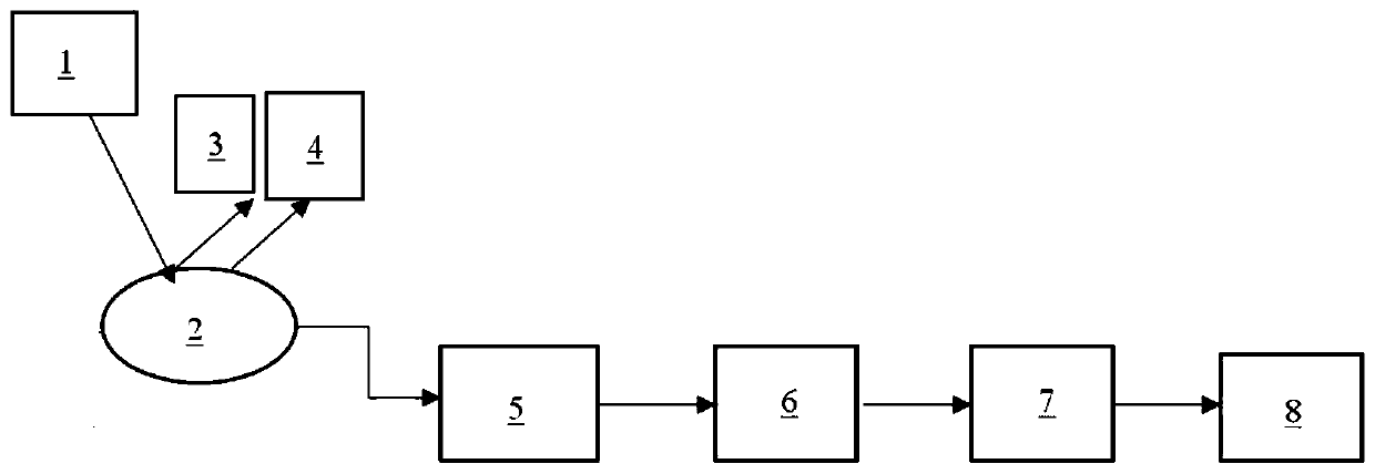
[0031] like figure 1 Shown is a GNSS-R based fire monitoring system according to an embodiment of the present invention, which is used for forest fire monitoring, including: a GNSS satellite 1, and a temperature sensing device 3 and a GNSS-R receiver 4 connected in sequence , denoising system 5, data storage system 6, data discrimination system 7 and alarm system 8.
[0032] GNSS Satellite 1 is set to transmit a direct signal. The quantity of GNSS satellite 1 is multiple, and it can be the satellite of navigation system such as GPS, GLONASS, GALileo, Beidou, the incident zenith angle of this GNSS satellite 1 is in 0~90 °, and incident azimuth angle is in 0~360 °, by This enables multi-angle observation of GNSS-R. The ...
PUM
 Abstract
Description
Claims
Application Information