Remote sensing image color consistency processing method based on optimal path

A remote sensing image and optimal path technology, applied in the field of optical satellite remote sensing image processing, can solve the problem of low processing efficiency of color consistency, achieve the effect of eliminating color differences and improving processing efficiency

Pending Publication Date: 2021-12-10
NORTHEAST INST OF GEOGRAPHY & AGRIECOLOGY C A S
View PDF0 Cites 0 Cited by
  • Summary
  • Abstract
  • Description
  • Claims
  • Application Information

AI Technical Summary

Problems solved by technology

[0004] Aiming at the problem of low efficiency in processing color consistency of multiple remote sensing images, the present invention provides a method for processing color consistency of remote sensing images based on the optimal path

Method used


Image

  • Remote sensing image color consistency processing method based on optimal path
  • Remote sensing image color consistency processing method based on optimal path
  • Remote sensing image color consistency processing method based on optimal path

Examples


specific Embodiment

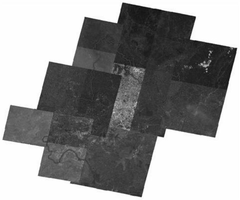
[0053] 1. The data preparation of the study area is as follows: figure 2 As shown, the research area is a certain city (the vector range in the figure), which is composed of 11 Gaofen-1 orthophotos and 4 Ziyuan-3 orthophotos. The spatial resolution of the images is 2m, and the number and order of the bands They are all consistent, and the image acquisition time is between April and November 2018, and there are obvious color differences between the images;

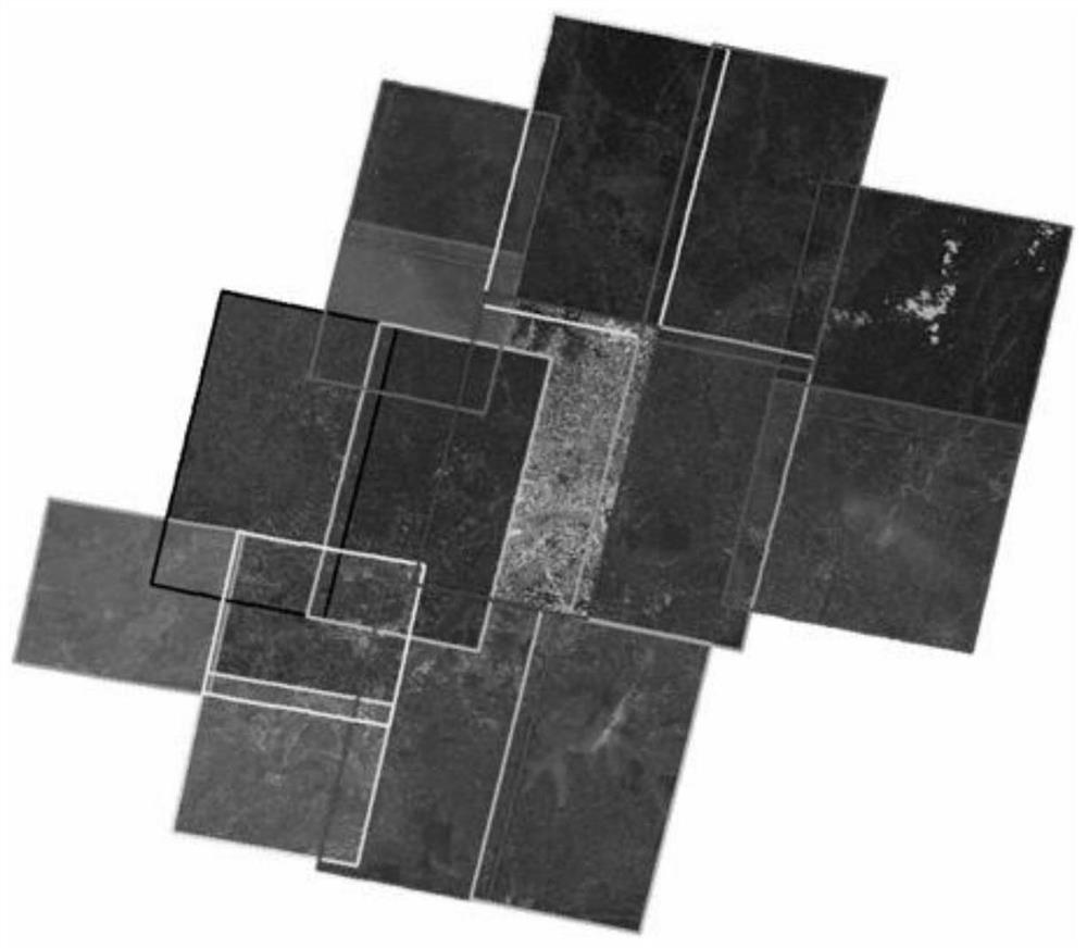
[0054] 2. Schematic diagram of calculating the effective boundary of the image, as shown in the figure below, the effective boundary of the image is calculated by using the 8-neighborhood boundary tracking algorithm, and the effective boundary polygon is simplified by combining the Douglas Puke algorithm. The effective boundaries of the 15 images in the study area are as follows image 3 shown;

[0055] 3. Automatically select the schematic diagram of the color reference image, number the 15 images in the study area in se...


PUM


Abstract

The invention discloses a remote sensing image color consistency processing method based on an optimal path, belongs to the technical field of optical satellite remote sensing image processing, and solves the problem of low efficiency of color consistency processing of multiple remote sensing images in the prior art. The method comprises the following steps: determining a to-be-processed remote sensing image set, calculating effective boundaries of all remote sensing images in the set, and determining a spatial position relationship among the images in the set; selecting a color reference image from all the remote sensing images in the set; calculating an optimal uniform color path based on the spatial position relationship among the images in the set; based on the color reference image, performing brightness normalization preprocessing on all the images in the set; and performing color consistency processing on all the images subjected to brightness normalization preprocessing according to the sequence in the optimal uniform color path: performing color consistency processing on the node images according to the sequence in the optimal uniform color path, so that each node image is consistent with the reference image in color until all the node images in the path are completely processed.

Description

technical field [0001] The invention relates to the technical field of optical satellite remote sensing image processing, in particular to a method for processing color consistency of remote sensing images based on an optimal path. Background technique [0002] As a carrier of spatial data, remote sensing images are becoming more and more important in the field of geographic information. In the construction of national spatial data infrastructure, remote sensing image data plays an important role in the basic data information layer. In the acquisition process of remote sensing images, due to the influence of many factors, such as uneven optical lens imaging, external clouds, atmospheric attenuation, and sunny and backlit conditions, there will be different degrees of hue, brightness, and contrast in different areas of the same image. At the same time, due to the influence of different satellite imaging methods, imaging periods, and changes in the underlying surface topograph...

Claims


Application Information

Patent Timeline
IPC IPC(8): G06T7/90G06T5/40
CPCG06T7/90G06T5/40G06T2207/10032G06T2207/30204
Inventor 王铭毛德华宋开山
Owner NORTHEAST INST OF GEOGRAPHY & AGRIECOLOGY C A S
Why Eureka
Try Eureka