Remote sensing intelligent interpretation method suitable for alpine and gorge regions
A technology of canyons and regions, applied in the field of remote sensing data interpretation, can solve the problems of low result accuracy and interpretation efficiency, time-consuming, etc., and achieve the effect of high-quality interpretation results, interpretation intelligence, and efficient interpretation.
- Summary
- Abstract
- Description
- Claims
- Application Information
AI Technical Summary
Problems solved by technology
Method used
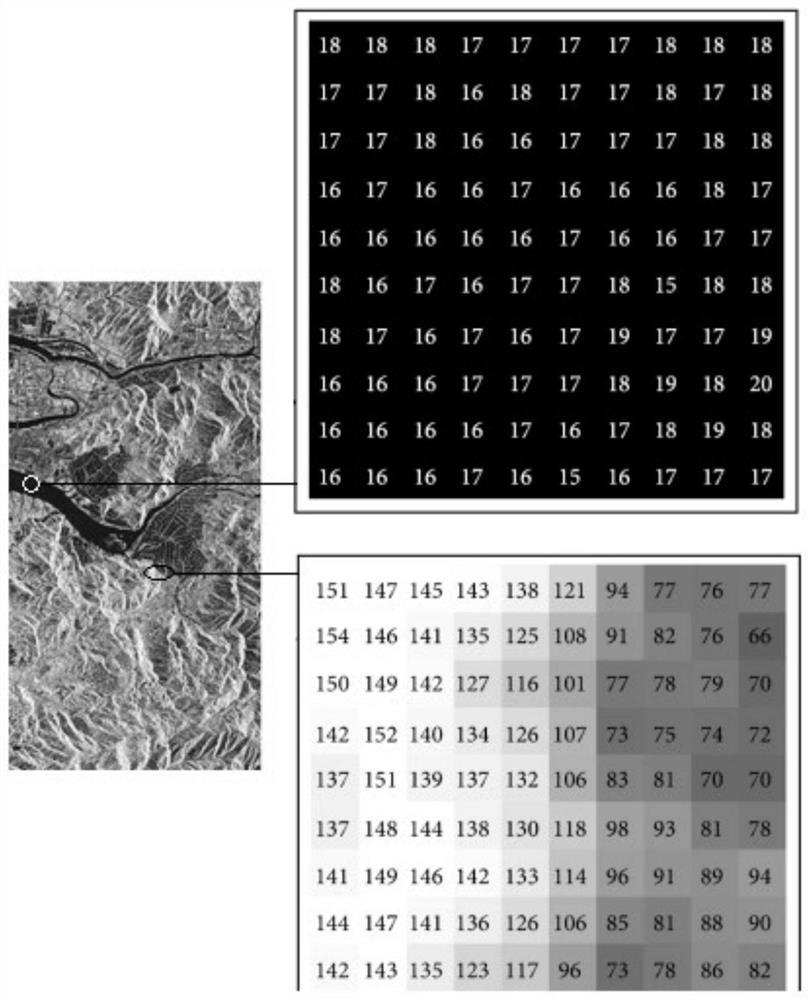
Image

Examples
Embodiment Construction
[0016] The present invention will be further described below in conjunction with accompanying drawing.
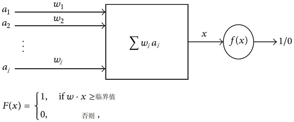
[0017] The present invention provides a remote sensing intelligent interpretation method suitable for alpine and canyon areas, using at least 5 bands of data, namely blue band, green band, red band, near-infrared band and short-wave infrared band, based on linear prediction function classification , which combines the eigenvectors. Eigenvectors are properties that represent objects; the more eigenvectors there are, the easier the classification process will be. These feature vectors are combined with weights to build the prediction function. With a binary classifier, an input "x" is mapped to a value "y" using a hard limit function (such as figure 1 shown).
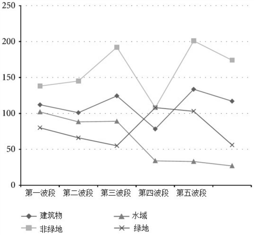
[0018] w is the weight vector, and w x is the dot product. To perform classification using a perceptron, the first step is to define a feature vector by finding the descriptors that characterize the body of water. ...
PUM
 Abstract
Description
Claims
Application Information
 - R&D Engineer
- R&D Manager
- IP Professional
- Industry Leading Data Capabilities
- Powerful AI technology
- Patent DNA Extraction
Browse by: Latest US Patents, China's latest patents, Technical Efficacy Thesaurus, Application Domain, Technology Topic.
© 2024 PatSnap. All rights reserved.Legal|Privacy policy|Modern Slavery Act Transparency Statement|Sitemap