

A digital non-integer tracking loop for satellite positioning and navigation receiving system
A technology of receiving system and tracking loop, which is applied in the field of tracking loop, can solve the problems of using high sampling rate, etc., and achieve the effect of fine time resolution
- Summary
- Abstract
- Description
- Claims
- Application Information
AI Technical Summary
Problems solved by technology
Method used
Image

Examples
Embodiment Construction
[0042] In the following, the present invention will be further described in conjunction with the drawings and specific embodiments.
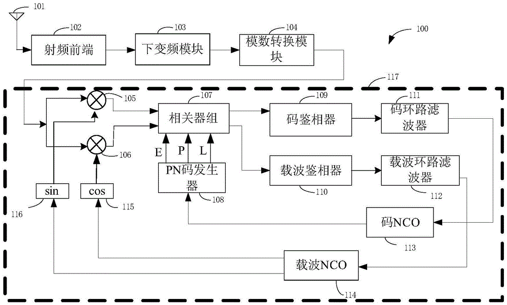
[0043] combine image 3 with Figure 4 As shown, a digital non-integer tracking loop for a satellite positioning and navigation receiving system includes a first mixer 402, a second mixer 403, a correlator group 404, a code phase detector 405, and a code loop Filter 406, PN code generator 409, carrier phase detector 408, carrier loop filter 407, carrier NCO413, sin mapping unit 411, cos mapping unit 410, decimal interpolation filter 401, first adder 415, calibration A control unit 412 , a scaling factor unit 416 , a phase adjuster 414 and a second adder 417 . The illustrated bank of correlators 404 consists of six correlators.
[0044] The output terminals of the first mixer 402 and the second mixer 403 are connected to the first input terminal of the correlator group 404, and the first output terminal of the correlator group 404 passes throu...
PUM
 Abstract
Description
Claims
Application Information