Forest fixed sample area unmanned plane oblique photograph technical method

A technology of oblique photography and fixed sample plots, which is applied in the field of UAV oblique photography technology of forest fixed sample plots, can solve the problems of insignificant measurement significance of forest fixed sample plots, great influence on image clarity, and high image prices. The effect of easy 3D modeling of forests, reducing human workload and improving investigation efficiency

Inactive Publication Date: 2015-05-20
北京北林生态田园景观规划设计有限公司
View PDF2 Cites 5 Cited by
  • Summary
  • Abstract
  • Description
  • Claims
  • Application Information

AI Technical Summary

Problems solved by technology

[0003] ①Using ground sample plots for regular measurement requires a lot of manpower and material resources, high cost, high work intensity, and long measurement cycle, especially for sudden forest fire disasters, it is difficult to carry out investigations
[0004] ②Using ordinary manned aerial remote sensing requires high cost and poor security due to the need for many links such as transition
[0005] ③When using aerospace satellite remote sensing monitoring, since the sensor is above the cloud layer, the image clarity is greatly affected

Method used


Image

  • Forest fixed sample area unmanned plane oblique photograph technical method
  • Forest fixed sample area unmanned plane oblique photograph technical method
  • Forest fixed sample area unmanned plane oblique photograph technical method

Examples


Example Embodiment

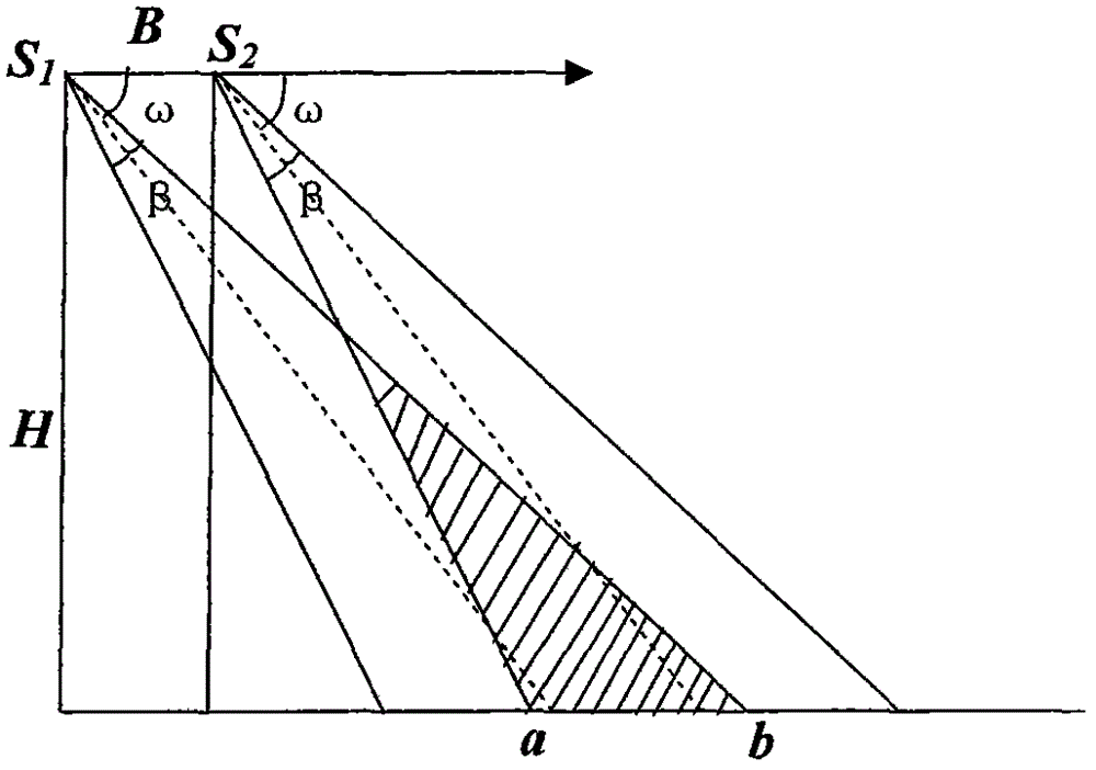
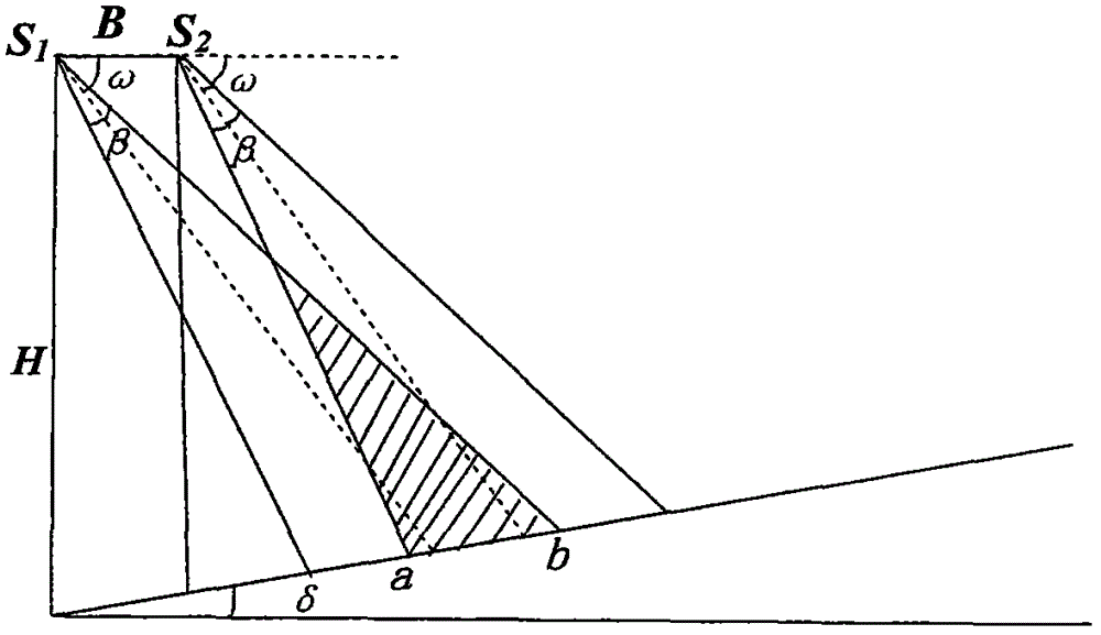
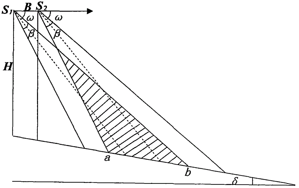
[0021] Compared with the existing observation technology of forest fixed sample plots, the technology solution of drone tilt photography for forest fixed sample plots is greatly improved, specifically:

[0022] 1) Provide a technical solution for unmanned aerial vehicle forest fixed sample plot tilt photography: use drone photography technology to apply drone tilt photography technology to the forest fixed sample plot survey, and then, according to the size of the fixed sample plot, reasonable Determine the drone tilt photography plan and establish the drone flight parameters (including the baseline length B of the drone photography twice, the drone flight height H, the drone tilt photography angle ω, and the drone camera shooting field of view The geometric relationship between the angle β and the side length a) of the fixed forest plot, and then obtain the parameters of the forest plot (including diameter at breast height D, tree height H, volume V, etc.), and finally obtain the...


PUM


Abstract

The invention discloses a forest fixed sample area unmanned plane oblique photograph technical method. According to the method, an unmanned plane oblique photographing technology is used, a geometric scheme relation among a base length B between two photograph points of an unmanned plane, a flight height H from a take-off place of the unmanned plane, an unmanned plane oblique photographing angle omega, a camera photograph field angle beta of the unmanned plane and an edge length a of a forest fixed sample area is established for three different terrains (flat ground, uphill ground and downhill ground) of the forest fixed sample area, so that an optimum flight scheme for different terrain situations can be respectively designed. On the basis of the optimum flight scheme, various parameters of the forest sample area can be measured and acquired, and finally the biomass and stand volume of the forest can be solved.

Description

1. Technical field [0001] The invention relates to a data acquisition method for sample tree measurement and three-dimensional modeling in the survey of fixed forest plots, in particular to a technical method for oblique photography of unmanned aerial vehicle fixed plots in forests. 2. Technical background [0002] The methods used in the traditional survey of fixed forest plots are mainly to combine artificial ground regular measurements with aerial remote sensing and space satellite remote sensing to assist forest resource surveys, and the current method of using UAV aerial photography and upright photography, but the above-mentioned technologies The method has obvious shortcomings and deficiencies in actual operation practice: [0003] ①Using ground sample plots for regular measurements requires a lot of manpower and material resources, high cost, high work intensity, and long measurement cycles, especially for sudden forest fire disasters, it is difficult to carry out in...

Claims


Application Information

Patent Timeline
IPC IPC(8): G01C11/00
CPCG01C11/00
Inventor 冯仲科刘金成
Owner 北京北林生态田园景观规划设计有限公司
Why Eureka
Try Eureka