
A registration method of airborne and vehicle LiDAR point clouds considering the characteristics of eaves
A point cloud registration and feature point technology, applied in computer parts, image analysis, image enhancement, etc., can solve the problems of inapplicable eaves area, few airborne and vehicle LiDAR features with the same name, etc., and achieve short cycle and low cost. , fast effect
- Summary
- Abstract
- Description
- Claims
- Application Information
AI Technical Summary
Problems solved by technology
Method used
Image

Examples
Embodiment Construction
[0059] Below in conjunction with accompanying drawing and specific embodiment the present invention is described in further detail:
[0060] In order to achieve the above object, the present invention adopts the following technical solutions:
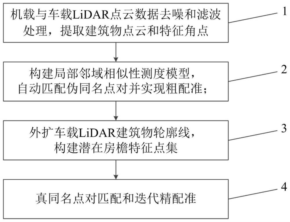
[0061] A point cloud registration method for airborne and vehicle-mounted LiDAR that takes into account the characteristics of the eaves. The process is as follows: figure 1 shown, including the following steps:
[0062] Step 1: Denoise and filter the airborne LiDAR (Airborne Laser Scanning, ALS) and vehicle-borne LiDAR (Vehicle-borne Laser Scanning, VLS) point cloud data, and extract building point clouds and feature corners from ground object points;
[0063] Denoise and filter the airborne and vehicle-mounted LiDAR point cloud data, and use existing technology to extract building point clouds and feature corners;
[0064] Step 2: Establish a local neighborhood similarity measurement model to realize fast automatic matching of pseud...
PUM
 Abstract
Description
Claims
Application Information