Ground-based SAR multi-angle image registration method based on homonymous point matching and dem assistance

A technology of image registration and eponymous point, which is used in the reflection/re-radiation of radio waves, instruments, measuring devices, etc., and can solve the problems of large differences in imaging results.

Active Publication Date: 2021-08-17
BEIJING INSTITUTE OF TECHNOLOGYGY
View PDF6 Cites 0 Cited by
  • Summary
  • Abstract
  • Description
  • Claims
  • Application Information

AI Technical Summary

Problems solved by technology

A problem that exists in practice is that when each radar observes the same area from different positions, the imaging results of each radar are very different

Method used


Image

  • Ground-based SAR multi-angle image registration method based on homonymous point matching and dem assistance
  • Ground-based SAR multi-angle image registration method based on homonymous point matching and dem assistance
  • Ground-based SAR multi-angle image registration method based on homonymous point matching and dem assistance

Examples


Embodiment Construction

[0045] The present invention will be described in detail below with reference to the accompanying drawings and examples.

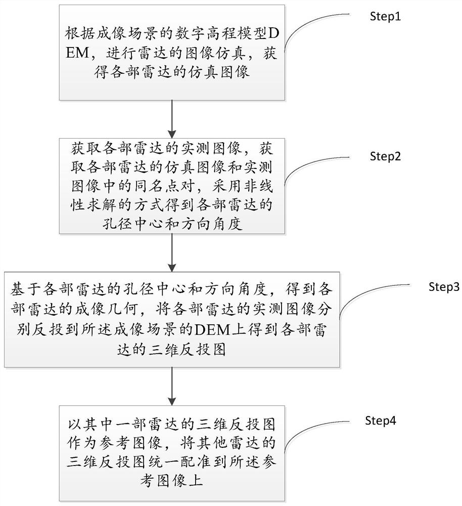
[0046] The invention provides a ground-based SAR multi-angle image registration method based on homonymous point matching and DEM assistance. At least two radars are used to observe the imaging scene from different observation angles. The radar is a ground-based synthetic aperture radar SAR. The process flow of the method like figure 1 shown, including the following steps:

[0047] Step1. According to the digital elevation model DEM of the imaging scene, the image simulation of the radar is carried out, and the simulation images of each radar are obtained;

[0048] The steps are specifically:

[0049] s101. Perform imaging geometric projection on the DEM of the imaging scene under the radar projection geometric model to obtain a simulation image.

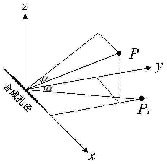
[0050] Establish a reference coordinate system O-xyz. If radar A exists, the synthetic aperture direction ...


PUM


Abstract

The invention discloses a ground-based SAR multi-angle image registration method based on homonymous point matching and DEM assistance, which can realize high-precision registration of various radar images under greatly different observation angles of view. The present invention uses at least two radars to observe the imaging scene from different observation angles respectively. The radar is a ground-based SAR, which includes the following steps: performing radar image simulation according to the DEM of the imaging scene, and obtaining the simulation images of each radar. Obtain the measured image of each radar, obtain the simulation image of each radar and the point pairs of the same name in the measured image, use the nonlinear solution to obtain the aperture center and direction angle of each radar, and further obtain the imaging geometry of each radar, and combine the The measured images are respectively reverse-projected onto the DEM of the imaging scene to obtain the three-dimensional reverse projection maps of each radar. Taking the 3D reverse projection image of one of the radars as a reference image, the 3D reverse projection images of other radars are uniformly registered to the reference image.

Description

technical field [0001] The invention relates to the technical field of synthetic aperture radar, in particular to a ground-based SAR multi-angle image registration method based on homonymous point matching and DEM assistance. Background technique [0002] Ground-based SAR (Synthetic Aperture Radar, Synthetic Aperture Radar) is a measuring instrument working in the microwave band, which can monitor the target scene within tens of meters to several kilometers. Ground-based SAR is usually based on differential interferometry technology to obtain the deformation information of the monitoring scene. The measurement accuracy can reach the submillimeter level. It has the advantages of all-weather, non-contact, continuous measurement and near real-time. It has been widely used in deformation monitoring of glaciers, glaciers and buildings. [0003] A typical disadvantage of ground-based SAR is that it can only acquire one-dimensional deformation information of the target area along ...

Claims


Application Information

Patent Timeline
Patent Type & Authority Patents(China)
IPC IPC(8): G01S13/90
CPCG01S13/9005G01S13/9017G01S13/9023
Inventor 胡程田卫明邓云开曾涛
Owner BEIJING INSTITUTE OF TECHNOLOGYGY
Why Eureka
Try Eureka