Spatial asset management system and method

a technology of asset management system and database population, applied in the field of field data capture system and automatic gis database population, can solve the problems of preventing many users from either implementing or fully exploiting the gis, manually entering into a database with questionable accuracy and time-consuming labor, and limiting the recording of street point information

Inactive Publication Date: 2006-02-21
LOCKHEED MARTIN CORP
View PDF17 Cites 59 Cited by
  • Summary
  • Abstract
  • Description
  • Claims
  • Application Information

AI Technical Summary

Problems solved by technology

These costs have prohibited many users from either implementing or fully exploiting the GIS.
Once the inspector returns to the central data repository the entries so collected are manually entered into a database with questionable accuracy and time consuming labor.
Audio based data entry systems have been developed but are limited to the recording of street point information sequenced with a manually recorded location input.
None of the described systems provide the automatic population of the GIS with fully attributed and correlated data generated from speech recognition.

Method used


Image

  • Spatial asset management system and method
  • Spatial asset management system and method
  • Spatial asset management system and method

Examples


Embodiment Construction

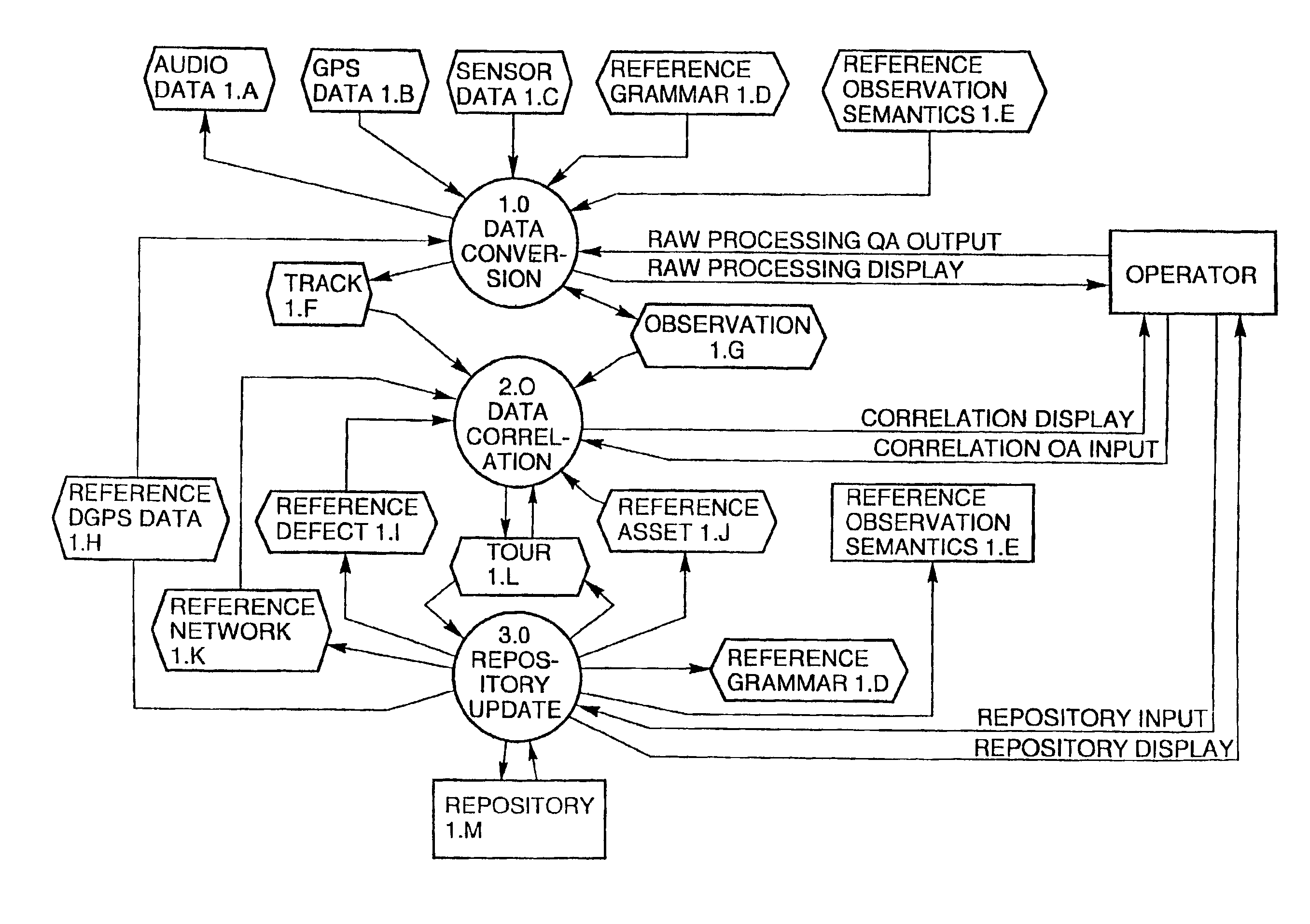
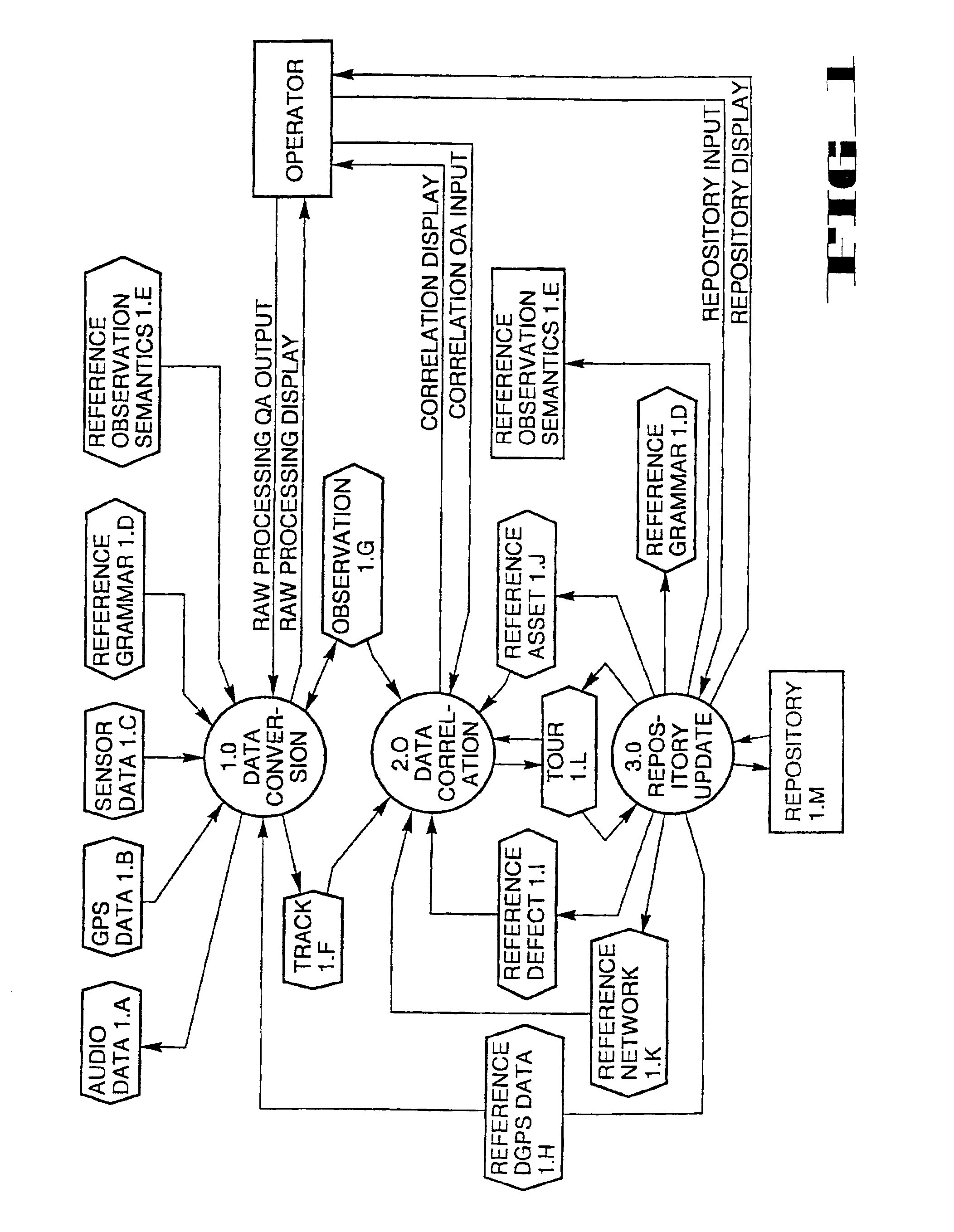
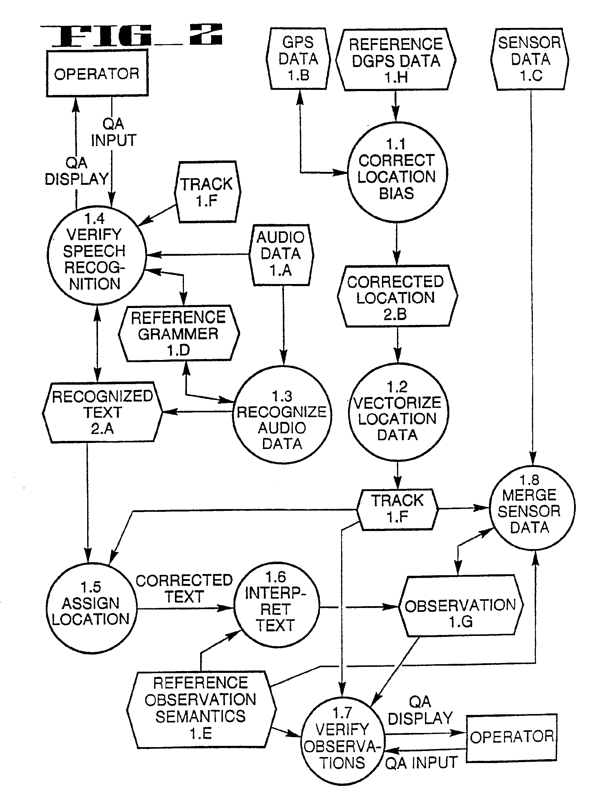
[0026]FIG. 1 presents an overview of a preferred form of the spatial asset management system and method. Subsequent FIGS. 2-4 expand each major process shown in FIG. 1. For example, the process 1.0 Data Conversion (the top circle in FIG. 1) is expanded into a more detailed flow chart in FIG. 2.

[0027]The spatial asset management system and method described herein is a hardware independent system solution for managing assets with a strong geospatial component. The preferred form of the system is implemented in a commercial off-the-shelf laptop or pen-based computer for the mobile system component and a high performance PC for the processing workstation home base computer.

[0028]The three data stores Audio Data 1.A, GPS Data 1.B, and Sensor Data 1.C shown in FIG. 1 are generated in the mobile system laptop computer. All subsequent processes and data stores are maintained in the home base computer or workstation.

[0029]The system provides for a seamless, fully automatic capture, translati...


PUM


Abstract

A data collection and automatic database population system which combines global positioning system (GPS), speech recognition software, radio frequency (RF) communications, and geographic information system (GIS) to allow rapid capture of field data, asset tracking, and automatic transfer of the data to a GIS database. A pre-defined grammar allows observations to be continuously captured along with GPS location and time, and stored on the field mobile unit. A mobile unit's location is tracked in real time or post processed through wireless RF transmission of location information between the mobile unit and a central processing station. The captured data is electronically transferred to a central processing station for quality assurance and automatic population of the GIS database. The system provides for automatic correlation of field data with other GIS database layers. Tools to generate predefined or user defined reports, work orders, and general data queries allow exploitation of the GIS database.

Description

CROSS REFERENCE TO RELATED APPLICATION[0001]This application is a divisional application of application Ser. No. 08 / 714,583, filed on Sep. 16, 1996 now U.S. Pat. No. 6,272,457, which is hereby incorporated herein by reference.FIELD OF THE INVENTION[0002]This invention relates to methods for combining Global Positioning System (“GPS”), Speech Recognition, Radio Frequency (“RF”), and Geographic Information System (“GIS”) to perform mobile field data collection and automatic population of a GIS database with fully attributed and correlated observation data. The system relates particularly to a field data capture system and automatic GIS database population tool for a user to build GIS layers and fully exploit the data in the GIS.BACKGROUND OF THE INVENTION[0003]Organizations responsible for the maintenance and inventory of assets are turning to GIS as the tool of choice to manage and display these assets. Over eighty percent of the cost of a GIS is capturing and placing accurate, fully...

Claims


Application Information

Patent Timeline
Patent Type & Authority Patents(United States)
IPC IPC(8): G06F17/27G01C21/36G01S19/48G10L15/26
CPCG01C21/3629G10L15/26G06T17/05
Inventor FORD, TERRY EDWARDYOTKA, JOHN ANTHONYTUREK, JR., RICHARD JAMES
Owner LOCKHEED MARTIN CORP
Why Eureka
Try Eureka