
System for visualizing three dimensional objects or terrain

a three-dimensional object and terrain technology, applied in the field of visualization of three-dimensional objects and/or three-dimensional terrain, can solve the problems of small devices and heavy weight, and achieve the effects of fast and easy visualization, fast geometric representation, and fast and easy visualization

Active Publication Date: 2015-09-29
HARMAN BECKER AUTOMOTIVE SYST
View PDF3 Cites 7 Cited by
  • Summary
  • Abstract
  • Description
  • Claims
  • Application Information

AI Technical Summary

Benefits of technology

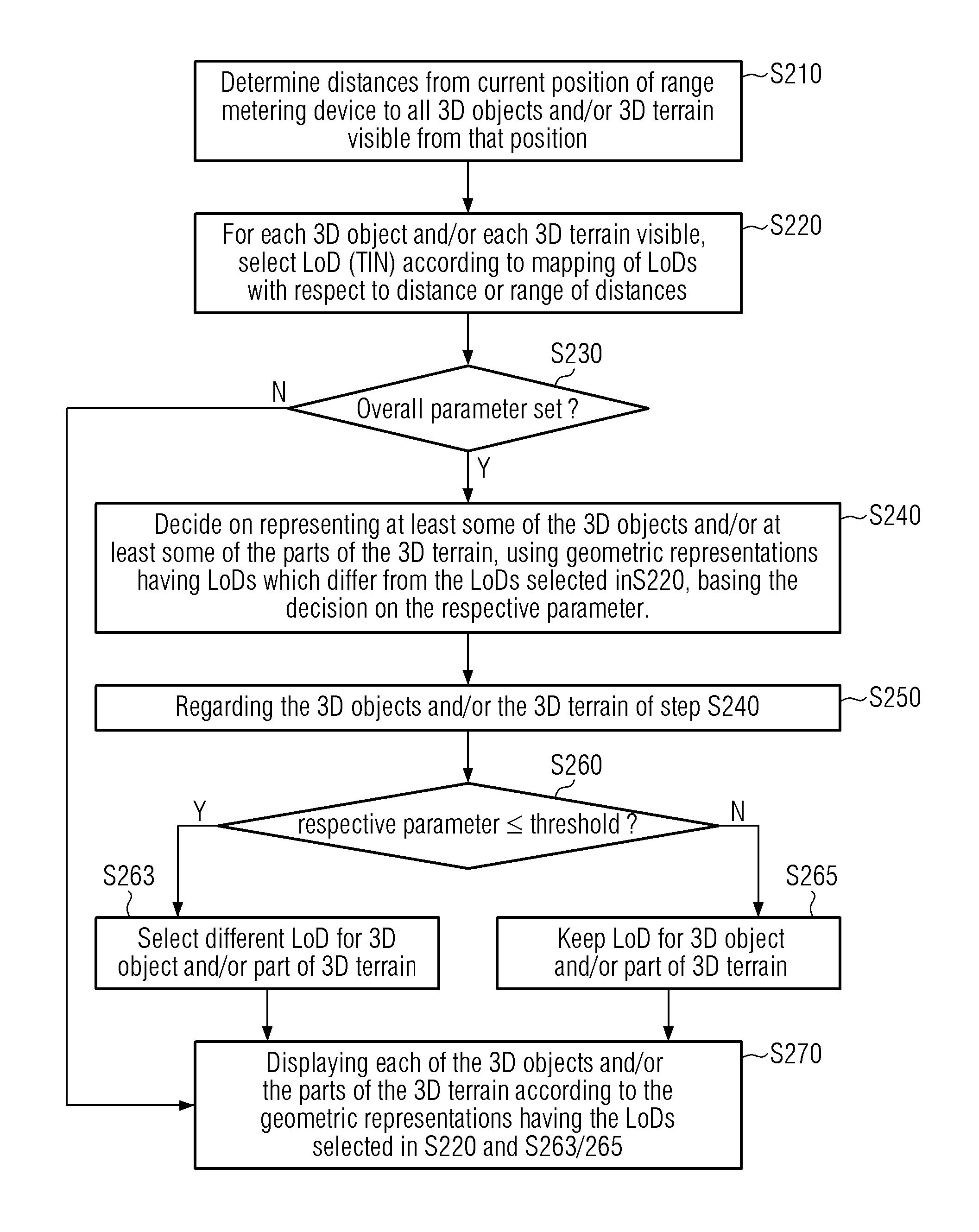
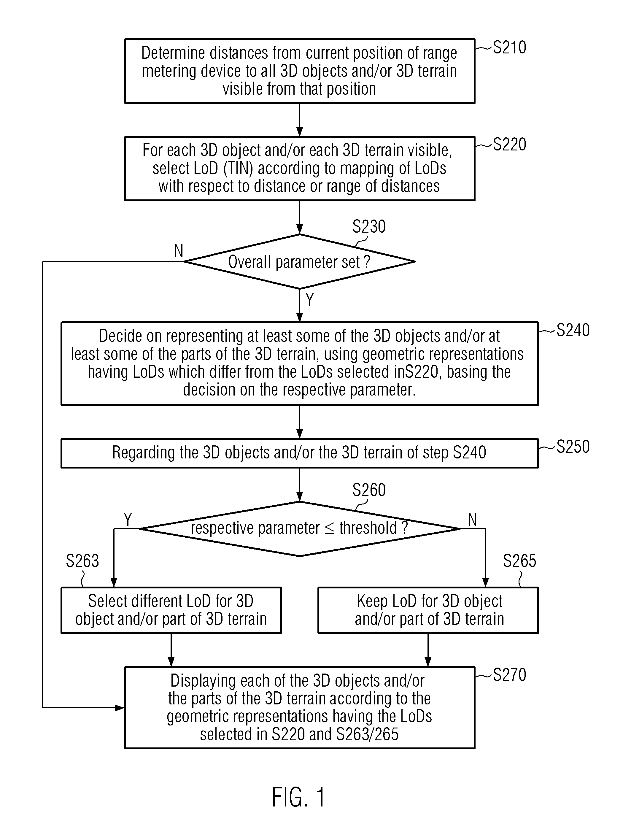
[0008]The geometric representation may be based on the respective distances from a viewer, that is, a user of the device to the respective 3D objects and terrain. The detail of the 3D objects and / or the 3D terrain may be described by a respective parameter measuring the detail of the 3D object and the 3D terrain. The detail of the objects and terrain may be known beforehand. Further, the distances to the objects may be provided very quickly, since, in a specific projection scheme. In a central or camera projection the distances (intra distances of the scene) between the various objects and terrain to be visualized are typically already known, only the distance from the viewer to a specific point of the scene needs to be determined. Thus, both parameters may be provided very quickly such that a fast and easy visualization of the 3D objects and the 3D terrain is possible.
[0009]In the method described above, typically each of the 3D objects may have a geometric representation having a Level of Detail (“LoD”) selected from a plurality of different LoDs for the 3D objects. Thus, sets of levels of detail for each of the 3D objects may be provided, which are easily accessible and may provide a fast geometric representation of the 3D objects.
[0012]The levels of detail thus may comply with modern industry standards which gear towards standardizing information content for mobile devices, in particular navigational systems, handhelds, smartphones etc. Using these standards also provides the benefits of having the opportunity to easily upgrade card maps for the above-mentioned systems. The application and the data thus are separable. The version management of the card data is simplified, the format is compact and the data may be applicable basically worldwide.
[0019]The method as described above may further comprise in step (c) comparing the respective parameter to a predetermined threshold, where if the respective parameter is less than or equal to the predetermined threshold, selecting for displaying the respective 3D object and / or the part of the 3D terrain a respective geometric representation having an LoD which is less detailed than the LoD selected in step (b), unless the geometric representation selected in step (b) comprises already the least level of detail of the plurality of LoDs for 3D objects and 3D terrain, respectively. The threshold may be predetermined. It may be possible to change the threshold during use of the device. For example, the user may interact to set or reset the threshold. It may also be possible to have an object-specific threshold for each object. Thus, the above-described method provides a combination of ease of use together with the possibility to individually tailor the system to the user's need.
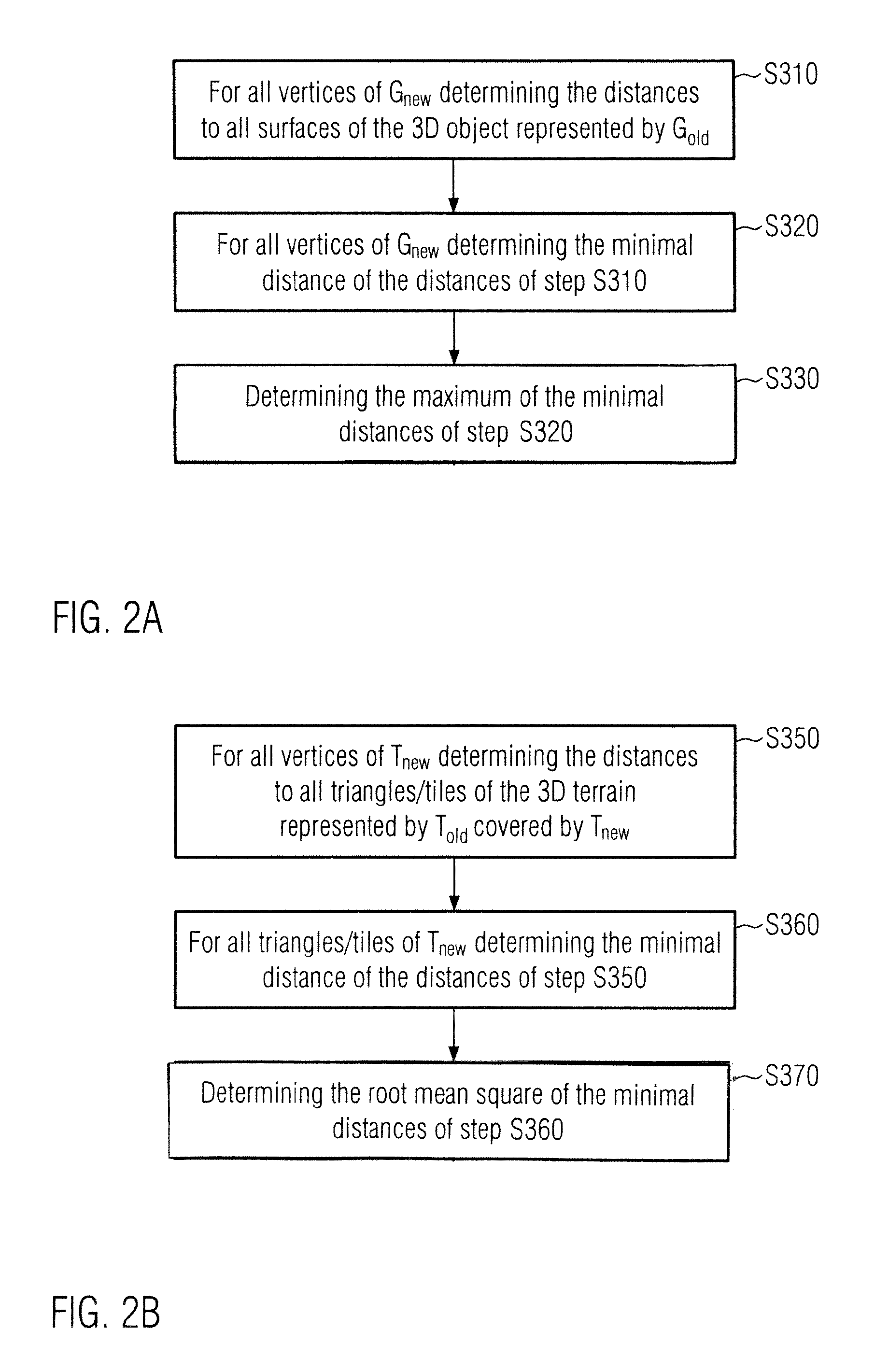
[0027]The comparison of parts of the 3D terrain thus is very similar to the comparison of different level of detail. Therefore, both may be performed very quickly.

Problems solved by technology

Typically these devices are small and lightweight.

Method used


Image

  • System for visualizing three dimensional objects or terrain
  • System for visualizing three dimensional objects or terrain
  • System for visualizing three dimensional objects or terrain

Examples


Embodiment Construction

[0037]Process and rendering of 3D objects often utilize polygon meshes. A polygon mesh or unstructured grid denotes a set or a collection of vertices, edges and faces / surfaces that define the shape of a polyhedral 3D object in graphics representation and in solid modeling. The faces can consist of triangles, quadrilaterals or other simple convex polygons, since this can simplify rendering by generating the object from the underlying model. Alternatively, the faces may be composed of more general concave polygons, or polygons with holes.

[0038]For a graphics representation which may be used in devices such as mobile devices, the scene complexity or scene realism can be balanced against the rendering speed, or how much information is needed for the user using the device. In particular for navigational systems, the user may not need much detailed information for each and every object or terrain displayed in the scene in front of him. Some information may even be reduced to serve as mark...


PUM


Abstract

A system for visualization of 3D objects and / or 3D terrain includes a processor, a display in communication with the processor, and a range metering device in communication with the processor. The system visualizes the 3D objects and / or the 3D terrain based upon their respective distances from the mobile device and based upon a respective parameter measuring the detail of the 3D object and / or the 3D terrain.

Description

BACKGROUND OF THE INVENTION[0001]1. Priority Claim[0002]This application claims the benefit of priority from European Patent Application 11 006 316.1, filed Aug. 1, 2011, which is incorporated by reference.[0003]2. Technical Field[0004]The present invention relates to a method of visualization of 3D objects and / or 3D terrain using a device having a display and a range metering device.[0005]3. Related Art[0006]Portable handheld devices or embedded devices, vehicle navigational systems, but also navigational systems for cyclists, hikers or pedestrians are known in the state of the art. Such devices often present a 3D view from the current position of its user applying the device for orientation, guiding through often a multitude of sometimes unknown objects and or terrain. These devices provide the user with an approximation of the 3D world he / she encounters from his / her current viewpoint.SUMMARY[0007]A system for visualization of 3D objects and / or 3D terrain provides geometric repres...

Claims


Application Information

Patent Timeline
Patent Type & Authority Patents(United States)
IPC IPC(8): G06T17/00G09G5/00G06T17/05G06T19/00
CPCG06T17/05G06T19/00G06T2210/36
Inventor KUNATH, PETERPRYAKHIN, ALEXEYSTRASSENBURG-KLECIAK, MAREKFELDBAUER, THOMASIVANOV, VLADIMIR
Owner HARMAN BECKER AUTOMOTIVE SYST
Learn More