

Method and device for automatic interpretation of remote sensing images
A remote sensing image and remote sensing image technology, applied in the field of remote sensing image processing, can solve a large number of problems, such as cumbersome content and large amount of calculation.
- Summary
- Abstract
- Description
- Claims
- Application Information
AI Technical Summary
Problems solved by technology
Method used
Image

Examples
Embodiment Construction
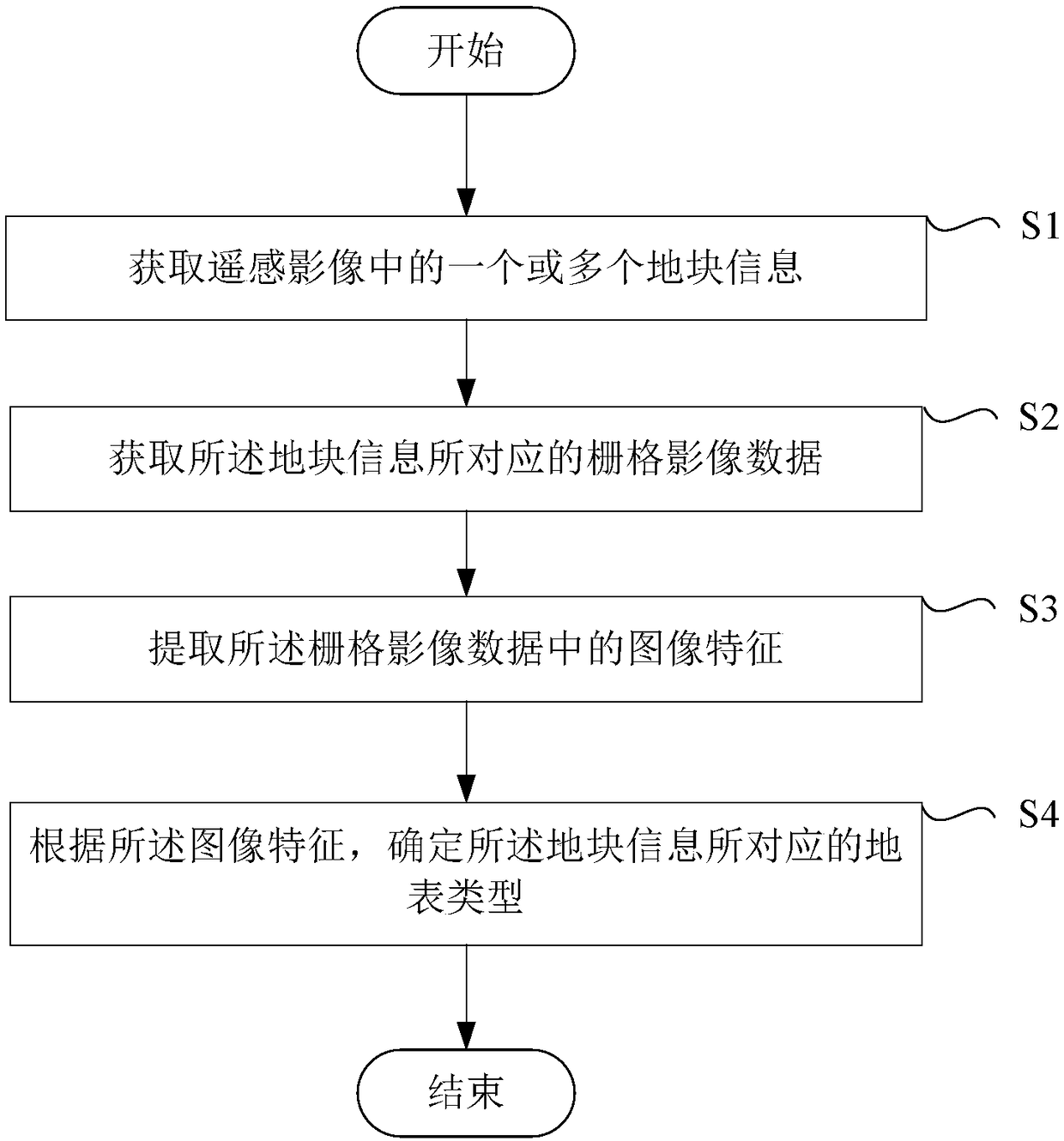
[0104] Before discussing the exemplary embodiments in more detail, it should be mentioned that some exemplary embodiments are described as processes or methods depicted as flowcharts. Although the flowcharts describe operations as sequential processing, many of the operations may be performed in parallel, concurrently, or simultaneously. In addition, the order of operations can be rearranged. The process may be terminated when its operations are complete, but may also have additional steps not included in the figure. The processing may correspond to a method, function, procedure, subroutine, subroutine, or the like.
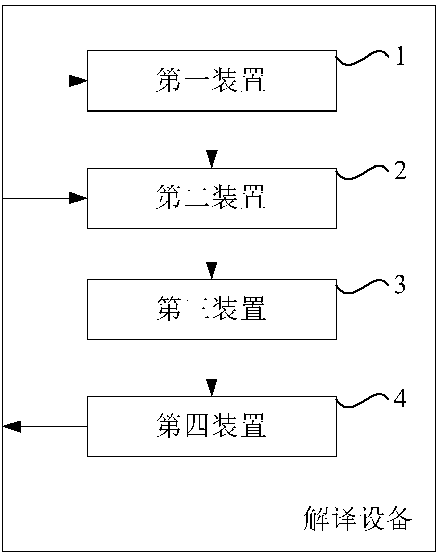
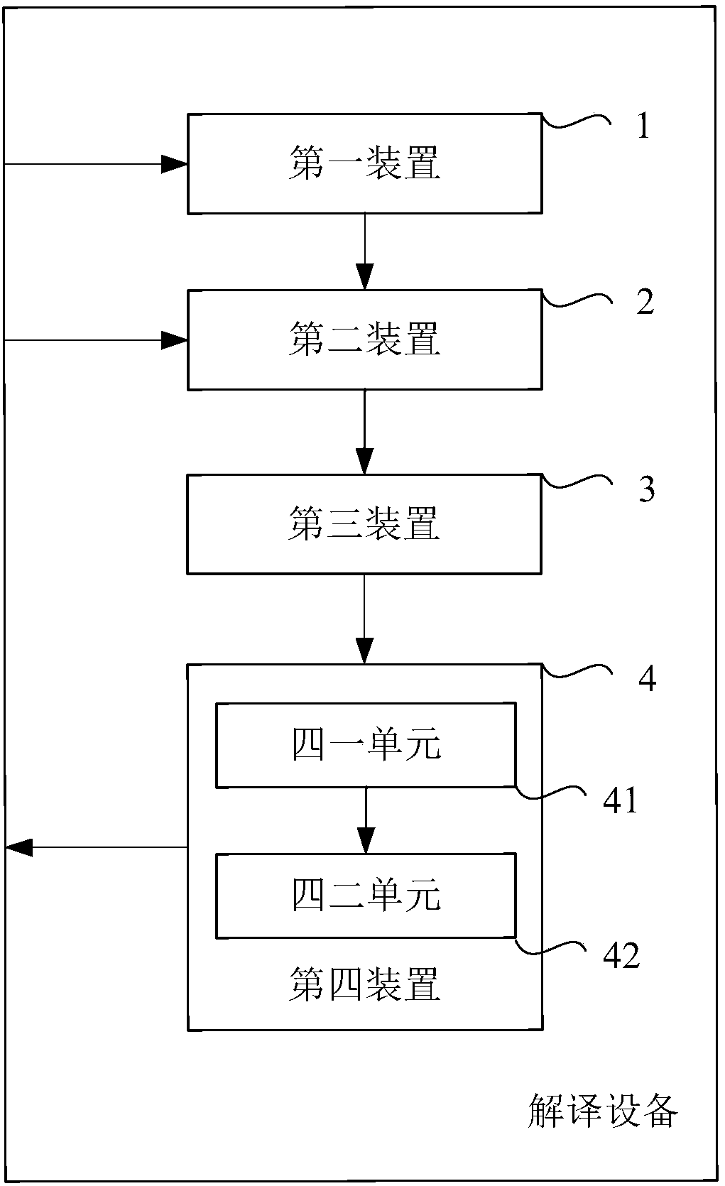
[0105] The "interpretation device" referred to in the context is "computer device", also known as "computer", which refers to an intelligent device that can perform predetermined processing procedures such as numerical calculations and / or logical calculations by running predetermined programs or instructions. Electronic equipment, which may include a processor ...
PUM
 Abstract
Description
Claims
Application Information