

An automatic remote sensing instruction generation and verification method
A technology of command generation and verification method, which is applied in the field of remote sensing satellite measurement and control, can solve the problems of time-consuming and laborious, difficult to guarantee the reliability of payload control, low efficiency of research and development and operation control, so as to ensure accuracy and reduce technical mastery Requirements and difficulty of operation, strong maintainability
- Summary
- Abstract
- Description
- Claims
- Application Information
AI Technical Summary
Problems solved by technology
Method used
Image

Examples
Embodiment Construction
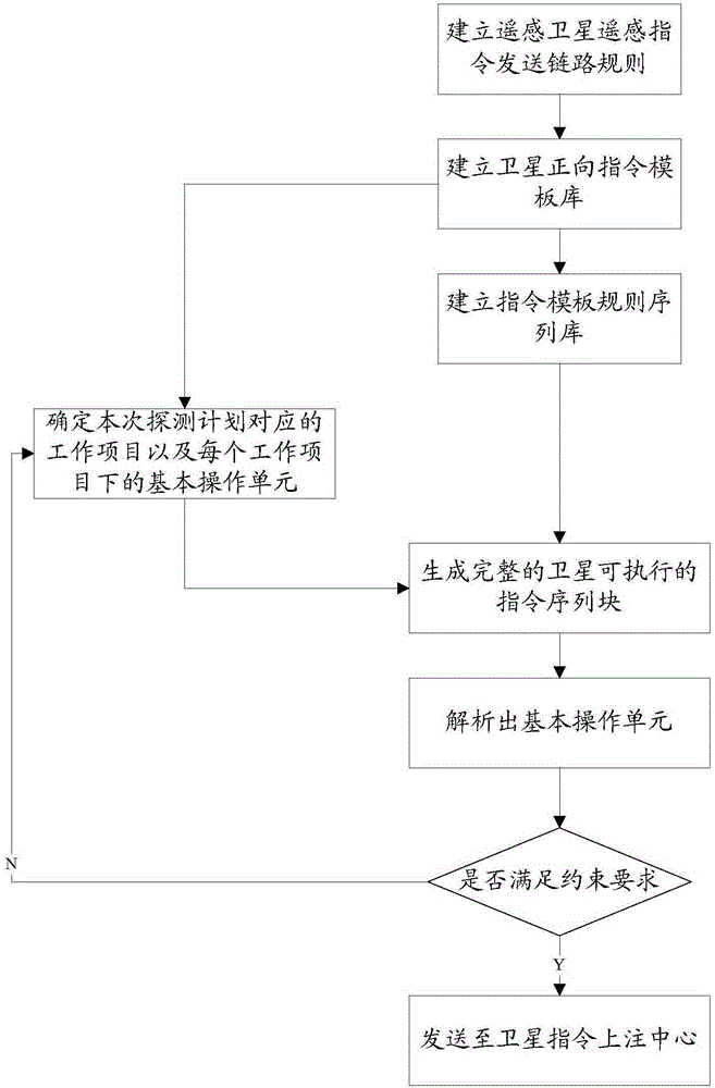
[0024] An automatic remote sensing satellite command generation and anti-compilation automatic comparison method, such as figure 1 shown, including the following complete implementation steps:
[0025] (1) Establishment of command sending link rules
[0026] General remote sensing satellite business commands need to transmit data through optical fiber and satellite command notification center, including the above remote control commands and real-time telemetry data. The ground system needs to control and manage the link, including the control management responsible for the initialization, management, monitoring and working status control of each thread module.
[0027] In order to ensure the validity and reliability of the data during the link sending process, the link mechanism of "three judgments and two" is adopted in the link protocol, that is, for each command task, it is sent three times, and two of the command data are extracted CRC (checksum) comparison is performed ...
PUM
 Abstract
Description
Claims
Application Information