Method for realizing virtual information marking and drawing marking line in enhanced practical field

A technology for labeling lines and fields, applied in the field of computer vision, can solve the problems of virtual information without labeling visual relevance

Active Publication Date: 2013-03-13
CHENGDU IDEALSEE TECH
View PDF2 Cites 28 Cited by
  • Summary
  • Abstract
  • Description
  • Claims
  • Application Information

AI Technical Summary

Problems solved by technology

[0004] The purpose of the present invention is to provide a method for realizing virtual information labeling and drawing labeling lines in the field of augmented reality, which solves the problem of poor visual correlation between the above-mentioned virtual information without labeling and labeling, and can combine the virtual information superimposed on the real scene with the mobile terminal The annotation information on the interface is connected

Method used


Image

  • Method for realizing virtual information marking and drawing marking line in enhanced practical field
  • Method for realizing virtual information marking and drawing marking line in enhanced practical field
  • Method for realizing virtual information marking and drawing marking line in enhanced practical field

Examples


Embodiment 1

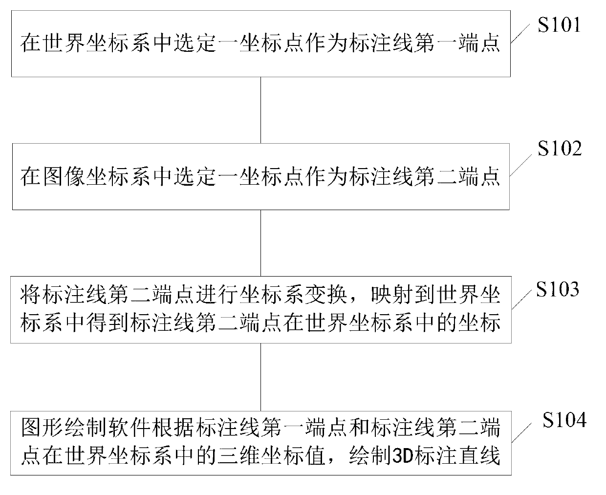
[0052] see figure 1 It is a flow chart of the method for drawing label lines in Embodiment 1 of the present invention, including steps:

[0053] S101: Select a coordinate point in the world coordinate system as the first end point of the label line;

[0054] S102: Select a coordinate point in the image coordinate system as the second endpoint of the label line;

[0055] S103: Perform coordinate system transformation on the second end point of the labeling line, and map it to the world coordinate system to obtain the coordinates of the second end point of the labeling line in the world coordinate system;

[0056] S104: The graphic drawing software draws a 3D marked straight line according to the three-dimensional coordinate values ​​of the first end point of the marked line and the second end point of the marked line in the world coordinate system. The image drawing software described in this step is OPENGL or OPENGLES or DirectX.

[0057] In step S103, the coordinate system ...

Embodiment 2

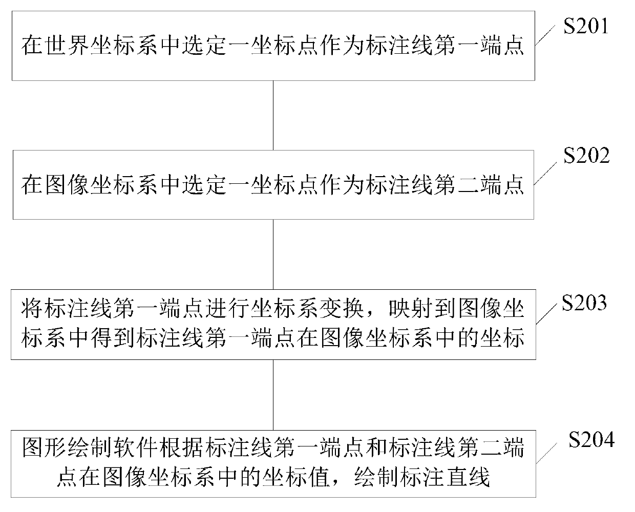
[0066] see figure 2 , which is a flowchart of a method for drawing marking lines in Embodiment 2 of the present invention, including steps:

[0067] S201: Select a coordinate point in the world coordinate system as the first end point of the label line;

[0068] S202: Select a coordinate point in the image coordinate system as the second endpoint of the label line;

[0069] S202: Transform the coordinate system of the first endpoint of the labeling line, and map it to the image coordinate system to obtain the coordinates of the first endpoint of the labeling line in the image coordinate system;

[0070] S202: The graphic drawing software draws the marked line according to the coordinate values ​​of the first end point of the marked line and the second end point of the marked line in the image coordinate system. The image drawing software mentioned in this step is OPENGL or OPENGLES or DirectX. In this embodiment, the marked straight line is a marked line with a 2D effect. ...

Embodiment 3

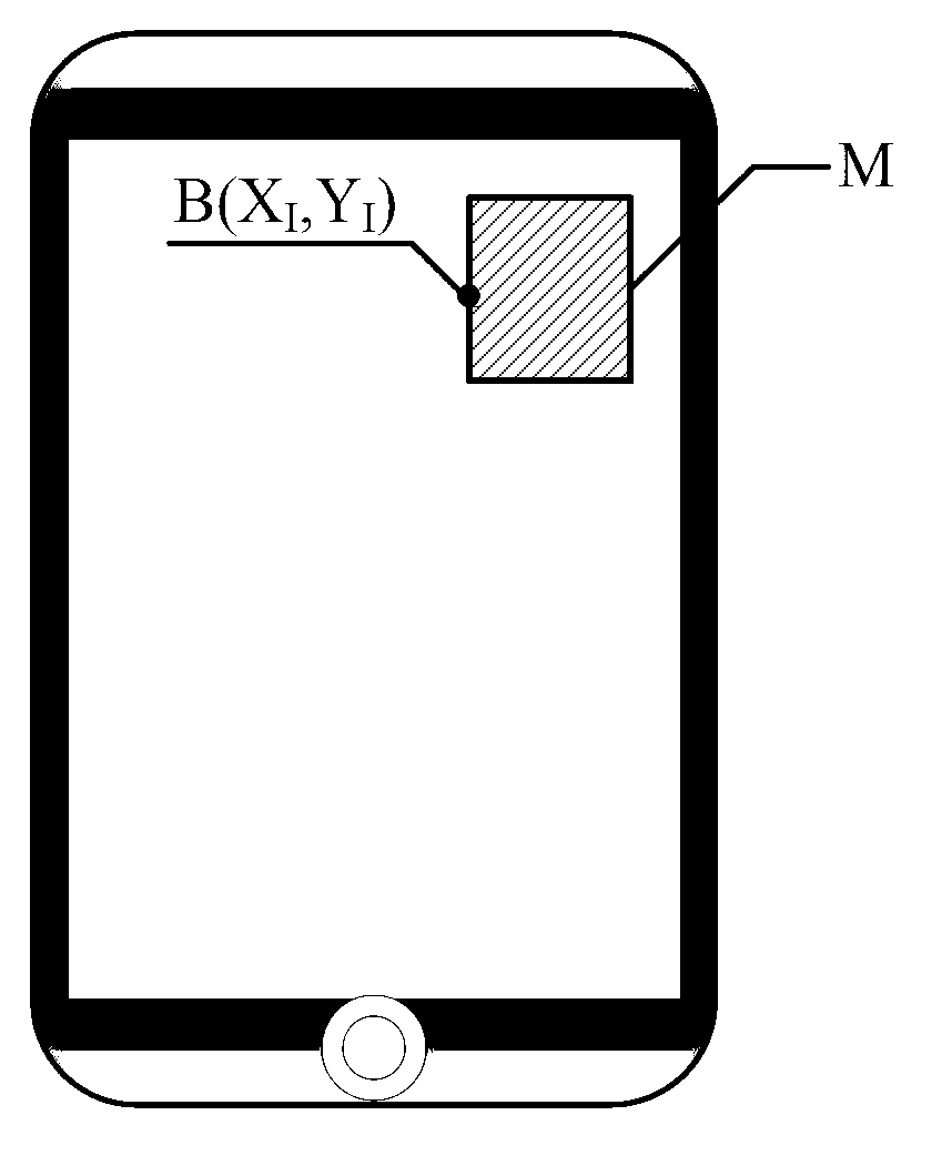
[0079] This embodiment provides a method for realizing virtual information labeling in the field of mobile augmented reality. When implementing this embodiment, it is necessary to draw a labeling line. The drawing of the labeling line adopts the labeling line drawing method in Embodiment 1, which will be combined below Figure 3 to Figure 6 To introduce this embodiment, specifically, this embodiment includes the following steps:

[0080] a1: Set a fixed area on the mobile terminal interface as the marked information area, for example, you can image 3 The fixed area M is set on the schematic mobile terminal interface as the marked information area. This area will only appear when the virtual information superimposed on the real scene is marked and displayed during the augmented reality process. image 3 for indication only;

[0081] a2: Choose a coordinate point on the outline of the augmented reality template in the world coordinate system as the first endpoint of the label ...


PUM


Abstract

The invention discloses a method for drawing a marking line. The method comprises the following steps: firstly, respectively selecting a point in a world coordinate and an image coordinate as two end points of the marking line; then, carrying out coordinate system transformation for transforming one point to the coordinate system of the other point; and finally, using graph drawing software to draw a marking straight line according to the coordinate values of the two end points in the same coordinate system. Correspondingly, the invention further discloses a method for realizing virtual information marking in a mobile enhanced practical field, so that virtual information superposed on a real scene can be marked, and the virtual information superposed on the real scene is linked with marking information on a mobile terminal interface by the marking line. The invention provides a brand-new information marking and displaying mode, so that a user has a feeling that a video or picture superposed on a real scene and marking information on the screen are linked by a 3D (Three Dimensional) or a 2D (Two Dimensional) wire through the screen, and a very fantastic visual effect is achieved.

Description

technical field [0001] The invention relates to the field of computer vision, in particular to a method for realizing virtual information labeling and drawing label lines in the field of augmented reality. Background technique [0002] Mobile augmented reality (Mobile Augmented Reality), that is, augmented reality based on mobile terminals, is a research direction resulting from the combination of augmented reality (AR) technology and mobile computing, and is one of the hot spots in the field of human-computer interaction in recent years. Mobile augmented reality has the essence of traditional augmented reality, that is, in the scene presented in the real environment, with the help of computer graphics technology and visualization technology, the virtual information is "seamlessly" integrated with it in real time, and the virtual information is used to supplement and enhance the real scene. ; At the same time, the combination with the mobile terminal platform can maximize th...

Claims


Application Information

Patent Timeline
Patent Type & Authority Applications(China)
IPC IPC(8): G06T11/00G06T19/00
Inventor 陈更李薪宇宋海涛
Owner CHENGDU IDEALSEE TECH
Why Eureka
Try Eureka