Sparse surface feature classification and labeling method based on visible light and laser radar images

A technology for classification of lidar images and ground objects, applied in the field of spatial information, can solve problems such as difficult extraction of target areas, low accuracy, and time-consuming, so as to improve classification speed and labeling accuracy, ensure accuracy, and reduce The effect of classification time

Active Publication Date: 2015-11-11
XIDIAN UNIV
View PDF4 Cites 4 Cited by
  • Summary
  • Abstract
  • Description
  • Claims
  • Application Information

AI Technical Summary

Problems solved by technology

[0005] The purpose of the present invention is to provide a sparse object classification and labeling method based on visible light and lidar images, in order to solve the problem that the target area is not easy to extract, and the sliding window strategy traverses the entire image for object classification. Time-consuming and low accuracy The problem

Method used


Image

  • Sparse surface feature classification and labeling method based on visible light and laser radar images
  • Sparse surface feature classification and labeling method based on visible light and laser radar images
  • Sparse surface feature classification and labeling method based on visible light and laser radar images

Examples


Embodiment Construction

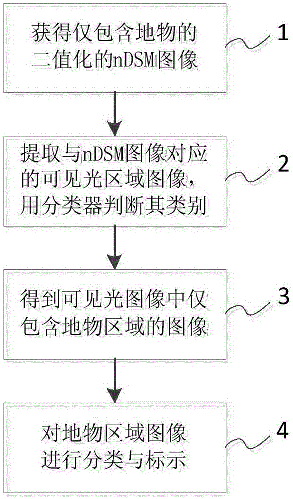
[0029] Such as figure 1 As shown, a sparse object classification and labeling method based on visible light and lidar images includes the following four steps:

[0030] Step 1: Obtain a binary nDSM (NormalizedDigitalSurfaceModel) image containing only ground objects;

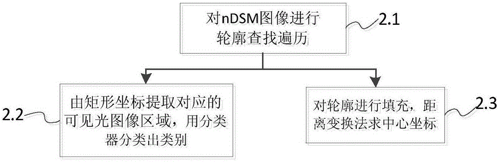
[0031] Step 2: extract the image regions corresponding to the nDSM images in step 1 from the visible light image, and use a classifier to judge the categories of these image regions;

[0032] Step 3: Obtain an image that only contains the object area in the visible light image;

[0033] Step 4: Use the information obtained in the above steps to classify and label the image of the ground object area.

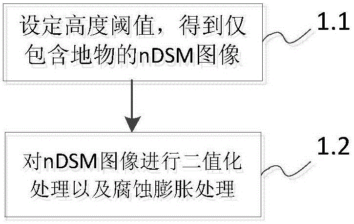
[0034] Such as figure 2 As shown, described step 1: obtain only the binarized nDSM image that comprises ground object, and its feature comprises the following steps:

[0035] Step 1.1: Set the height threshold, further filter out ground points or noise points in the nDSM image, and obtain an nDSM image contain...


PUM


Abstract

The present invention relates to a sparse surface feature classification and labeling method based on visible light and laser radar images. According to the method, the height information of the laser radar image is used to extract corresponding surface feature image areas in the visible light image and coordinate positions, then the surface feature image areas are subjected to classification judgment by using a classifier, and labeling is carried out on the corresponding coordination positions. According to the method, the problems of difficult extraction of a target area and time consumption and low accuracy brought by a sliding window strategy are solved, surface features can be accurately and rapidly classified and labeled, the classification speed and labeling accuracy of the surface features are improved, the accuracy of classification and labeling is ensured, and the classification time is reduced.

Description

technical field [0001] The technical field of the present invention is the field of spatial information technology or pattern recognition, and relates to technologies such as image processing and computer vision, and in particular to a method for classifying and marking sparse ground objects based on visible light and laser radar images. Background technique [0002] Classification of raised sparse objects such as buildings, vehicles or trees in the image can use the traditional detection and classification method based on object modeling, that is, to calibrate a large number of training sample targets, train different classifiers, and then perform multiple scales on the image Sliding window scanning, so as to obtain the circumscribed rectangular window of all objects of interest in the image. However, the sliding window strategy used in the above method consumes a lot of time, especially when the target category is not one but multiple, this strategy is more difficult to re...

Claims


Application Information

Patent Timeline
Patent Type & Authority Applications(China)
IPC IPC(8): G06K9/46G06K9/62
CPCG06V10/44G06F18/24
Inventor 刘贵喜吕孟娇方兰兰赵丹张音哲范勇涛
Owner XIDIAN UNIV
Why Eureka
Try Eureka