

Method for extracting debris flow information in remote sensing images
A remote sensing image and debris flow technology, applied in the field of remote sensing interpretation, can solve problems such as low accuracy, poor recognition results, and low efficiency, and achieve the effect of eliminating terrain shadows and accurate and fast image processing
- Summary
- Abstract
- Description
- Claims
- Application Information
AI Technical Summary
Problems solved by technology
Method used
Image

Examples
Embodiment Construction
[0021] In order to better understand the present invention, the method of the present invention will be further described below with reference to the description of the embodiments in conjunction with the accompanying drawings.
[0022] In the following detailed description, numerous specific details are set forth in order to provide a thorough understanding of the present invention. However, it will be understood by those skilled in the art that the present invention may be practiced without these specific details. In the embodiments, well-known methods, procedures, components have not been described in detail so as not to unnecessarily obscure the embodiments.
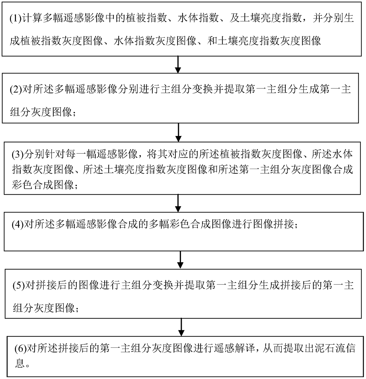
[0023] see figure 1 As shown, a method for extracting debris flow information in a remote sensing image of the present invention comprises the following steps:
[0024] (1) Calculate the vegetation index, water body index, and soil brightness index in multiple remote sensing images, and generate vegetation index gr...
PUM
 Abstract
Description
Claims
Application Information