Web3D network communication platform and construction method thereof

A network and platform technology, applied in 3D modeling, software engineering design, image data processing, etc., can solve the problems of neglecting the elastic-plastic constitutive characteristics of soil, large impact of landslide thrust, and neglecting slope geometry.

CN110196717AInactive Publication Date: 2019-09-03CHINA UNIV OF GEOSCIENCES (BEIJING)
2 Cites 5 Cited by

Patent Information

Authority / Receiving Office
CN · China
Current Assignee / Owner
Publication Date
2019-09-03
Estimated Expiration
Not applicable · inactive patent

Smart Images

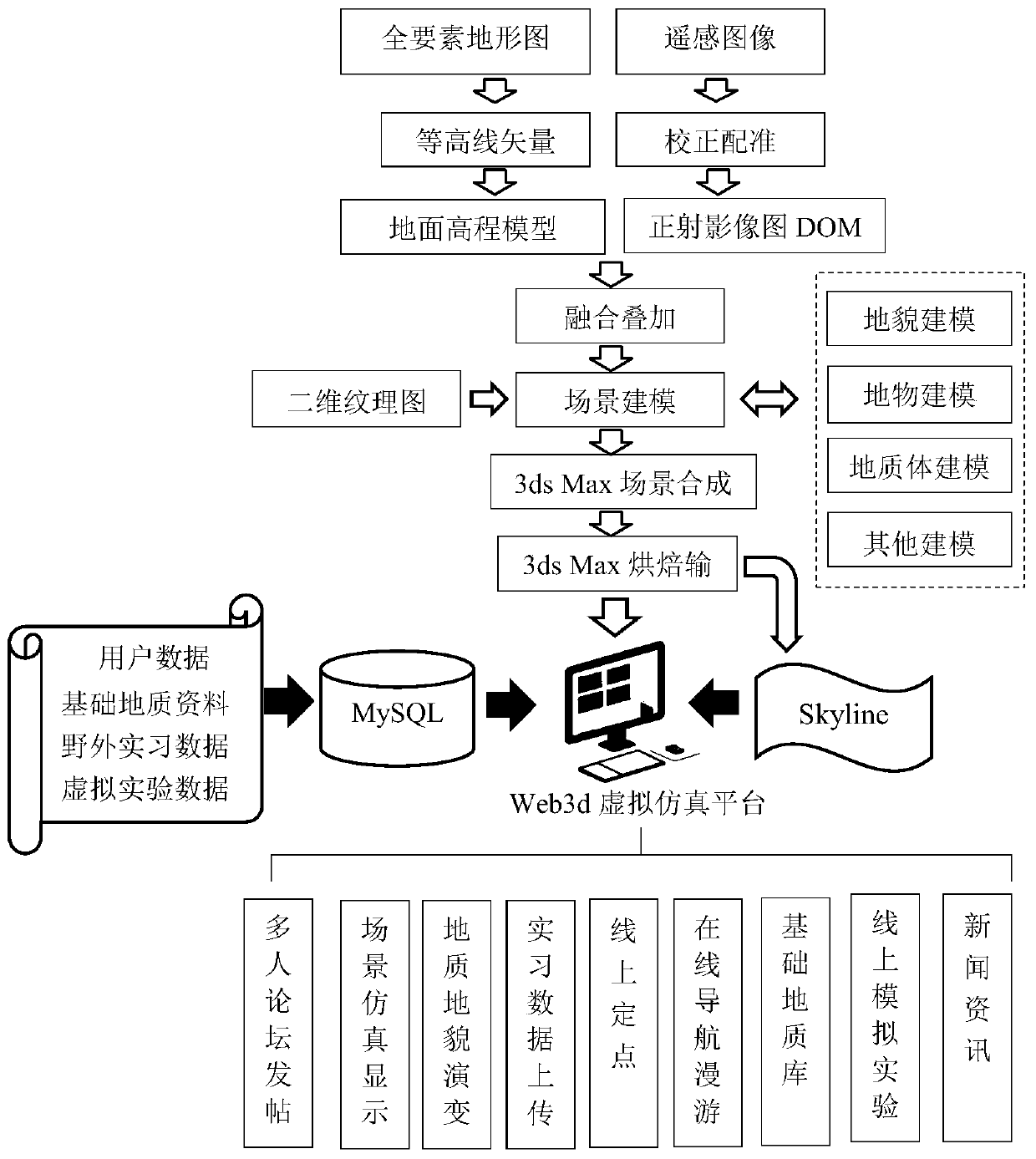
  • Figure 1
    Figure 1
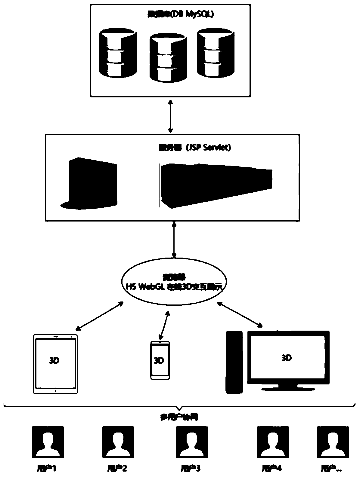
  • Figure 2
    Figure 2
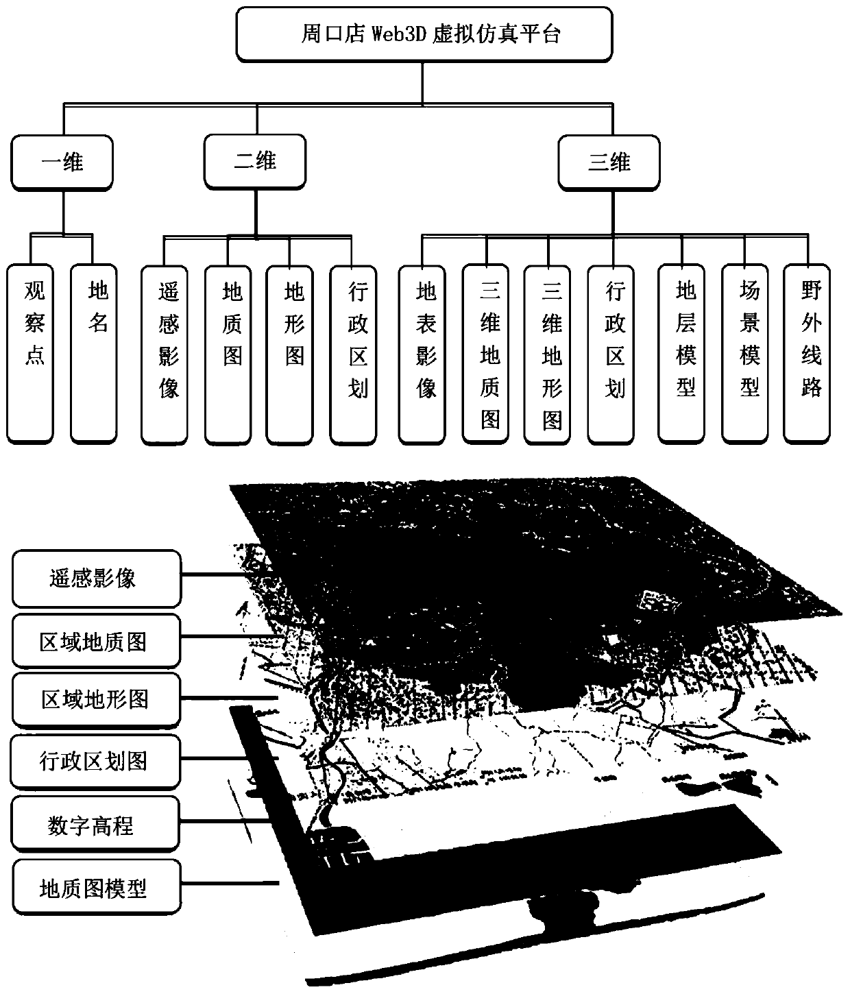
  • Figure 3
    Figure 3
Patent Text Reader

Abstract

The invention discloses a Web3D network communication platform and a construction method thereof, and the method comprises the steps: integrating unmanned aerial vehicle data, remote sensing data, GISdata, DEM and other multi-source, multi-scale and multi-dimensional data by means of public data and related news information of a Chinese geological survey bureau, and building a multi-dimensional display interface of the communication platform. A 3D model is embedded in the website by adopting a WebGL. JavaScript is used for processing interaction operation between the webpage front end and a user, and the functions of POI point online construction, data uploading, online forum discussion, positioning, multi-dimensional virtual reality interface display and the like are achieved. A rear-enddatabase stores user POI data, forum data and related data, so that the user can check the data in real time, and knowledge transmission and sharing are realized to a great extent. The Web3D networkcommunication platform has a field practice communication function, and topographic map cognition, field route geological examination and mapping, typical geological phenomenon research and analysis and the like can be carried out in combination with practice requirements; and a traditional classroom education mode is broken through.
Need to check novelty before this filing date? Find Prior Art

Description

technical field

[0001] The present invention relates to the technical field of teaching software, in particular to a field communication platform and a construction method thereof that use Web3D technology to realize the basic scene of a webpage virtual reality practice base, and use three-dimensional display and interactive browsing operations for teaching. Background technique

[0002] Field geological practice is an important part of geological teaching, and it is also a practical teaching link for cultivating high-quality and knowledge-based talents. Traditional geological teaching methods are relatively abstract in elaborating geoscience concepts and geoscience theories. Many traditional classrooms not only have single and rigid teaching methods, but also boring teaching content. At the same time, there are also problems: teachers are difficult to manage basic maps, and students are difficult to construct spatial concepts. , It is difficult to understand geological phen...

Examples

Embodiment approach

[0049] Multi-source data collection and preprocessing

[0050] This development not only relies on public data on Geological Cloud, such as geological maps, topographic maps, text data (geological reports, census reports, detailed survey reports, news information, etc.), but also a series of drone data, remote sensing data, and GIS data , DEM and other data, thus forming a multi-scale, multi-dimensional, multi-perspective Zhoukoudian field practice exchange website interface, multi-data framework and basic data superimposed display as follows image 3 shown. The text data on the website mainly include the geological survey report documents of Zhoukoudian in the National Geological Archives and related news information in the China Geological Survey Bureau. Among them, the relevant news information calls the news content of the website of the National Geological Survey Bureau. This part uses the code of the "China Geological Survey Bureau" website of the python web crawler to ...