A laser radar turntable and its measuring device and measuring method

A laser radar and measurement method technology, applied in radio wave measurement systems, instruments, etc., can solve the problems of increased cost, time consumption, low efficiency, etc., and achieve the effects of improving measurement efficiency, high measurement density, and high efficiency

CN111366908BActive Publication Date: 2022-05-24BEIJING GUODIAN FUTONG SCI & TECH DEV
8 Cites 0 Cited by

Patent Information

Authority / Receiving Office
CN · China
Patent Type
Patents(China)
Current Assignee / Owner
Publication Date
2022-05-24

Smart Images

  • Figure 1
    Figure 1
  • Figure 2
    Figure 2
  • Figure 3
    Figure 3
Patent Text Reader

Abstract

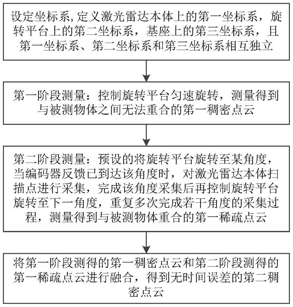
The invention discloses a laser radar turntable and its measurement device and measurement method. The invention adopts a two-stage measurement method. In the first stage, the rotating platform is controlled to rotate at a uniform speed, and the first dense point cloud that cannot be overlapped with the measured object is obtained by measurement. ; In the second stage, the rotating platform is preset to rotate to a certain angle. When the encoder feedback has reached the angle, the scanning point of the lidar body is collected. After the acquisition of the angle is completed, the rotating platform is controlled to rotate to the next angle, and repeat The acquisition process of several angles is completed multiple times, and the first sparse point cloud that coincides with the measured object is obtained by measurement; finally, the first dense point cloud and the first sparse point cloud are fused to obtain the second dense point cloud without time error. The invention can solve the problem of low measurement efficiency of the existing laser radar turntable for the external environment. In the first stage, the turntable is kept at a fast and uniform speed for measurement, and in the second stage, multiple key angle static measurements are performed, and finally registration is performed to improve measurement efficiency.
Need to check novelty before this filing date? Find Prior Art

Description

technical field

[0001] The invention relates to a laser radar measuring device and technology, in particular to a laser radar turntable and its measuring device and measuring method. Background technique

[0002] Laser measurement technology is a surveying and mapping technology that has been rapidly developed and applied in recent years. A typical product of this technology (lidar) is widely used in industrial fields such as aerial mapping and autonomous driving. Compared with traditional surveying and mapping technology, lidar has the characteristics of large amount of data, convenient use and high production efficiency; compared with image photogrammetry technology, it has the characteristics of high resolution and high precision, so it has strong irreplaceability.

[0003] Restricted by the production and adjustment process of lidar equipment (mainly relying on manual completion), high-line-count lidar is expensive and expensive, which limits its application to a certai...

Examples

Embodiment Construction

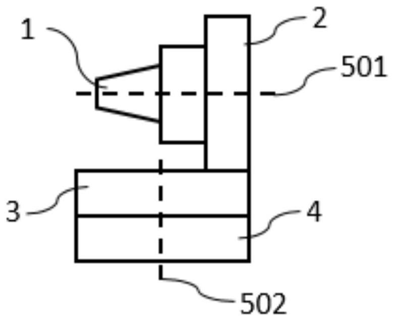
[0049] The laser radar turntable calibration method provided by the present invention will be described below with reference to the accompanying drawings.

[0050] The invention innovatively adopts a two-stage method for the measurement task of the lidar turntable. The first stage adopts the motion mode of uniform rotation to perform continuous collection to obtain dense point clouds; the second stage uses the key angle collection method to obtain key points. Feature point cloud. The present invention designs a two-stage point cloud (dense point cloud, key feature point cloud) pose registration method, the dense point cloud is registered to the key feature point cloud, and the final measurement point cloud is obtained. The invention combines the rapidity of the continuous acquisition method and the accuracy of the key angle acquisition method. Using a multi-stage measurement method, the method of registering the dense point cloud to the key feature point cloud through pose ch...