A geographic information collection device portable geographic information surveying and mapping instrument

A technology of geographic information and collection device, applied in the directions of surveying instruments, surveying devices, surveying and mapping, and navigation, etc., can solve the problems of inconvenience for personnel to move surveying and mapping, inability to disassemble or adjust the length, inconvenience, etc., to achieve convenient surveying and mapping work, easy storage, Data display intuitive effect

Active Publication Date: 2021-10-29
LULIANG UNIV
View PDF9 Cites 1 Cited by
  • Summary
  • Abstract
  • Description
  • Claims
  • Application Information

AI Technical Summary

Problems solved by technology

[0003] Although the traditional geographic information surveying and mapping instrument can realize the function of data surveying and mapping, it must be manually measured and recorded in real time next to the surveying and mapping instrument. The fixed type cannot be disassembled or adjusted in length, so it is inconvenient to carry the surveying and mapping instrument. For this reason, we propose a geographic information collection device portable geographic information surveying and mapping instrument

Method used


Image

  • A geographic information collection device portable geographic information surveying and mapping instrument
  • A geographic information collection device portable geographic information surveying and mapping instrument
  • A geographic information collection device portable geographic information surveying and mapping instrument

Examples


Embodiment Construction

[0027] The following will clearly and completely describe the technical solutions in the embodiments of the present invention with reference to the accompanying drawings in the embodiments of the present invention. Obviously, the described embodiments are only some, not all, embodiments of the present invention.

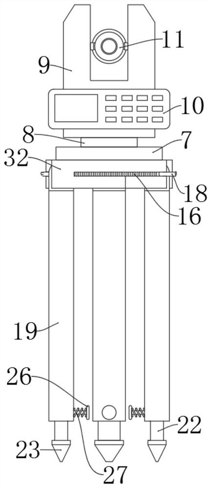
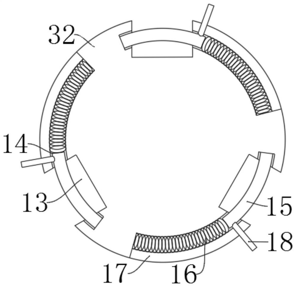
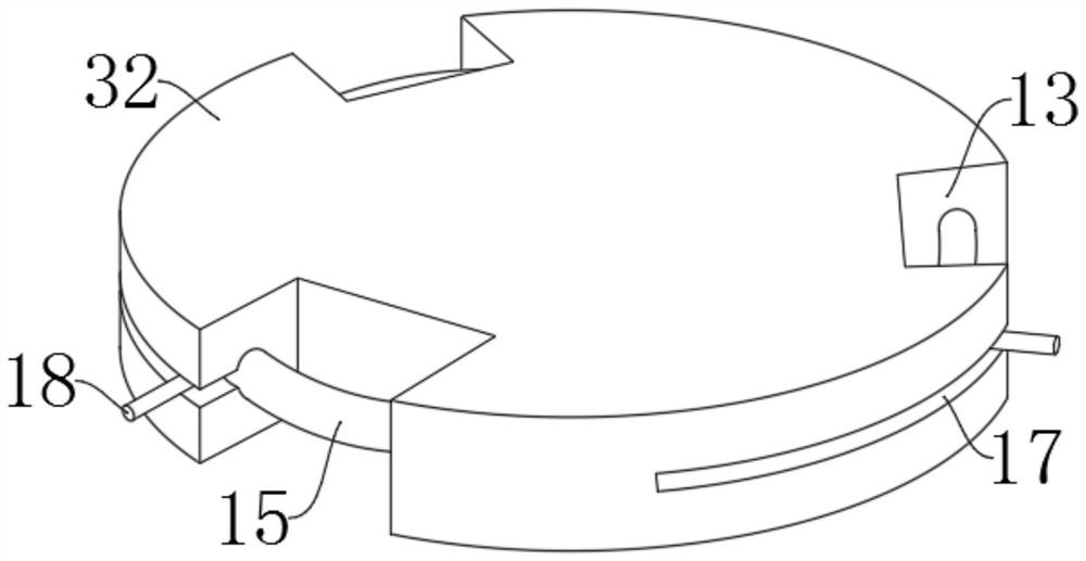
[0028] refer to Figure 1-7 , a geographic information collection device portable geographic information mapping instrument, including a bluetooth module 1, a controller module 2, a storage battery 3, a data measurement module 4, a data processing module 5, a storage module 6, a surveying instrument assembly, a bluetooth module 1, a controller Module 2, storage battery 3, data measurement module 4, data processing module 5, and storage module 6 are all arranged inside the surveying and mapping stand body 9, the Bluetooth module 1 is electrically connected to the controller module 2 in two directions, and the controller module 2 and the data measurement module 4. Two-...


PUM


Abstract

The invention discloses a portable geographical information surveying and mapping instrument of a geographical information collection device, which relates to the field of surveying and mapping equipment, including a bluetooth module, a controller module, a storage battery, a data measurement module, a data processing module, a storage module, and a surveying and mapping instrument component. The controller The module includes a wireless transmission module and a controller. The data processing module includes a data analysis unit and a graphic creation unit. The surveying instrument component includes a base, and the upper side wall of the base is fixedly connected with a mounting seat. Through the Bluetooth module, The wireless transmission module and the controller module are used together to connect the mobile display device to the surveying instrument through the network, and the geographical information data measured by the surveying instrument can be processed and fed back to the mobile device in real time, enabling the operator to The data operation on the mobile device does not require the operator to perform data surveying and mapping next to the surveying instrument, and the data display is more intuitive, which greatly facilitates the surveying and mapping work of geographic information.

Description

technical field [0001] The invention relates to the field of surveying and mapping equipment, in particular to a geographic information collection device and a portable geographic information surveying and mapping instrument. Background technique [0002] Geographical information refers to information related to spatial geographical distribution. It represents the inherent data, quality, distribution characteristics, connections and laws of surface objects and environments. In environmental protection and other work, land surveying and surveying and mapping of various maps must be carried out for planning and management. In geological exploration, mineral development, water conservancy, transportation and other constructions, control surveying, mine surveying, route surveying and topographic map drawing must be carried out , for geological census and various building design and construction, and the measurement of these environmental data must be inseparable from the mapping...

Claims


Application Information

Patent Timeline
Patent Type & Authority Patents(China)
IPC IPC(8): G01C15/00
CPCG01C15/00
Inventor 刘鹏珍杨三萍
Owner LULIANG UNIV
Why Eureka
Try Eureka