Rapid Surveying and Mapping Method and Device

A fast, mapping point technology, applied in the field of UAV surveying and mapping, can solve the problems of low efficiency of manual surveying and mapping, large amount of data, inability to adapt to fast operations, etc., to achieve the effect of easy path planning, improved accuracy, and high-efficiency surveying and mapping work.

Active Publication Date: 2022-06-03
SUZHOU EAVISION ROBOTIC TECH CO LTD
View PDF0 Cites 0 Cited by
  • Summary
  • Abstract
  • Description
  • Claims
  • Application Information

AI Technical Summary

Problems solved by technology

Among them, the efficiency of manual surveying and mapping is low, and automatic aerial surveying and mapping is not conducive to the use of rapid spraying operations due to the large amount of data and long calculation time, which increases equipment costs and personnel workload.
[0003] Nowadays, before aerial photography surveying and mapping, image control point positioning targets are set in the operation plot for positioning and calibration, so as to improve the mapping accuracy of aerial photography drones. This method needs to determine the positioning target in the field operation plot in advance, and Obtaining complete and accurate positioning information, the efficiency of surveying and mapping is low, and it cannot meet the needs of fast operations

Method used


Image

  • Rapid Surveying and Mapping Method and Device
  • Rapid Surveying and Mapping Method and Device
  • Rapid Surveying and Mapping Method and Device

Examples


Embodiment Construction

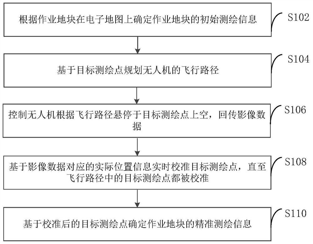
[0048] In order to facilitate the understanding of the present embodiment, a kind of rapid surveying and mapping method disclosed in the embodiment of the present invention is firstly described.

[0049] FIG. 1 provides a flow chart of a rapid surveying and mapping method according to an embodiment of the present invention.

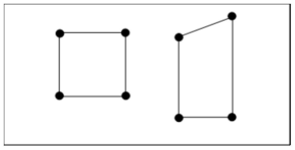
[0076] Based on the numbering, establish a one-to-one correspondence between the precise position information and the initial position information of the target mapping point.

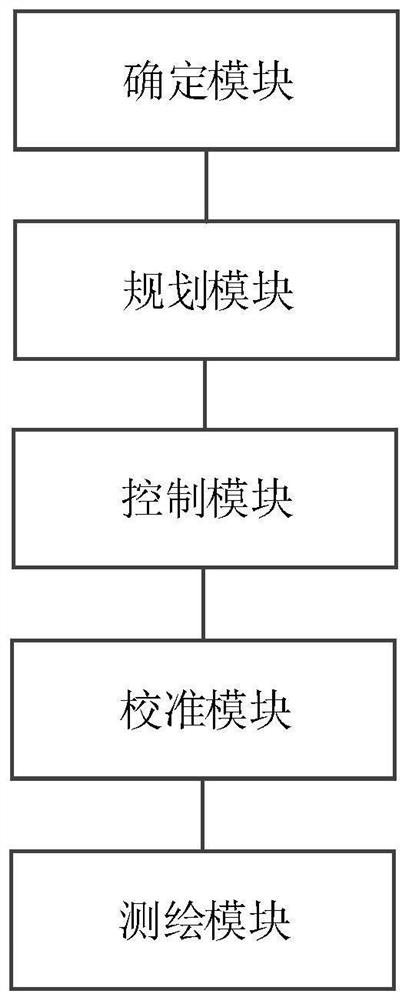
[0102] The surveying and mapping module determines the precise surveying and mapping information of the operation plot based on the calibrated target surveying and mapping point.

[0104] The computer program product of the rapid surveying and mapping method and device provided by the embodiment of the present invention includes a stored program


PUM


Abstract

The present invention provides a fast surveying and mapping method and device, which relate to the technical field of unmanned aerial vehicle surveying and mapping, including determining the initial surveying and mapping information of the operation site on the electronic map according to the operation site, and the initial surveying and mapping information includes target surveying and mapping point; plan the flight path of the drone based on the target surveying point, wherein the flight path is a path traversing the target surveying point; control the drone to hover over the target surveying and mapping according to the flight path point above the sky, and return the image data; based on the actual position information corresponding to the image data, the target surveying points are calibrated in real time until all target surveying points in the flight path are calibrated; based on the calibrated target surveying points, the The accurate surveying and mapping information of the work plot, through the image data returned by the drone, realizes the purpose of automatic real-time calibration of the target surveying and mapping points, and improves the surveying and mapping efficiency.

Description

Rapid surveying and mapping method and device technical field [0001] The present invention relates to the technical field of unmanned aerial vehicle surveying and mapping, in particular to a rapid surveying and mapping method and device. Background technique [0002] Before using an unmanned aerial vehicle for spraying, it is generally necessary to survey and map the operation plot to obtain accurate position information. At present, manual surveying and automatic aerial photography surveying and mapping methods can be used to plan the flight path according to the operation plot. Among them, artificial The surveying and mapping efficiency is low. Due to the large amount of data and long computing time, automatic aerial surveying and mapping increase equipment costs and personnel workload. Useful for quick spraying operations. [0003] Generally, before aerial surveying and mapping, image control point positioning targets are set in the operation plots to perform positio...

Claims


Application Information

Patent Timeline
Patent Type & Authority Patents(China)
IPC IPC(8): G01C11/04G01S19/43B64D47/08B64C39/02
CPCG01C11/04G01S19/43B64D47/08B64C39/02B64U2101/30
Inventor 董雪松殷熙梅
Owner SUZHOU EAVISION ROBOTIC TECH CO LTD
Why Eureka
Try Eureka