Apparatus for securing a land surveyor's mark based on the use of a radio frequency identifier tag

Active Publication Date: 2009-08-13
KYNDRYL INC
View PDF82 Cites 19 Cited by
  • Summary
  • Abstract
  • Description
  • Claims
  • Application Information

AI Technical Summary

Benefits of technology

[0031]This invention has many advantag

Problems solved by technology

The main problem that the prior art proposes to solve is to p

Method used


Image

  • Apparatus for securing a land surveyor's mark based on the use of a radio frequency identifier tag
  • Apparatus for securing a land surveyor's mark based on the use of a radio frequency identifier tag
  • Apparatus for securing a land surveyor's mark based on the use of a radio frequency identifier tag

Examples


Embodiment Construction

General Principles

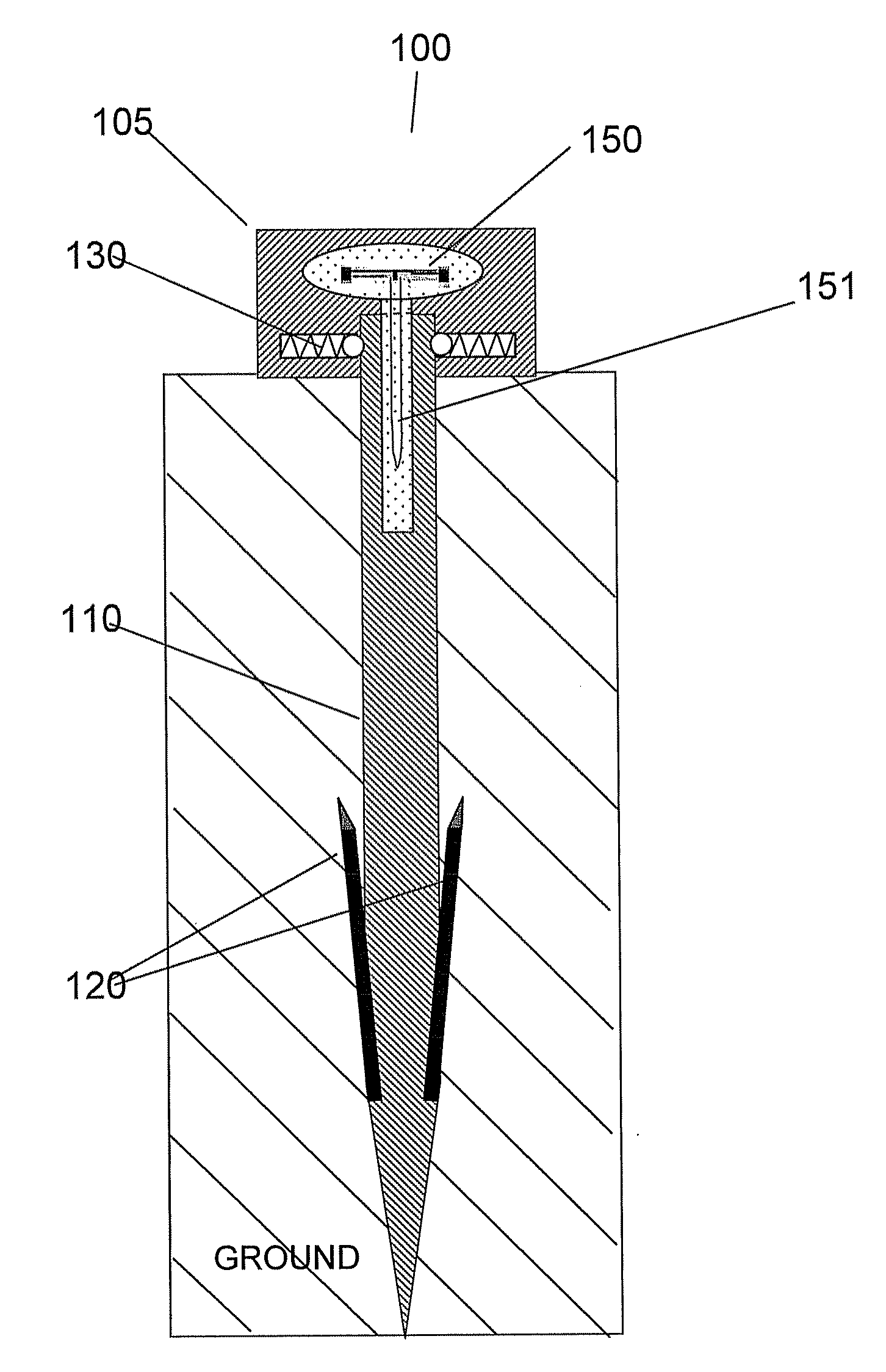
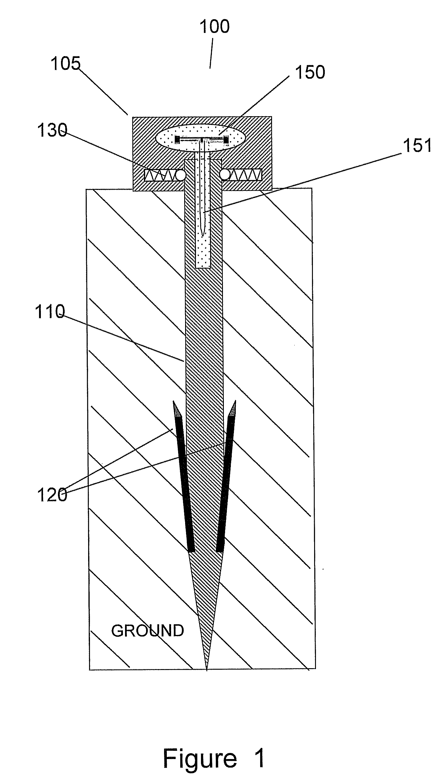
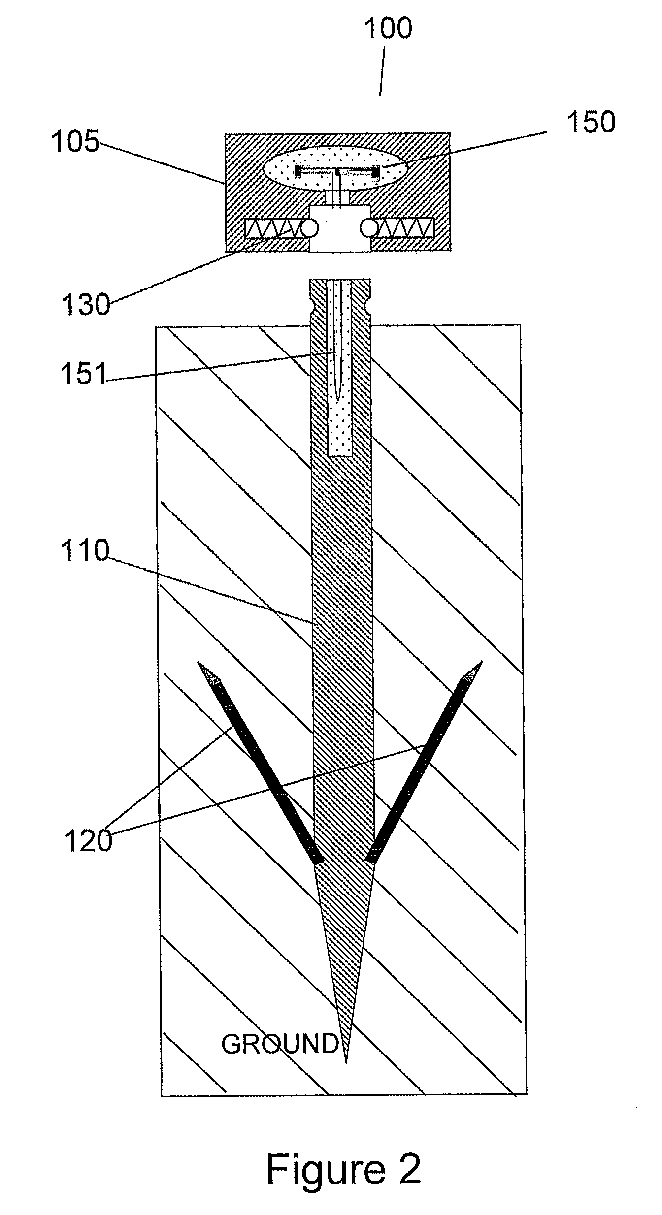
[0037]The present invention relates to Geomatics Engineering and more particularly to “Land Information Management” such as surveying, including land, cadastral and engineering surveying. The present invention discloses an apparatus comprising means for:

[0038]1—Immediately Retrieving Information Related to a Surveyor's Mark:[0039]position of the mark (geographical coordinates),[0040]elevation of the mark,[0041]identification of the mark,[0042]identification of the surveyor who positioned the mark (or professional responsible of the mark),[0043]. . . ,

[0044]2—Determining Whether or not the Mark has Been Moved.

[0045]The surveyor's mark according to the present invention has the following characteristics:[0046]A RFID (Radio Frequency IDentifier) tag is embedded in the surveyor's mark. This RFID tag comprises information related to the mark. This information is written (and signed) by the surveyor who positioned it.[0047]Once the mark has been positioned, the informati...


PUM


Abstract

A surveyor's mark and a method for forming the mark. The mark includes a stick and a head assembled to the stick. The stick is configured to be planted in a ground and the head is configured to be above the ground. The head includes a tag having an identification number. The identification number has a value which is a first code value. The stick includes a tinny wire configured as an electrical conducting loop and connected to the tag. If the stick is planted in the ground and the head is above the ground, then pulling the head in an attempt to pull up the mark from the ground results in the head being disassembled from the stick and the tinny wire breaking so as to open the loop which changes the value of the identification number from the first code value to a second code value.

Description

FIELD OF THE INVENTION[0001]The present invention relates to Geomatics Engineering and Land Information Management more particularly to land, cadastral and engineering surveying. The present invention discloses an apparatus for securing a land surveyor's mark based on the use of a RFID tag (Radio Frequency IDentifier).BACKGROUND OF THE INVENTIONGeomatics Engineering[0002]Geomatics Engineering is a rapidly developing discipline that focuses on spatial information (i.e. information that has a location). The location is the primary factor used to integrate a very wide range of data for viewing and analysis. Engineering principles are applied to spatial information in order to implement relational data structures involving measurement sciences.[0003]Geomatics engineers manage local, regional, national and global spatial data infrastructures.[0004]Geomatics Engineering is a new expression incorporating what used to be called “Surveying” along with many other aspects of spatial data manag...

Claims


Application Information

Patent Timeline
IPC IPC(8): G08B13/14
CPCG01C15/04
Inventor BAUCHOT, FREDERICMARMIGERE, GERARDSECONDO, PIERRE
Owner KYNDRYL INC
Why Eureka
Try Eureka