Method for comparing and demarcating multi-component seismic data positions

A seismic data and multi-component technology, applied in the field of multi-component seismic data horizon correlation and calibration, can solve the problems of poor continuity and inability to meet the needs of complex oil and gas exploration, and achieve the effect of high-precision velocity ratio

Active Publication Date: 2009-12-09
BC P INC CHINA NAT PETROLEUM CORP +1
View PDF2 Cites 41 Cited by
  • Summary
  • Abstract
  • Description
  • Claims
  • Application Information

AI Technical Summary

Problems solved by technology

[0015] Since the well logging data are often aimed at the target layer, which is relatively short vertically and poorly continuous horizontally, this method is only suitable for formations with very dense logging data or very gentle structural changes in the work area, and still cannot meet the requirements. Today's complex oil and gas exploration needs

Method used


Image

  • Method for comparing and demarcating multi-component seismic data positions
  • Method for comparing and demarcating multi-component seismic data positions
  • Method for comparing and demarcating multi-component seismic data positions

Examples


Embodiment Construction

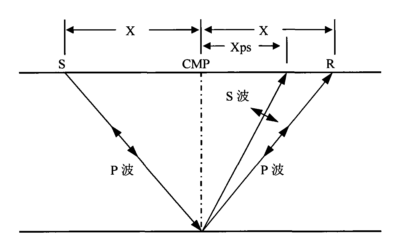
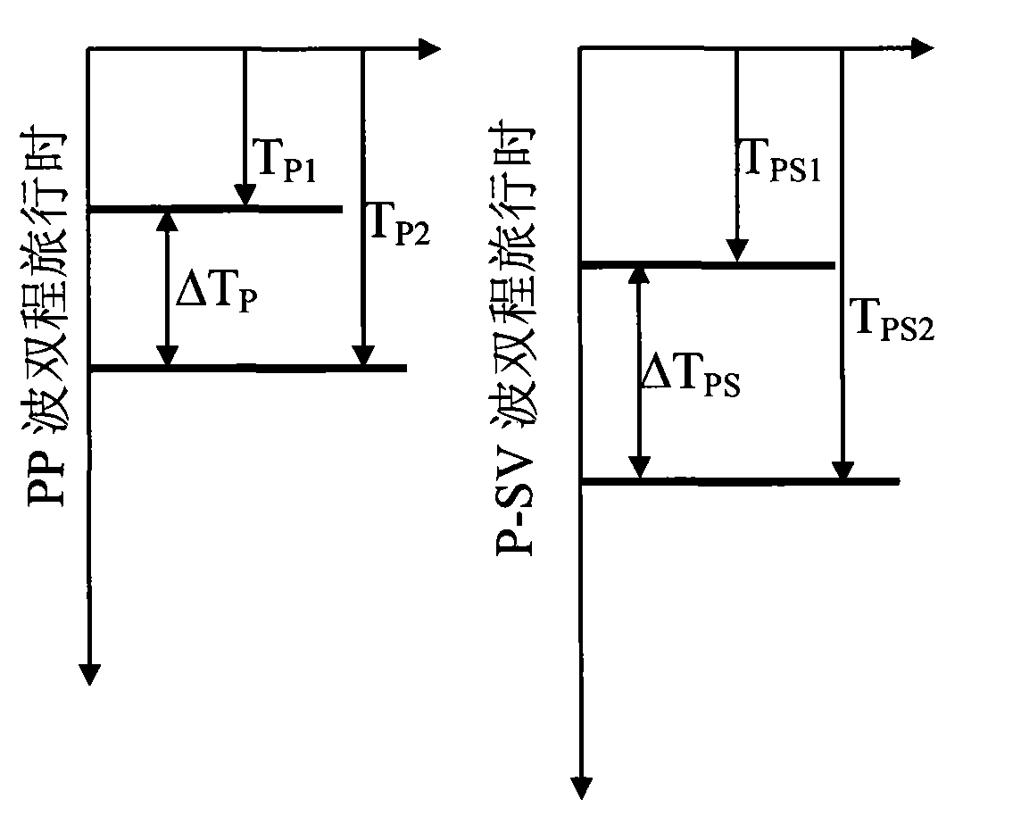
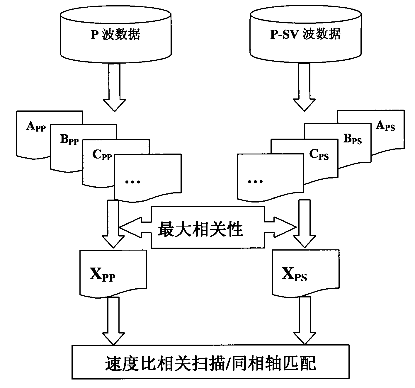
[0040] The multi-component seismic data horizon comparison and calibration method of the present invention is a data-driven method, which does not require well logging / VSP data. The principle is to extract the attribute with the greatest correlation from the PP wave and P-SV while considering the difference in the amplitude characteristics of the longitudinal wave and the converted wave, and then use the correlation characteristics of these two attributes to realize the horizon correlation and velocity of multi-component seismic data. Ratio extraction, and then realize the fine horizon comparison and calibration of multi-component data ( image 3 shown).

[0041] The method provided by the invention, its specific embodiment is by Figure 4 Shown:

[0042] (1) Excite seismic waves and use three-component geophones to record seismic waves, and perform high-fidelity processing on the vertical component longitudinal wave ① according to the conventional seismic data processing fl...


PUM


Abstract

The invention relates to the processing of petroleum geophysical exploration data, in particular to a method for comparing and demarcating seismic data positions. The method comprises the following steps: carrying out pre-stack AVO processing on longitudinal wave data after data spectrum equalization to ensure that a difference attribute C and the frequency band of post-stack data of a P-SV converted wave are equivalent; carrying out large control position collection by utilizing the attribute C and the post-stack data of the P-SV converted wave processed by wavelet consistency to obtain a variation tendency of the ratio of a longitudinal wave velocity and a transverse wave velocity in a work area; scanning a sliding time window velocity ratio of the attribute C and the post-stack data of the P-SV converted wave; determining a velocity ratio on a velocity ratio spectrum; and compressing the time of the P-SV converted wave data to a longitudinal wave time scale to finish the position comparison. The invention does not need priori information restriction, avoids difficulty of position collection caused by a conventional method and can obtain a high-precision velocity ratio.

Description

technical field [0001] The invention relates to petroleum geophysical exploration data processing technology, and is a method for realizing horizon comparison and calibration of multi-component seismic data by using the amplitude information of longitudinal waves and converted waves (downgoing P waves, upgoing S waves, P-SV waves for short). Background technique [0002] Seismic exploration used in the exploration of oil and natural gas fields is to artificially stimulate seismic waves according to certain rules, and use single-component or multi-component geophones to record the vibration of the underground medium in a certain way on the surface or underground, and analyze the vibrations detected by Process and analyze the kinematic and dynamic characteristics of refracted waves and / or reflected waves generated by various geological structure interfaces to obtain the properties of underground media and geological structure forms, and then find oil and gas and other mineral r...

Claims


Application Information

Patent Timeline
Patent Type & Authority Applications(China)
IPC IPC(8): G01V1/28
Inventor 孙鹏远李彦鹏卢秀丽
Owner BC P INC CHINA NAT PETROLEUM CORP
Why Eureka
Try Eureka