A method for creating cascaded maps for mobile robots based on hybrid features
A mobile robot, mixed feature technology, applied in the directions of maps/plans/charts, instruments, image enhancement, etc., can solve the problem that the robot cannot provide room information, and achieve the effect of preventing association failure, enriching room information, and improving position accuracy.
- Summary
- Abstract
- Description
- Claims
- Application Information
AI Technical Summary
Problems solved by technology
Method used
Image
Examples
Embodiment Construction
[0035] The present invention will be further described in detail below in conjunction with the accompanying drawings.
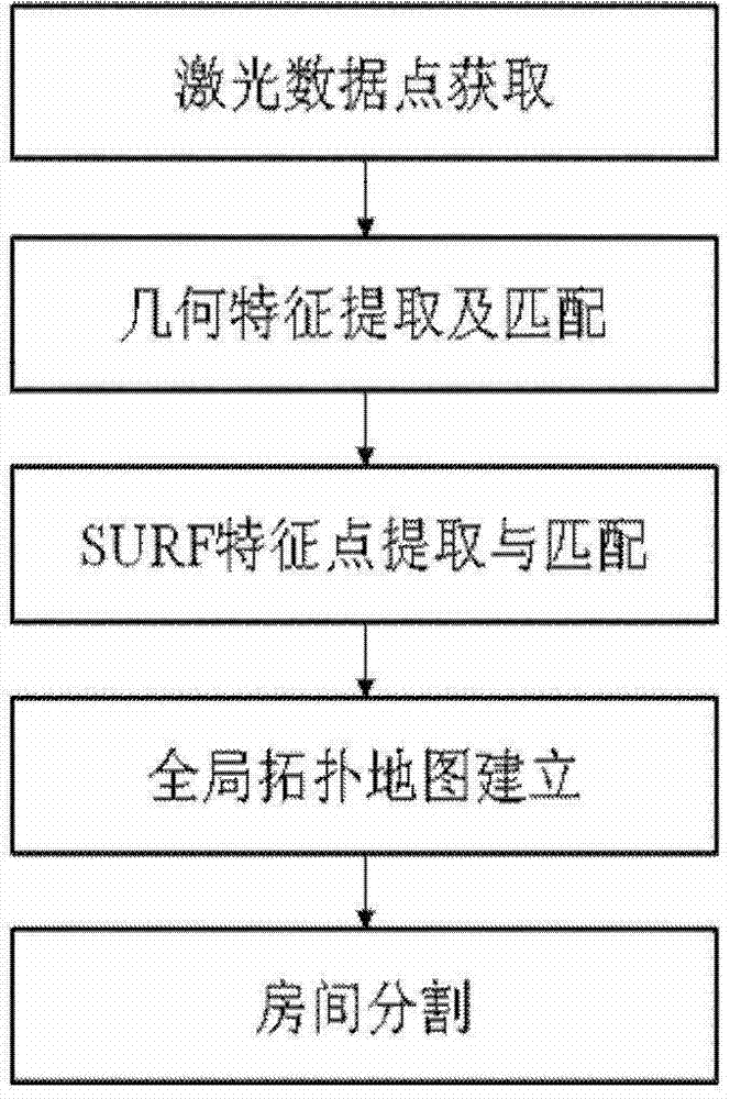
[0036] The main flowchart of the method of the present invention is attached figure 1 shown, including the following steps:
[0037] Step 1: Obtain laser data points, the specific method is as follows:
[0038] The measuring range of the laser sensor is 20-4000mm; Angle resolution: 0.36°; Scanning time: 100ms. It is characterized by high precision, high resolution and wide measurement range.
[0039] The principle of laser sensor data collection:
[0040] The angle θ corresponding to the i-th data point i for:
[0041] θ i = ( i × 360 1024 - 30 ) × π / 180
[0042] Convert polar coordinates to rectangular coordinates to obtain data p...
PUM
 Abstract
Description
Claims
Application Information
 - R&D
- Intellectual Property
- Life Sciences
- Materials
- Tech Scout
- Unparalleled Data Quality
- Higher Quality Content
- 60% Fewer Hallucinations
Browse by: Latest US Patents, China's latest patents, Technical Efficacy Thesaurus, Application Domain, Technology Topic, Popular Technical Reports.
© 2025 PatSnap. All rights reserved.Legal|Privacy policy|Modern Slavery Act Transparency Statement|Sitemap|About US| Contact US: help@patsnap.com


